- Okutadami Dam
-
Okutadami Dam 
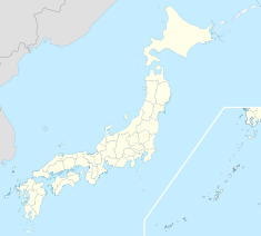
Location of Okutadami Dam Country Japan Location Uonuma Coordinates 37°09′12″N 139°15′00″E / 37.15333°N 139.25°ECoordinates: 37°09′12″N 139°15′00″E / 37.15333°N 139.25°E Construction began 1953 Opening date 1961 Owner(s) Electric Power Development Company Dam and spillways Type of dam Gravity Height 157 m (515 ft) Length 475 m (1,558 ft) Volume 1,636,000 m3 (2,139,807 cu yd) Impounds Tadami River Reservoir Creates Lake Okutadami Capacity 601,000,000 m3 (487,239 acre·ft) Active capacity 458,000,000 m3 (371,307 acre·ft) Catchment area 595 km2 (230 sq mi) Surface area 115 ha (284 acres)[1] Normal elevation 750 m (2,461 ft) Power station Commission date 1960, 2003 Hydraulic head 120 MW units: 170 m (558 ft)
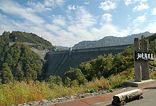
200 MW unit: 164.2 m (539 ft)Turbines 3 x 120 MW, 1 x 200 MW Francis-type Installed capacity 560 MW The Okutadami Dam is a concrete gravity dam on the Tadami River, 26 km (16 mi) east of Uonuma on the border of Niigata and Fukushima Prefectures, Japan. The primary purpose of the dam is hydroelectric power generation and it supports a 560 MW power station which is the largest conventional hydroelectric power station in Japan.[2] The dam also forms the second largest reservoir in Japan, next to that of the Tokuyama Dam.[3]
Background
Construction on the dam began and its original 200 MW power station was commissioned 2 December 1960. The rest of the project was complete in 1961. Between 1999 and 2003, the power station was expanded, adding an additional 360 MW in installed capacity. In addition, a 2.7 MW generator was added to ensure a flow of 2.5 m3/s (88 cu ft/s) downstream for environmental purposes.[2] Along with the same power plant upgrade, a second Kaplan turbine-generator was added to the 83 m (272 ft) tall Otori Dam's power station downstream at 37°12′53″N 139°12′50″E / 37.21472°N 139.21389°E. This generator has a 87 MW capacity in addition to the existing 95 MW unit, for an installed capacity of 182 MW.[4]
Design
The Okutadami Dam is a 157 m (515 ft) tall and 475 m (1,558 ft) long concrete gravity dam with a structural volume of 1,636,000 m3 (2,139,807 cu yd). Sitting at the head of a 595 km2 (230 sq mi) catchment area, the dam creates a reservoir with a 601,000,000 m3 (487,239 acre·ft) capacity of which 458,000,000 m3 (371,307 acre·ft) is active (or "useful") storage. The reservoir has a surface area of 1,150 ha (2,842 acres). The power station is underground and located on the right bank of the river next to the dam's abutment. It consists of two underground caverns, one for the original power station and another adjacent for the expansion. After being received by the dam's intake, water supplied to the original power plant travels down three penstocks 185–189 m (607–620 ft) in length before reaching an individual 200 MW Francis turbine-generator. The 200 MW Francis turbine-generator receives water via a 280 m (919 ft) long penstock. After water is processed through the generators, its travels down two tailrace tunnels before being discharged over 3 km (2 mi) downstream at the upstream edge of the Otori Reservoir.[5]
References
- ^ "Okutadami Dam". Japan Dam Handbook. http://damnet.or.jp/cgi-bin/binranA/All.cgi?db4=0500. Retrieved 14 August 2011.
- ^ a b "Start of Commercial Operation of the Okutadami (Extension) and Otori (Extension) Hydropower Plants and of the Okutadami-dam Ecological Flow Hydropower Plant". J-Power. http://www.jpower.co.jp/english/news_release/news/news176.pdf. Retrieved 14 August 2011.
- ^ "Dam Okutadami" (in Japanese). DamMania. http://dammania.net/niigata/okutadami.html. Retrieved 14 August 2011.
- ^ Sato, Asami; Keiichi Got0. "Commissioning of 87,000-kW Kaplan Turbine and Generator for Otori Power Statio". Hitachi. http://www.hitachi.com/ICSFiles/afieldfile/2004/09/07/r2004_03_104.pdf. Retrieved 14 August 2011.
- ^ "Case study 01-02: Biological Diversity - Okutadami and Ohtori Expansion Hydropower Project, Japan". IEA Hydropower Implementing Agreement Annex VIII: Hydropower Good Practices: Environmental Mitigation Measures and Benefit. New Energy Foundation. 2006. http://www.ieahydro.org/reports/Annex_VIII_CaseStudy0102_Okutadami_Ohtori_Japan.pdf. Retrieved 14 August 2011.
Dams in Niigata Prefecture Aburumagawa Dam · Agekawa Dam · Asagawara Dam · Futai Dam · Iwafune Dam · Kajigawa Dam · Kakizakigawa Dam · Kanose Dam · Kasabori Dam · Ketto Dam · Kassa Dam · Kassagawa Dam · Konoyama Dam · Kuromata Dam · Kuromatagawa Dam · Miomote Dam · Miyanaka Dam · Oishi Dam · Okumiomote Dam · Okutadami Dam · Otani Dam · Sagurigawa Dam · Saruta Dam · Sasagamine Dam · Shozenji Dam · Tainai Dam · Tainaigawa Dam · Takanosu Dam · Toyomi Dam · Uchinokura Dam · Yamamoto DamDams in Fukushima Prefecture Akimotoko Dam · Asahi Dam · Fujinuma Dam · Hatori Dam · Honna Dam · Jyurokkyou Dam · Kaminojiri Dam · Katakado Dam · Miharu Dam · Miyagawa Dam · Miyashita Dam · Okawa Dam · Okutadami Dam · Otori Dam · Ouchi Dam · Shingo Dam · Shinmiyagawa Dam · Surikamigawa Dam · Tadami Dam · Taki Dam · Tagokura Dam · Uwada Dam · Yamasato Dam · Yanaizu DamCategories:- Dams in Fukushima Prefecture
- Dams in Niigata Prefecture
- Hydroelectric power stations in Japan
- Gravity dams
Wikimedia Foundation. 2010.

