- Nova Kapela, Zagreb County
-
Nova Kapela — Naselje — Location of Nova Kapela within Croatia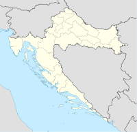
 Nova Kapela
Coordinates: 45°53′8″N 16°34′28″E / 45.88556°N 16.57444°ECoordinates: 45°53′8″N 16°34′28″E / 45.88556°N 16.57444°E Country Croatia County Zagreb County Municipality Dubrava Population (2001) – Total 279 Time zone CET (UTC+1) – Summer (DST) CEST (UTC+2) Postal code 10343 Area code +385 (0) 1 Nova Kapela is a settlement (Croatian: naselje) within the Dubrava municipality (Croatian: općina) of Zagreb County in Croatia. According to the 2001 census, it has 279 inhabitants. It is thus the second-most populous settlement in its municipality, right after Dubrava, the eponymous one. The place is located 6 kilometers (3.7 mi) from the Dubrava settlement and a 60 km (37 mi) from Zagreb, the Croatian capital. The main road leading through the settlement is the county route Ž3042. The association football team Croatia plays in Nova Kapela. The alignment of the planned extension of the B28 expressway into A13 highway passes north of Nova Kapela. Prior to the 1991 Yugoslav wars the name of the town was Srpska Kapela.
Categories:- Zagreb County geography stubs
- Populated places in Zagreb County

Wikimedia Foundation. 2010.