- Zion Canyon
-
Zion Canyon Mukuntuweap 
Zion Canyon viewed from the canyon floorLocation in Utah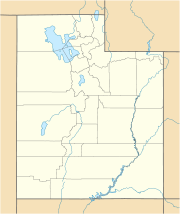
 Zion Canyon
Floor elevation 4,300 feet (1,300 m) Coordinates 37°09′54″N 113°00′43″W / 37.165°N 113.01194°WCoordinates: 37°09′54″N 113°00′43″W / 37.165°N 113.01194°W Zion Canyon (also called Little Zion, Mukuntuweap, Mu-Loon'-Tu-Weap, and Straight Cañon; weap is Paiute for canyon) is a deep and narrow gorge in southwestern Utah, United States, carved by the North Fork of the Virgin River. Nearly the entire canyon is located within the eastern half of Zion National Park.[1]
Contents
Description
 Large view of the canyon
The beginning of the canyon is usually delineated as the Temple of Sinawava, a vertical-walled natural amphitheater nearly 3,000 feet (910 m) deep. The canyon actually begins much further upstream, however, and runs southward about 16 miles (26 km) through the Narrows to reach the Temple, where the North Fork plunges over a tall waterfall. The gorge then runs southwest through the national park, approaching 2,000 feet (610 m) deep in places. While the canyon rim is dominated by desert, the canyon floor supports a forest and riparian zone watered by the North Fork Virgin River. The gorge then merges with Pine Creek Canyon as it winds out of the national park and past the community of Springdale. The canyon's end is where it meets the Virgin River, some 100 miles (160 km) northeast of Lake Mead, which the river ultimately flows into.[2] [3]
Zion Canyon Drive and Zion-Mount Carmel Highway are the two major roads throughout the canyon. Zion Canyon Drive ends at the Temple of Sinawava, where hiking trails follow the river upstream to the Emerald Pools. Hiking trails further upstream descend into the Narrows, where the canyon floor is on average 20 feet (6.1 m) wide. Hiking is permitted in the Narrows when water levels are low enough, however, flash floods are known to rise quickly following heavy rainstorms. Many areas in the drainage of Zion Canyon have little or no soil cover, contributing to extremely brief but heavy storm runoff. In contrast, the floor of most of the main Zion Canyon is close to 1,000 feet (300 m) wide, and is rich with river-deposited sediments. Tributaries to the river within the canyon include Deep, Kolob, Goose, Pine, and Oak Creeks.[4]
Geology and history
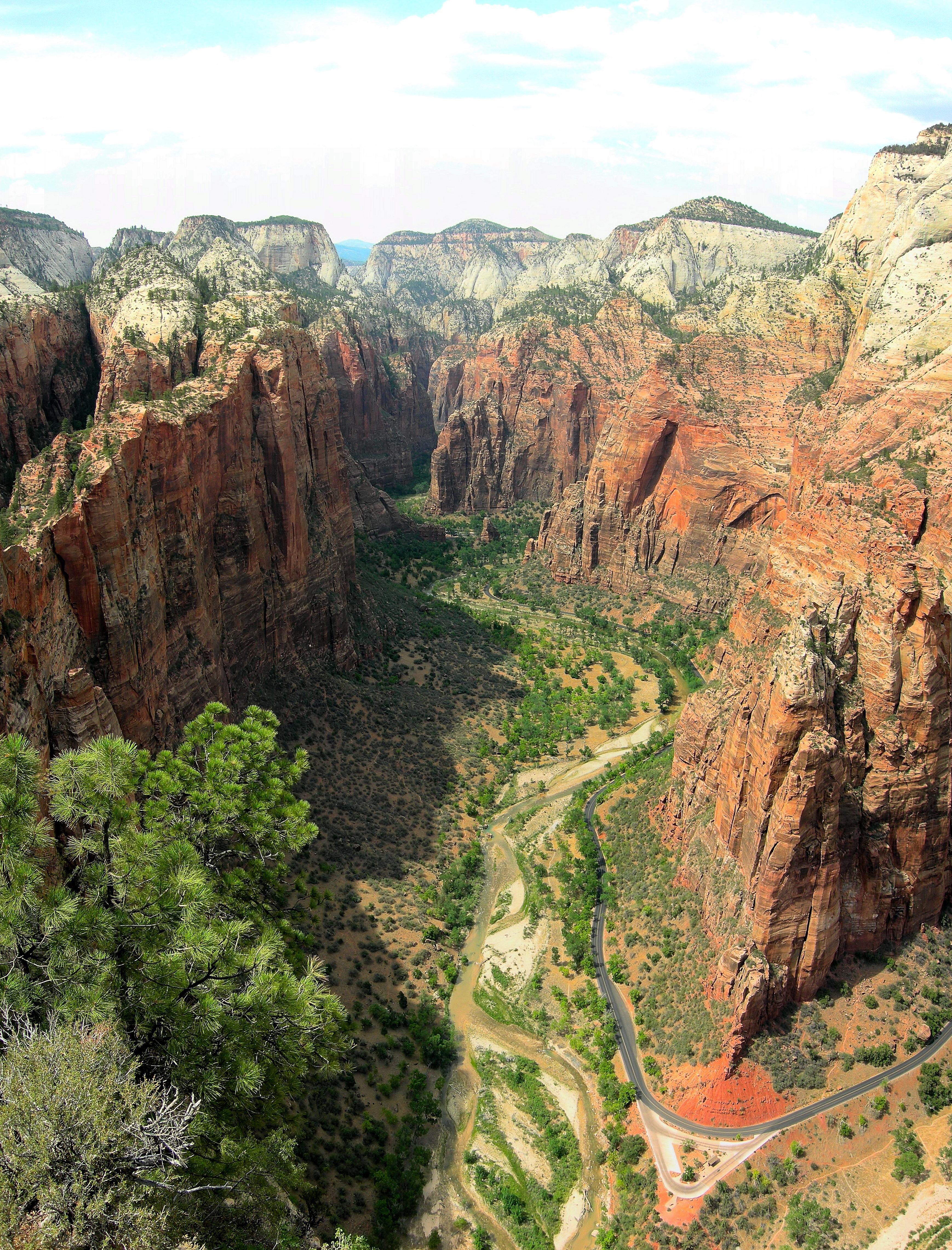
 Zion Canyon viewed from Angel's Landing, showing the immense vertical relief
Geologically Zion Canyon is part of the Navajo sandstone Colorado Plateau, which contained many joints and cracks when first uplifted, one of which was cut by the North Fork of the Virgin River to become Zion Canyon. The river was the largest force in cutting the canyon, mostly by flash floods, as the average flow of the river is very light. This relatively quick downcutting has left many seasonal tributaries with hanging valleys. Some of the largest tributaries have cut down to nearly an equal elevation as the valley floor.
Strong winds continue to sculpt the canyon walls, creating natural arches. It is believed that there is another 1,000 feet (300 m) of vertical bedrock that the Virgin River can still erode. Mass wasting, often caused by ice wedging into cracks in the canyon walls, is another force that widens the valley. The Navajo Sandstone formation is easily eroded and is known to be very porous. Unstable geology is prevalent throughout the canyon, and occasional rockslides have formed impounded lakes in the canyon, the most recent of which was roughly 4,000 years ago. Owing to the extreme depth of the canyon, there are many springs fed by the surrounding groundwater, permitting water in the canyon to run year round.[5][6]
The first settlers in Zion Canyon were Mormons that migrated from the lower Virgin River area in the late 1850s. The canyon was named by settler Isaac Behunin, who named the canyon after a "place of peace" mentioned in the Bible. Explorer John Wesley Powell is credited with the name Mukuntuweap, supposedly the native name of the canyon. In 1909, the canyon was first declared a national monument, and in 1919 was declared a national park. The Zion-Mount Carmel Highway, cutting through Pine Creek Canyon and lower Zion Canyon, first opened in 1930.[6]
See also
Notes and references
- ^ "Zion National Park, Utah". U.S. National Park Service. http://www.nps.gov/zion/index.htm. Retrieved 2009-11-03.
- ^ ACME Mapper. USGS Topo Maps for United States (Map). Cartography by United States Geological Survey. http://mapper.acme.com/. Retrieved 2009-10-29.
- ^ U.S. National Park Service. Zion National Park Maps (Map). Cartography by National Park Service. http://www.nps.gov/archive/zion/Maps.htm. Retrieved 2009-11-03.
- ^ "Zion National Park". zionnational-park.com. http://www.zionnational-park.com/zion-canyon.htm. Retrieved 2009-11-03.
- ^ "Zion Canyon Geology: Carving Zion Canyon". zionnational-park.com. http://www.zionnational-park.com/zgeology3.htm. Retrieved 2009-11-03.
- ^ a b Harris, Ann G.; Tuttle, Esther; Tuttle, Sherwood D. (2004). Geology of National Parks. Kendall Hunt. p. 31. ISBN 0-7872-9970-7.
External links
Categories:- Canyons and gorges of Utah
- Landforms of Washington County, Utah
- Zion National Park


Wikimedia Foundation. 2010.