North End (Bexley ward)

North End (Bexley ward)
North End
—  electoral ward  —
Country United Kingdom
Region London
County Greater London
London borough Bexley
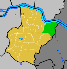
North End ward (green) within the London Borough of Bexley (yellow)

North End is an electoral ward in the London Borough of Bexley which consists of Slade Green, the eastern part of Erith and a tiny part of Barnehurst, along with parts of Northend. Community interests are represented by Slade Green Community Forum, which is a registered charity. There are approximately 4800 residences within the ward.

Ward Councillors are Alan Deadman, John Eastaugh and Brenda Langstead (all Labour).

Coordinates: 51°28′16″N 0°11′24″E / 51.471°N 0.190°E / 51.471; 0.190


Wikimedia Foundation. 2010.

Игры ⚽ Поможем написать курсовую

Look at other dictionaries:

  • North End, Bexley — Coordinates: 51°28′01″N 0°11′39″E / 51.46693°N 0.19408°E / 51.46693; 0.19408 …   Wikipedia

  • List of named ethnic enclaves in North American cities — This is a list of ethnic enclaves in North American cities. An ethnic enclave in this context denotes an area primarily populated by a population with similar ethnic or racial background. It does not include LGBT communities. This list also… …   Wikipedia

  • Old Bexley and Sidcup (UK Parliament constituency) — Old Bexley and Sidcup Borough constituency for the House of Commons Boundary of Old Bexley and Sidcup in Greater London …   Wikipedia

  • Enfield North (UK Parliament constituency) — Enfield North Borough constituency for the House of Commons Boundary of Enfield North in Greater London …   Wikipedia

  • College of North West London — Type Further Education Principal Vicki Fagg Location Dudden Hill Lane …   Wikipedia

  • List of churches in London — St. Paul s from the South London is the location of many famous churches, chapels and cathedrals, in a density unmatched anywhere else in England.[1] …   Wikipedia

  • Erith — infobox UK place country = England map type = Greater London region= London population= official name= Erith latitude= 51.4763 longitude= 0.1681 london borough= Bexley constituency westminster= Erith Thamesmead constituency westminster1=… …   Wikipedia

  • Crayford — For other uses, see Crayford (disambiguation). Coordinates: 51°26′57″N 0°10′52″E / 51.4491°N 0.1812°E / 51.4491; 0.1812 …   Wikipedia

  • Slade Green — infobox UK place country = England map type = Greater London region= London population= official name= Slade Green latitude= 51.4668 longitude= 0.1964 london borough= Bexley constituency westminster= Bexleyheath and Crayford post town= ERITH… …   Wikipedia

  • Barnehurst — infobox UK place country = England map type = Greater London region= London population= official name= Barnehurst latitude= 51.4613 longitude= 0.1690 london borough= Bexley constituency westminster= Bexleyheath and Crayford post town= BEXLEYHEATH …   Wikipedia

Share the article and excerpts

Direct link
Do a right-click on the link above
and select “Copy Link”