- Nong Na Kham District
-
Nong Na Kham
หนองนาคำ— Amphoe — Amphoe location in Khon Kaen Province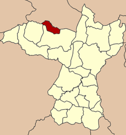
Coordinates: 16°48′3″N 102°20′28″E / 16.80083°N 102.34111°ECoordinates: 16°48′3″N 102°20′28″E / 16.80083°N 102.34111°E Country  Thailand
Province Khon Kaen Seat Ban Khok Tambon Muban Amphoe established Area – Total 158.9 km2 (61.4 sq mi) Population (2005) – Total 23,402 – Density 147.3/km2 (381.5/sq mi) Time zone THA (UTC+7) Postal code 40150 Geocode 4023 Nong Na Kham (Thai: หนองนาคำ) is a district (Amphoe) of Khon Kaen Province, northeastern Thailand.
Contents
History
The minor district (King Amphoe) was established on April 30 1994 by splitting it from Phu Wiang district[1]. It includes the Baan Non Nok Tha (TH: บ้านโนนนกทา) [2] (E 102°18'17" N 16°47'57"), and Ban Na Di (TH: บ้านนาดี) (E 102°18'04" N 16°48'02") Prehistoric Thailand archaeological sites.[3]
Following a decision of the Thai government on May 15 2007, all of the 81 minor districts were to be upgraded to full districts[4]. With the publishing in the Royal Gazette on August 24 the upgrade became official[5].
Geography
Neighboring districts are (from the north clockwise) Si Bun Rueang and Non Sang of Nongbua Lamphu Province, Phu Wiang, Wiang Kao and Si Chomphu of Khon Kaen Province.
Administration
The district is subdivided into 3 subdistricts (tambon), which are further subdivided into 34 villages (muban). There are no municipal (thesaban) areas, and further 3 Tambon administrative organizations (TAO).
No. Name Thai name Villages Inh. 1. Kut That กุดธาตุ 16 11,762 2. Ban Khok บ้านโคก 8 4,810 3. Khanuan ขนวน 10 6,830 References
- ^ "ประกาศกระทรวงมหาดไทย เรื่อง แบ่งเขตท้องที่อำเภอภูเวียง จังหวัดขอนแก่น ตั้งเป็นกิ่งอำเภอหนองนาคำ" (in Thai). Royal Gazette 111 (42 ง): 27. May 26 1994. http://www.ratchakitcha.soc.go.th/DATA/PDF/2537/D/042/27.PDF.
- ^ This Ancient Land of Dinosaurs, Siamoid, Siamese, and Thais Part III
- ^ EcoNETVIS Site Description
- ^ "แถลงผลการประชุม ครม. ประจำวันที่ 15 พ.ค. 2550" (in Thai). Manager Online. http://www.manager.co.th/Politics/ViewNews.aspx?NewsID=9500000055625.
- ^ "พระราชกฤษฎีกาตั้งอำเภอฆ้องชัย...และอำเภอเหล่าเสือโก้ก พ.ศ. ๒๕๕๐" (in Thai). Royal Gazette 124 (46 ก): 14–21. August 24 2007. http://www.ratchakitcha.soc.go.th/DATA/PDF/2550/A/046/14.PDF.
External links
Mueang Khon Kaen · Ban Fang · Phra Yuen · Nong Ruea · Chum Phae · Si Chomphu · Nam Phong · Ubolratana · Kranuan · Ban Phai · Pueai Noi · Phon · Waeng Yai · Waeng Noi · Nong Song Hong · Phu Wiang · Mancha Khiri · Chonnabot · Khao Suan Kwang · Phu Pha Man · Sam Sung · Khok Pho Chai · Nong Na Kham · Ban Haet · Non Sila · Wiang Kao
Categories:- Amphoe of Khon Kaen

Wikimedia Foundation. 2010.