- Nong Bua Rawe District
-
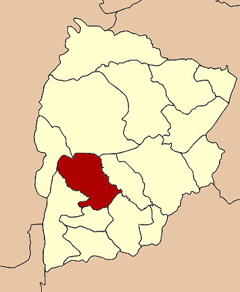
Nong Bua Rawe
หนองบัวระเหว— Amphoe — Amphoe location in Chaiyaphum Province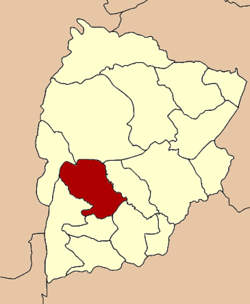
Coordinates: 15°44′55″N 101°45′34″E / 15.74861°N 101.75944°ECoordinates: 15°44′55″N 101°45′34″E / 15.74861°N 101.75944°E Country  Thailand
Province Chaiyaphum Seat Nong Bua Rawe Amphoe established 1978 Area – Total 841.8 km2 (325 sq mi) Population (2008) – Total 36,371 – Density 43.2/km2 (111.9/sq mi) Time zone THA (UTC+7) Postal code 36250 Geocode 3608 Nong Bua Rawe (Thai: หนองบัวระเหว) is a district (Amphoe) of Chaiyaphum Province, northeastern Thailand.
Contents
History
The area was originally a tambon of Chatturat district. It was separated and together with tambon Wang Takhe became a minor district (King Amphoe) on April 17, 1978.[1] It was officially upgraded to a full district on January 1, 1988.[2]
Geography
Neighboring districts are (from the north clockwise) Nong Bua Daeng, Ban Khwao, Chatturat, Sap Yai, Thep Sathit and Phakdi Chumphon.
The Sai Thong National Park is located in the district.
Administration
The district is subdivided into 5 subdistricts (tambon), which are further subdivided into 58 villages (muban). There are three subdistrict municipalities (thesaban tambon), each covering the whole same-named subdistrict: Nong Bua Tawe, Huai Yae and Khok Sa-at. The remaining two subdistricts have a Tambon administrative organization (TAO).
No. Name Thai Inh.[3] 1. Nong Bua Rawe หนองบัวระเหว 5,892 2. Wang Takhe วังตะเฆ่ 13,680 3. Huai Yae ห้วยแย้ 7,104 4. Khok Sa-at โคกสะอาด 5,602 5. Sok Pla Duk โสกปลาดุก 4,093 References
- ^ "ประกาศกระทรวงมหาดไทย เรื่อง แบ่งท้องที่อำเภอจัตุรัส จังหวัดชัยภูมิ ตั้งเป็นกิ่งอำเภอหนองบัวระเหว" (in Thai). Royal Gazette 95 (45 ง): 1194. April 25, 1978. http://www.ratchakitcha.soc.go.th/DATA/PDF/2521/D/045/1194.PDF.
- ^ "พระราชกฤษฎีกาตั้งอำเภอนามน อำเภอพระยืน อำเภอหนองบัวระเหว อำเภอบ้านเหลื่อม อำเภอจะแนะ อำเภอหนองหงส์ อำเภอนาโพธิ์ อำเภอเกาะยาว อำเภอแกดำ อำเภอสระโบสถ์ อำเภอโนนคูณ อำเภอควนโดน อำเภอไชยวาน อำเภอหนองแสง และอำเภอตาลสุม พ.ศ. ๒๕๓๐" (in Thai). Royal Gazette 104 (278 ก special): 33–37. December 31, 1987. http://www.ratchakitcha.soc.go.th/DATA/PDF/2530/A/278/33.PDF.
- ^ "Population statistics 2008". Department of Provincial Administration. http://www.dopa.go.th/xstat/p5136_01.html.
External links
- amphoe.com (Thai)
- http://www.rawedistrict.com Website of district (Thai)
- Sai Thong National Park
Mueang Chaiyaphum · Ban Khwao · Khon Sawan · Kaset Sombun · Nong Bua Daeng · Chatturat · Bamnet Narong · Nong Bua Rawe · Thep Sathit · Phu Khiao · Ban Thaen · Kaeng Khro · Khon San · Phakdi Chumphon · Noen Sa-nga · Sap Yai
Categories:- Amphoe of Chaiyaphum
- Isan geography stubs
Wikimedia Foundation. 2010.