- Nogoa River
-
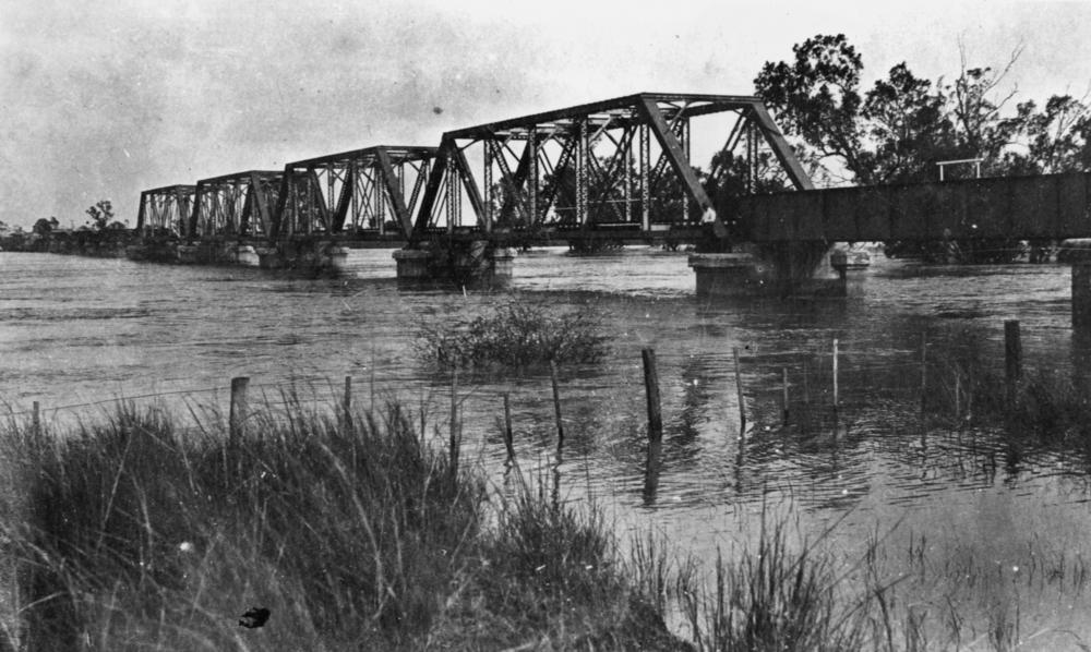
Nogoa River 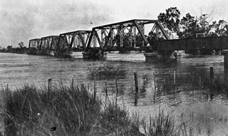 Railway bridge in Emerald during a flood, 1918.jpg
Country Australia State Queensland Region Central Queensland Part of Fitzroy River basin City Emerald Source Carnarvon Range Mouth confluence with Comet River, forming the Mackenzie River Basin 27,676 km2 (10,686 sq mi) [1] Wikimedia Commons: Nogoa River The Nogoa River rises on the Carnarvon Range in the Carnarvon National Park in Central Queensland and flows in a north easterly direction. The river ends where it meets the Comet River north of Comet. From this point the river is called the Mackenzie River.
Queensland's second largest lake, Lake Maraboon was formed when the Fairbairn Dam was built on the river in 1972. The dam and a network of channels along the Nogoa River supplies water for the Emerald Irrigation Area.[2]
Contents
2008 floods
In January 2008, the Nogoa River reached record flood levels. During the flood, water levels in the Fairbairn Dam rapidly exceeded 100%.[3] Within a week inundations had caused severe disruptions to graziers, crops growers and to residents of Emerald when waters broke its banks. The Nogoa peaked at 15.4 m (51 ft) in Emerald on the night of January 22 2008, causing more than 2500 people to be evacuated.[4] The unprecedented floods washed through the Ensham Mine, temporarily halting operations in two out of six coal pits, reducing output to less than 50% and rendering a huge dragline defunct after it had been submerged.[5]
2010-2011 floods
In December 2010 - January 2011 the river flooded again.
See also
References
- ^ "Comet, Nogoa and Mackenzie rivers". State of the Rivers report. Department of Environment and Resource Management (Queensland). 2008-10-23. http://www.nrw.qld.gov.au/science/state_of_rivers/comet_nogoa.html. Retrieved 2009-05-20.
- ^ "Water resources - Overview - Queensland - Basin & Surface Water Management Area: Nogoa / Mackenzie". Australian Natural Resources Atlas. Department of the Environment, Water, Heritage and the Arts. http://www.anra.gov.au/topics/water/overview/qld/swma-nogoa-mackenzie.html. Retrieved 2009-05-20.
- ^ "Drought-stricken Fairbairn Dam overflows". 2008-01-19. http://www.abc.net.au/news/stories/2008/01/19/2142199.htm. Retrieved 2008-01-20.
- ^ Scott Casey (2008-01-23). "Is Rockhampton next to flood?". The Brisbane Times. Brisbane Times. http://www.brisbanetimes.com.au/news/queensland/is-rockhampton-next-to-flood/2008/01/22/1200764254902.html?page=fullpage. Retrieved 2009-05-20.
- ^ Peter Morley (2008-04-26). "Central Highlands dragline a costly rust bucket". The Courier Mail. Queensland Newspapers. http://www.news.com.au/couriermail/story/0,23739,23592899-3102,00.html. Retrieved 2009-05-20.[dead link]
Categories:- Rivers of Queensland
- Queensland floods
- Central Queensland
Wikimedia Foundation. 2010.