- Nghĩa Lộ
-
Nghĩa Lộ — Urban District and town — 
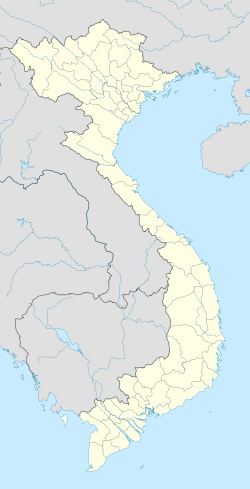
 Nghĩa Lộ
Coordinates: 21°34′33″N 104°31′9″E / 21.57583°N 104.51917°ECoordinates: 21°34′33″N 104°31′9″E / 21.57583°N 104.51917°E Country  Vietnam
Region Northeast Province Yen Bai Province Area - Total 11.2 sq mi (29 km2) Population (2003) - Total 25,256 Time zone UTC + 7 (UTC+7) Nghia Lo (Vietnamese: Nghĩa Lộ) is a town district (thị xã) of Yen Bai Province, in the northeastern region of Vietnam.
In 1951, the Viet Minh 312 Division fought French forces in the area as part of the First Indochina War.
As of 2003 the district had a population of 25,256.[1] The district covers an area of 29 km².[1]
References
 Media related to Nghĩa Lộ at Wikimedia Commons
- ^ a b "Districts of Vietnam". Statoids. http://www.statoids.com/yvn.html. Retrieved March 23, 2009.
 Districts of Northeast Vietnam (Dong Bac)
Bac Giang province Bac Giang · Hiep Hoa · Lang Giang · Luc Nam · Luc Ngan · Son Dong · Tan Yen · Viet Yen · Yen Dung · Yen Tha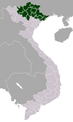
Bac Kan province Cao Bang province Cao Bang · Bao Lac · Bao Lam · Ha Lang · Ha Quang · Hoa An · Nguyen Binh · Phuc Hoa · Quang Uyen · Thach An · Thong Nong · Tra Linh · Trung KhanhHa Giang province Lang Son province Lao Cai province Phu Tho province Quang Ninh province Ha Long · Ba Che · Binh Lieu · Co To · Dam Ha · Dong Trieu · Hai Ha · Hoanh Bo · Tien Yen · Van Don · Yen HungThai Nguyen province Tuyen Quang province Yen Bai province Categories:- Northeast Vietnam geography stubs
- Districts of Yen Bai Province
- Populated places in Yen Bai Province
- District capitals in Vietnam


Wikimedia Foundation. 2010.