- Nautla, Veracruz
-
Nautla 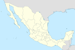
 Nautla
Coordinates: 20°13′0″N 96°47′0″W / 20.216667°N 96.783333°W Country Mexico State Veracruz Municipality Nautla Founded Government – Mayor Time zone CST (UTC-6) Postal code Nautla is a settlement in the Mexican state of Veracruz.
Nautla comes from the Nahuatl Naui, four; and from tlan, that means place; so it is known as Four Places. [1]
First it was a prehispanic town that was in Casitas, Veracruz. Now it is in the municipality of Nautla. In 1519, the Totonacos had an alliance with the Spaniards and they had a battle. Nautla was destroyed by the fire. In 16th century the king give to Juan de Cuenca the lands of the actual Nautla, San Sebastian and La Peña, so that they established the residence of where to stay. The weather is warm, with temperatures of 25.5°C. [2]
The village is in the middle of the Nautla and Misantla Rivers, both of which finish in the Gulf of Mexico. Nautla has an area of 358.63 km, which represents 0.49% of the state of Veracruz. The state is rich because of minerals, like the white one. And in vegetation the precious woods are the principal resources. According to INEGI, in the 2000 census, there are 2486 houses, with an average of 3.93 people living in. Most of them are owned by their owners, and the materials used are wood and rock. As the village is near the sea, the city has maritime activities like fishing, also many people dedicates to tourism.[3]
There you can visit a lot of places; there are French constructions that you can visit. And in September and October are dances so you can enjoy the Mexican culture. The artisanal pieces that are made there, are made from maize and its husk. You can eat robalo that it is a kind of fish that you can enjoy in many ways, in soup, or in tamale.
Government
The type of government of the village is republic, there is a Governor, and he is taking care of the village. The municipal president is the one who takes the decisions and he is chosen by voting.[4]
References
- ^ "Municipio of Nautla.". http://e-local.gob.mx/work/templates/enciclo/veracruz/municipios/30114a.htm. Retrieved 2008-01-29.
- ^ "Municipio of Nautla.". http://e-local.gob.mx/work/templates/enciclo/veracruz/municipios/30114a.htm. Retrieved 2008-01-29.
- ^ "INEGI.". http://www.inegi.gob.mx/lib/centrosfin.asp?c=11&s=prod_serv&enti=30. Retrieved 2008-01-29.
- ^ "Gobierno de Veracruz.". http://e-local.gob.mx/work/templates/enciclo/veracruz/municipios/30114a.htm. Retrieved 2008-01-29.
Xalapa (capital)Huasteca Alta
RegionChalma · Chiconamel · Chinampa de Gorostiza · El Higo · Naranjos · Ozuluama de Mascareñas · Pánuco · Platón Sánchez · Pueblo Viejo · Tamalín · Tamiahua · Tampico Alto · Tantima · Tantoyuca · Tempoal de Sánchez
Huasteca Baja
RegionBenito Juárez · Castillo de Teayo · Cerro Azul · Chicontepec de Tejeda · Chontla · Citlaltépetl · Huayacocotla · Ilamatlán · Ixcatepec · Ixhuatlán de Madero · Tancoco · Temapache (Álamo) · Tepetzintla · Texcatepec · Tlachichilco · Tuxpan · Zacoalpan · Zontecomatlán de López y Fuentes
Totonaca
RegionCazones de Herrera · Chumatlán · Progreso de Zaragoza · Coatzintla · Coxquihi · Coyutla · Espinal · Filomeno Mata · Gutiérrez Zamora · Mecatlán · Papantla · Poza Rica · Tecolutla · Tihuatlán · Zococolco de Hidalgo
Nautla
RegionAtzalán · Colipa · Juchique de Ferrer · Martínez de la Torre · Misantla · Nautla · San Rafael · Tenochtitlán · Tlapacoyan · Vega de Alatorre · Yecuatla
Capital
RegionAcajete · Acatlán · Actopan · Alto Lucero · Altotonga · Apazapan · Ayahualulco · Banderilla · Chiconquiaco · Coacoatzintla · Coatepec · Cosautlán de Carvajal · Emiliano Zapata (Dos Ríos) · Ixhuacán de los Reyes · Jalacingo · Jalcomulco · Jilotepec de Molina Enríquez · Las Minas · Las Vigas de Ramírez · Landero y Coss · Miahuatlán · Naolinco de Victoria · Perote · Rafael Lucio · Tatatila · Teocelo · Tepetlán · Tlacolulan · Tlalnelhuayocan · Tonayán · Villa Aldama · Xalapa · Xico
Sotavento
RegionBoca del Río · Cotaxtla · Jamapa · La Antigua (José Cardel) · Manlio Fabio Altamirano · Medellín · Puente Nacional · Soledad de Doblado · Tlalixcoyan · Úrsulo Galván · Veracruz
Mountains
RegionAcultzingo · Alpatláhuac · Amatlán de los Reyes · Aquila · Astacinga · Atlahuico · Atoyac · Atzacan · Calcahualco · Camarón de Tejeda · Camerino Z. Mendoza (Ciudad Mendoza) · Carrillo Puerto (Tamarindo) · Chocamán · Coetzala · Comapa · Córdoba · Coscomatepec de Bravo · Cuichapa · Cuitláhuac · Fortín de las Flores · Huatusco · Huiloapan de Cuauhtémoc · Ixhuatlán del Café · Ixhuatlancillo · Ixtaczoquitlán · La Perla · Los Reyes · Magdalena · Maltrata · Mariano Escobedo · Mixtla de Altamirano · Naranjal · Nogales · Omealca · Orizaba · Paso del Macho · Rafael Delgado · Río Blanco · San Andrés Tenejapan · Sochiapa · Soledad Atzompa · Tehuipango · Tenampa · Tepatlaxco · Tequila · Tezonapa · Tlacotepec de Mejía · Tlaltetela · Tlaquilpa · Tlilapan · Totutla · Xoxocotla · Yanga · Zentla · Zongolica
Papaloapan
RegionAcula · Ángel R. Cabada · Alvarado · Amatitlán · Carlos A. Carrillo · Chacaltianguis · Cosamaloapan · Ignacio de la Llave · Isla · Ixmatlahuacan · José Azueta (Villa Azueta) · Juan Rodríguez Clara · Lerdo de Tejada · Otatitlán · Playa Vicente · Saltabarranca · Santiago Sochiapan (Xochiapa) · Tierra Blanca · Tlacojalpan · Tlacotalpan · Tres Valles · Tuxtilla
Los Tuxtlas
RegionCatemaco · San Andrés Tuxtla · Santiago Tuxtla · Hueyapan de Ocampo
Olmeca
RegionAcayucan · Agua Dulce · Chinameca · Coatzacoalcos · Cosoleacaque · Hidalgotitlán · Ixhuatlán del Sureste · Jáltipan · Jesús Carranza · Las Choapas · Mecayapan · Minatitlán · Moloacán · Nanchital · Oluta · Oteapan · Pajapan · San Juan Evangelista · Sayula de Alemán · Soconusco · Soteapan · Tatahuicapan · Texistepec · Uxpanapa) · Zaragoza
Coordinates: 20°13′N 96°47′W / 20.217°N 96.783°W
Categories:- Populated places in Veracruz
- Veracruz geography stubs

Wikimedia Foundation. 2010.