- National Council for Geographic Education
-
The National Council for Geographic Education (NCGE) is a non-profit organization whose mission is to enhance the status and quality of geography teaching and learning. The NCGE was chartered in 1915 as the National Council of Geography Teachers, and adopted its current name in 1956. Its mission over the past century has remained focused on excellence in geography education, at all levels—-through formal and informal education, in primary education, secondary education, community college, and university settings. Its membership totals over 1,200, mostly from the USA, but with a significant and growing international component. Its members include teachers, professors, students, managers, policymakers, administrators, and others who support geographic education. These members work in schools, community colleges, universities, nonprofit organizations, local, state, tribal, national, and international government agencies, and in private industry.
The NCGE promotes and supports geography education, enhances the preparation of geography education with respect to knowledge of content, techniques, and learning processes, facilitates communication and professional development among teachers of geography, encourages and supports research on geography education, develops, publishes, and promotes the use of exemplary curricular resources and other learning materials, recognizes exceptional instructors of geography, and collaborates with other organizations that have similar goals.
During the 1960s, NCGE member and professor Pattison published an article about the Four Traditions of Geography that helped define the discipline: 1) Spatial tradition, 2) Area studies tradition, 3) Man-land tradition, and 4) Earth science tradition. These became a method for organizing the study of geography. During the 1980s, the NCGE identified and promoted the "Five Themes of Geography," as a way of organizing the teaching and learning of sound geography content. These included movement, region, human-environment interaction, location, and place. The letters "MR HeLP" is a helpful way to remember these. The NCGE partnered with the National Geographic Society, the Association of American Geographers, and the American Geographical Society during the 1990s to create the national content standards for geography, entitled "Geography for Life" (1994). The content standards what students at specific educational levels should know and be expected to do by grades 4, 8, and 12. The National Standards in Geography are organized into 18 standards under 6 "essential elements." They represent the essentials and fundamental ideas of geography. The 6 essential elements include: (1) The world in spatial terms, (2) Places and regions, (3) Physical systems, (4) Human systems, (5) Environment and society, and (6) The uses of geography. The goal of a sound standards-based geography education is a geographically informed person who sees meaning in the arrangement of things across the Earth's surface; who appreciates the relationships between people, places, and environments; who uses geographic skills; and who applies geographic perspectives to life situations. The NCGE played a key role in revising and updating the national standards during the period 2008 to 2011, culminating in the publication of the updated standards document at the close of 2011.
Contents
Recent Projects
More recently, the NCGE created the Geography Map, a body of skills and exemplary activities, as part of the Partnership for 21st Century Skills. It also worked closely on joint publications, joint participation in conferences, and in research and curriculum development with other organizations, most notably the Geographical Association, the Association of American Geographers, the National Council for the Social Studies, and the North American Association for Environmental Education. The NCGE is also involved with an effort funded by National Science Foundation to National Geographic to create documents that define what geographic literacy is and why it is important to education and society.
Mission
The NCGE is guided by those who believe that geography is a relevant, high-tech, and essential part of 21st Century education. Key 21st Century issues of water quality and availability, energy, political instability and crime, family structure, migration, urban sprawl, natural hazards, climate change, biodiversity and habitat, transportation, agriculture, sustainability, and other issues are of increasing global concern and also more and more frequently impact our everyday lives. These issues are core to sound geography education. They have also never been in more demand by the workplace and in decision making in society as they are in today's complex and global society. The NCGE believes that a person's overall education is made more rigorous, more interconnected, and more thorough by repeated and deep exposure to geography throughout a person's educational journey. Thus, an ongoing concern of the NCGE is to ensure that geography is funded by foundations and governmental organizations and that it is supported by local, regional, national, and international educational entities, associations, and other groups. A movie describes the NCGE's mission. Moreover, the NCGE believes that a sound geography component to every citizen's education contributes a great deal to society, through wiser decision making. This is because geography education encourages critical thinking skills, problem solving skills, working with data from a variety of sources and at a variety of scales, and fosters deep inquiry.
The NCGE Statement as part of the National Educational Technology Plan reads as follows: The National Council for Geographic Education (NCGE) is committed to the proposition that every member of society must be geo-literate. Geo-literacy is the ability to rationally consider and make reasoned decisions about the interconnections between human and physical systems. As environmental systems go through global transitions and more rapid local changes in land cover and land use it is necessary that people make personal, civic, and workplace choices that result in sustainability of both the natural and human systems.
Geo-literacy impacts the lives of people in two major ways: 1. The importance of place: The human and physical characteristics of a place influence what human activities are practical, what are feasible, and what are detrimental at that place. Geo-spatial technology has a significant role in weighing those options through the presentation and analysis of spatial information.
2. The interconnectedness of places: Earth’s surface is a fabric of interconnected places. Changes in one place have consequences for that place and other places. Geo-spatial technology enables people from scientists to local citizens to project possible consequences of changes in human and physical systems.
Geo-spatial technology is an essential element in becoming geo-literate. A geo-literate citizen is able to reason critically and evaluate situations systematically using the best information available. A key component of geo-literacy in the 21st century is the ability to use geographic information systems (GIS) and other geo-spatial tools and technologies to collect, organize, visualize, analyze, and communicate about geographic data and location-specific information.
The National Council for Geographic Education (NCGE) urges the Department of Education to follow the recommendation of the National Research Council’s Panel on Spatial Thinking and incorporate geo-spatial concepts and skills within K-12 STEM and social studies education. In particular, NCGE recommends that geo-literacy developed through the use of geospatial technologies be recognized as an integral component of earth and environmental science, geography, service learning, and career/technology education at the K-12 level. Furthermore, NCGE endorses the statements submitted by the National Geographic Society and the Association of American Geographers.
What is Geography?
 Oblique aerial photograph, an essential tool for examining the landscape.
Geography is an ancient discipline, rooted in ancient Greek civilization, literally meaning "to describe (graph) the Earth (Geo)." Geography asks questions about how the Earth works, how it changes, and why it is spatially organized the way it is. Although Geography has deep historical roots, it also makes use of modern spatial and statistical techniques, as well as modern technologies such as Geographic Information Systems, Global Positioning Systems, [[Web_ Mapping Web Mapping], and Remote Sensing to understand our complex Earth. Geography education is infused with seveal key concepts, which include scale, the impact of humans on the environment and the impact of the environment on humans, and change over time and space. Much of geographic analysis is based on the spatial perspective, which makes heavy use of maps and related products such as satellite imagery, land surveys, slope maps, and cartograms, to understand location, pattern, and relationships of objects and phenomena. Sometimes, Geography is organized in education and research into two divisions: Physical Geography, which includes the study of soils, ecoregions, climate, vegetation, natural hazards, and the like, and Human or Cultural Geography, which includes the study of population, religions, cultures, languages, human-built structures, and the like. However, in practice, Geography is a holistic discipline, examining a multitude of perspectives and phenomena, and therefore, human and cultural geography are often intertwined, and geographic analysis is most often interdisciplinary. Geography education makes heavy use of critical thinking skills, real-world data, field work, and holistic thinking.
Governance
The NCGE is largely a volunteer-run organization, but does have a small paid dedicated and committed staff. Projects are chosen and completed by those passionate about and experienced in geography education. The Central Office is located in central Washington, DC near the headquarters of the Association of American Geographers in the headquarters of the National Geographic Society.
The NCGE is governed by an Administrative Committee and is guided by an Executive Planning Board. The Executive Planning Board includes committees on curriculum and instruction, external relations, finance, publications and products, and research. In addition, task forces and working groups are set up by members to work on short term projects such as developing remote sensing-based curricular materials, or to increase the breadth and depth of membership. The committee and board are elected by the members. At times, the NCGE has funded an Executive Director position. The NCGE has an elected President, which rotates annually, staffed by a member of the Administrative Committee. Each incoming President has served for several years as Vice President of one of the committees, and following the term as President, is responsible for several tasks as well as participating in the Administrative Committee. This multi-year rotation ensures continuity and commitment and that the long term goals of the organization are met.
Events
 The National Conference on Geography Education is an annual event open to all who are interested in geography education.
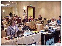
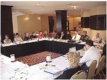
The NCGE holds an annual conference in the summer or fall, called the National Conference on Geography Education. The conference offers hands-on workshops in new teaching methods, technologies, and resources, as well as research papers, networking opportunities, and field trips. Field trips include local and regional places of geographic and historical significance, which may include forts, wetlands, coasts, campuses, historical districts, lakes, mountains, and rainforests. They may also include a service learning project that benefits the community in which the conference is held. An exhibit hall is staffed by government, industry, nonprofit, and academic organizations and offers the latest in books, journals, projects, curriculum, software, hardware, and more to support geography teaching. The conference also hosts a poster session showcasing exemplary geography projects by educators and students. Over 600 attendees typically participate in the annual conferences.
The conference rotates its location each year in North America and has been held in the following locations over the past 16 years: 1995: San Antonio. 1996: Santa Barbara. 1997: Orlando, Florida. 1998: Indianapolis. 1999: Boston. 2000: Chicago. 2001: Vancouver, British Columbia. 2002: Philadelphia. 2003: Salt Lake City. 2004: Kansas City. 2005: Birmingham, Alabama. 2006: Lake Tahoe, Nevada-California. 2007: Oklahoma City. 2008: Dearborn, Michigan. 2009: San Juan, Puerto Rico. 2010: Savannah. 2011: Portland, Oregon. The 2012 conference will be held in San Marcos, Texas, near Texas State University, the largest geography department in the USA. The 2015 conference will commemorate the 100th Anniversary of the NCGE, and will be held in Washington DC.
The NCGE also holds a webinar series that is open to all and free to members. Topics include teaching with web-based Geographic Information Systems, teaching about the Erie Canal using digital maps, imagery, and geographic inquiry, place-based learning, field work techniques, methods of teaching Advanced Placement Human Geography (APHG), and more. These webinars are conducted by the experts in the respective topics and offer live training as well as the ability to watch the webinar recordings that have been archived. Sign up for these webinars via the NCGE at http://www.ncge.org.
Partnerships
The NCGE as an organization actively partners with other organizations, including the Association of American Geographers, The National Council for the Social Studies, and other organizations. Its members are active in the National Science Teachers Association, the North_American_Association_for_Environmental_Education, the Geographical Association, and in other organizations. Many of its members are also active with the education program of the National_Geographic_Society and with the National_Science_Foundation. Some members are active in working with the U.S. Congress on bills and policy that strengthen geography education at all levels, most notably the "Teaching Geography Is Fundamental (TGIF)" Act.
Publications
The NCGE's newsletter is entitled "Perspective" and is published six times each year. Its contents include geography education news, events, opportunities, and resources.
The NCGE's journals include "Journal of Geography" and "The Geography Teacher." The Journal has been published for nearly a century, beginning with a different name, while The Geography Teacher began around 2000. The Journal of Geography focuses on research in geography education. It is a scholarly, peer-reviewed journal designed for educators, offering the best in teaching and research advancements in geographic education. JOG publishes research on innovative approaches to teaching and learning, classroom tested lesson ideas, curriculum, book reviews, and more.The Geography Teacher's focus is on illustrating how geography can be taught in the classroom, through short articles, lesson plans, teaching tips, and news especially relevant for today’s primary, secondary, and and pre-service teachers.
Taylor and Francis is the publisher of these journals.References
Bednarz, Sarah W. 2000. Geography Education Research in the Journal of Geography 1988-1997. International Research in Geographical and Environmental Education 9(2): 128-140.
Dougherty, Percy H. 1984. National Council for Geographic Education. The Professional Geographer 36(2): 242.
LeVasseur, Michal L. 1999. Students' knowledge of geography and geography careers. Journal of Geography 98(6): 265-271.
Nellis, M. Duane. 1995. Geography for life: Today's innovations are tomorrow's traditions. Journal of Geography 94(1): 302-304.
External links
National Council for Geographic Education
Categories:- Geographic societies
- Educational organizations based in the United States
Wikimedia Foundation. 2010.


