- Veluwezoom National Park
-
Veluwezoom National Park Nationaal Park Veluwezoom 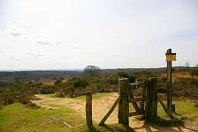
Posbank (part of NP Veluwezoom)Map of the National Park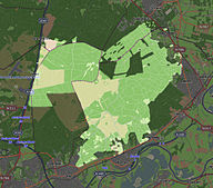
Location Gelderland, Netherlands Coordinates 52°2′N 5°57′E / 52.033°N 5.95°ECoordinates: 52°2′N 5°57′E / 52.033°N 5.95°E Area 50 km2 (19 sq mi) Established 1930[1] Governing body Natuurmonumenten Official website Veluwezoom National Park is a national park located in the Dutch province of Gelderland. This park is the oldest national park of the Netherlands.[2] It is an area of 50 square kilometers at the southeastern edge of the Veluwe, a complex of terminal push moraines from the Saalian glaciation. It has a pronounced relief by dutch standards, with the highest point in the park at 110 meters above sea level.[3]
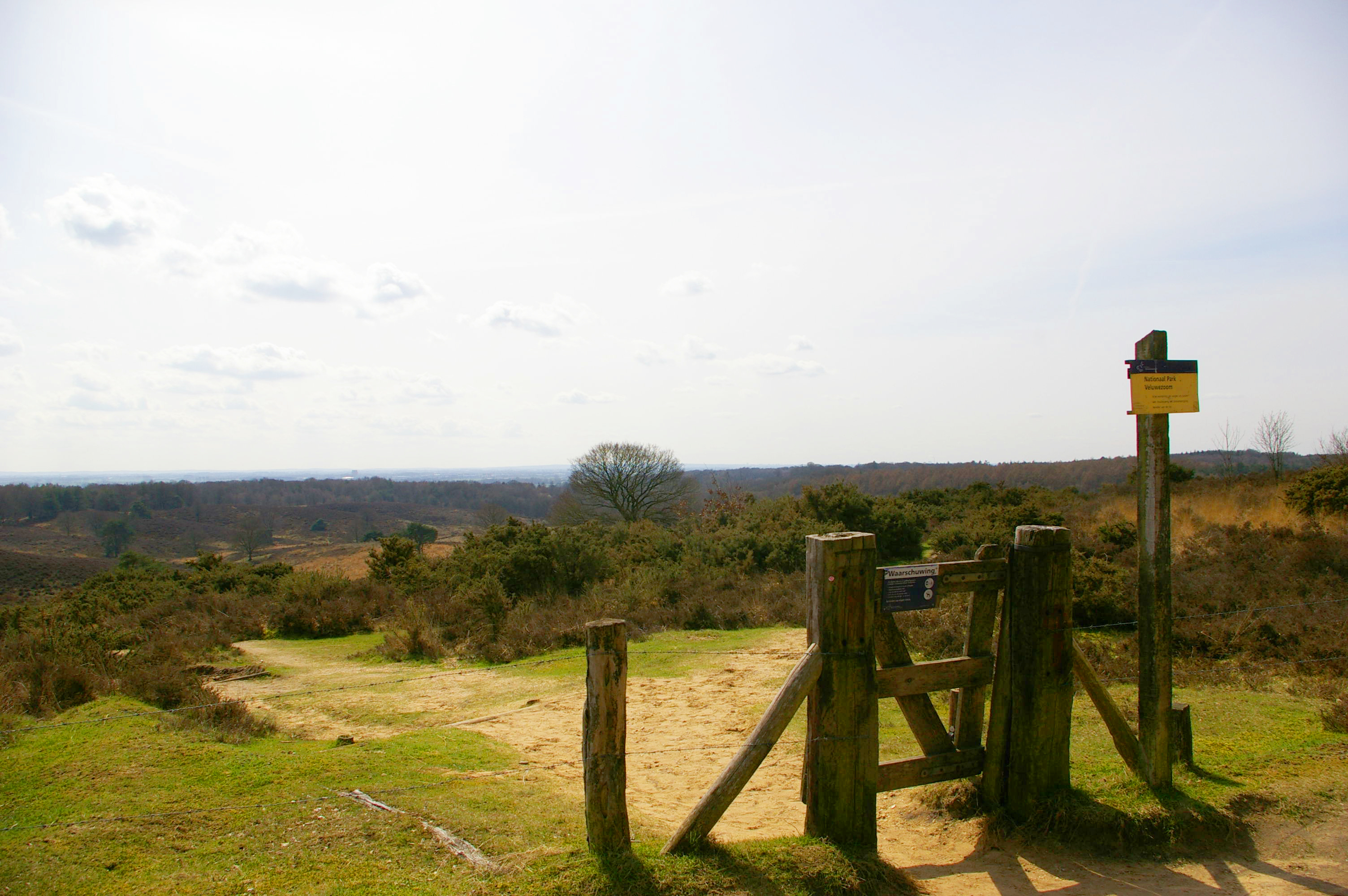
The landscape of the park consists of forests and heathland, which is kept open by grazing of highland cattle, and a small sand drift, which is kept open by human maintenance. The native fauna is represented by red deer, wild boar, badger and the regionally rare pine marten.
References
- ^ (Dutch)http://www.nationaalpark.com/content/view/24/47/ Nationaalpark.com, Veluwezoom
- ^ http://www.veluwezoom.nl/
- ^ (Dutch) veluwezoom.nl
National Parks of the Netherlands Alde Feanen • Biesbosch • Drentsche Aa • Drents-Friese Wold • Dunes of Texel • Dwingelderveld • Groote Peel • Hoge Veluwe • Lauwersmeer • Loonse en Drunense Duinen • Maasduinen • Meinweg • Oosterschelde • Sallandse Heuvelrug • Schiermonnikoog • Utrechtse Heuvelrug • Veluwezoom • De Weerribben-Wieden • Zoom - Kalmthoutse Heide • Zuid-Kennemerland
More info on national parksCategories:- IUCN Category II
- National parks of the Netherlands
- Gelderland
- Protected areas established in 1930

Wikimedia Foundation. 2010.