- Napsbury Park
-
Coordinates: 51°43′30″N 0°18′00″W / 51.725°N 0.300°W
Napsbury Park 
 Napsbury Park
Napsbury Park shown within HertfordshireOS grid reference TL175045 District St Albans Shire county Hertfordshire Region East Country England Sovereign state United Kingdom Post town ST ALBANS Postcode district AL2 Dialling code 01727 Police Hertfordshire Fire Hertfordshire Ambulance East of England EU Parliament East of England UK Parliament St Albans List of places: UK • England • Hertfordshire Napsbury Park is a village in Hertfordshire, England. It is located to the north of London, at Junction 22 of the M25 motorway.
It is near St Albans and part of the St Albans District. It falls within the London Colney Parish Council area. It is considered a satellite or dormitory village of St Albans, where some villagers travel to work and shop. The 659 bus connects the village with St Albans and London Colney.
Contents
Early history
The presence of prehistoric or Roman activity is indicated by cropmarks to the east of the railway in Napsbury hospital grounds; and again on the north side of the hospital. Documentary evidence suggests the existence of a lost medieval settlement.[1][2] Early Napsbury is mentioned in the Domesday Book: it had a house called Tylehouse which was associated with tile and brick workings. It is known that there were people settled there with tofts, smallholdings or farms, since tithes were payable in the 14th century.[3]
History
The Middlesex County Asylum was founded in 1898 with the hospital designed in a country estate style by architect Rowland Plumbe in 1900, who also rebuilt, to his designs, the Royal London Hospital, Whitechapel in 1897.
The hospital was designed for 1,205 residents,[4] and the grounds were designed by William Goldring.[4] Napsbury opened, following the construction of the numerous buildings and extensive grounds on June 3, in 1905.[5] According to Middlesex County Record, the initial cost, including land and equipment, was £545,000, or £473 per bed. In 1908 Plumbe designed an extension to accommodate a further 600 patients.[6]
During the First World War, Napsbury was used for and known as the County of Middlesex War Hospital, which tended for soldiers wounded at the Front.[4][7][8] Following this, in the late 1920s a nurses home was also added to the site, further adding to the variety of different buildings and facilities at the site.
Although Napsbury suffered some bomb damaged in the Blitz, it was in continuous use as a hospital until its official closure in 1998. However, until at least 2002 one building was still in use for psychiatric patients.[4] Due to its largely untouched parkland, Napsbury was listed by English Heritage as a Grade II Historic Park and Garden in 2001.[9]
Redevelopment
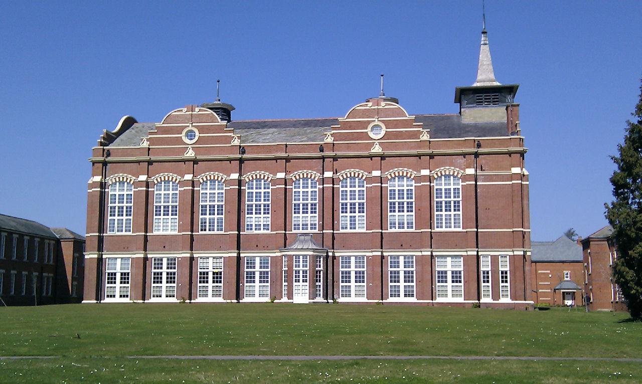
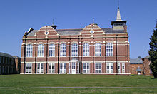 Renovated West Hall
Crest Nicholson, which specialises in creating new communities from redundant land and estates, seized the opportunity to acquire the site and to create a unique community, centred on the preservation and conservation of both the architectural and botanical heritage of the site.[10]
Local features
Napsbury Park is the home of several Arsenal FC & Watford FC footballers, due to its proximity to their training grounds.
Napsbury railway station was built by the Midland Railway in 1905 on its line to St Pancras station. It was never more than an island platform between the slow lines, with a siding serving the Middlesex County Asylum at Napsbury, and closed in 1959.
There is currently planning permission for the first commercial and retail units on the site, which will build upon the settlements village status.[11]
Famous residents
References
- ^ The Deserted Medieval Villages Of Hertfordshire 2nd Ed 1982- K. Rutherford Davis ISBN 0901354236
- ^ Bourn, Rob (September 2007). "Archaeological desk based assessment". Radlett SRFI St Albans Hertfordshire. St Albans District Council. http://www.stalbans.gov.uk/Images/Appendix-11.A1-Archaeology-DBA_tcm15-9089.pdf. Retrieved 25 March 2010.
- ^ Page (editor), William (1908). "British History Online". Parishes: St Peter's', A History of the County of Hertford: volume 2 (1908): "Napsbury". Victoria County History. pp. 412–424. http://www.british-history.ac.uk/report.aspx?compid=43302. Retrieved 25 March 2010.
- ^ a b c d e Warwack, O. (2007). "A bit about Napsbury". http://napsburypark.com/main/index.php?option=com_content&task=view&id=27&Itemid=41. Retrieved 2008-06-21.
- ^ "Middlesex County Asylum". Cracknell, P.. 2005. http://www.countyasylums.com/mentalasylums/napsbury01.htm. Retrieved 2008-06-21.
- ^ "A History of Napsbury Park". http://www.28dayslater.co.uk/forums/showthread.php?t=30403.
- ^ "Napsbury". Genealogy in Hertfordshire. 2007. http://www.hertfordshire-genealogy.co.uk/links/napsbury.htm. Retrieved 2008-06-21.
- ^ Toms, J. (2006). "Review of Forgotten Lunatics of the Great War by Peter Barham". Institute of Historical Research. http://www.history.ac.uk/reviews/paper/toms.html. Retrieved 2008-06-21.; Bill Pollard, email to Jamie Oliver, May 8, 2011.
- ^ Napsbury Park.com - http://www.napsburypark.com/main/
- ^ Napsbury Park.com - http://napsburypark.com/main/index.php?option=com_content&task=view&id=27&Itemid=41
- ^ St Albans City - www.stalbans.gov.uk
External links
Categories:- Villages in Hertfordshire

Wikimedia Foundation. 2010.