- Namaka, Alberta
-
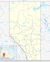
 NamakaLocation of Namaka Alberta
Namaka is a hamlet in southern Alberta, Canada within Wheatland County.[1] It is located approximately 10 kilometres (6.2 mi) south of Highway 1 and 55 kilometres (34 mi) east of Calgary.
See also
- List of communities in Alberta
- List of hamlets in Alberta
References
- ^ Alberta Municipal Affairs (2010-04-01). "Specialized and Rural Municipalities and Their Communities". http://municipalaffairs.gov.ab.ca/documents/msb/2010-ruralmun.pdf. Retrieved 2010-07-08.
 Subdivisions of Alberta
Subdivisions Regions · Census divisions · Municipal districts (counties) · Specialized municipalities · School districts · Regional health authoritiesCommunities Cities · Towns · Villages · Summer villages · Hamlets · Indian reserves · Métis settlements · Ghost towns · Designated placesCities and Urban
Service AreasAirdrie · Brooks · Calgary · Camrose · Cold Lake · Edmonton (capital) · Fort McMurray · Fort Saskatchewan · Grande Prairie · Lacombe · Leduc · Lethbridge · Lloydminster · Medicine Hat · Red Deer · Sherwood Park · Spruce Grove · St. Albert · Wetaskiwin Category ·
  Portal ·
  WikiProject
Coordinates: 50°57′31″N 113°17′33″W / 50.95861°N 113.2925°W
Categories:- Hamlets in Alberta
- Designated places in Alberta
- Wheatland County, Alberta
- Southern Alberta geography stubs

Wikimedia Foundation. 2010.