- Nam Phong District
-
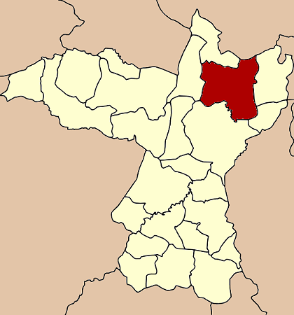
Nam Phong
น้ำพอง— Amphoe — Amphoe location in Khon Kaen Province
Coordinates: 16°42′7″N 102°51′24″E / 16.70194°N 102.85667°ECoordinates: 16°42′7″N 102°51′24″E / 16.70194°N 102.85667°E Country  Thailand
Province Khon Kaen Seat Wang Chai Area - Total 828.7 km2 (320 sq mi) Population (2008) - Total 112,414 - Density 136.8/km2 (354.3/sq mi) Time zone THA (UTC+7) Postal code 40140 Geocode 4007 Nam Phong (Thai: น้ำพอง) is a district (Amphoe) of Khon Kaen Province.
Contents
Geography
Neighboring district are (from the north clockwise) Non Sa-at of Udon Thani Province, Kranuan, Sam Sung, Mueang Khon Kaen, Ubolratana and Khao Suan Kwang.
The district is located at Mittraphap Road (Thailand Route 2), as well as the northeastern railway. The district office and the train station are located about 7 km east of the main settlement, Ban Nam Phong.
Despite its name, the Nam Phong National Park does not cover any territory of the Nam Phong district, but is located southeast of the district. Both are named after the Nam Phong River, which originates within the national park, and after the Ubol Ratana dam flows through the district towards the Chi River.
An oil survey in 1979 found a natural gas reserve of estimated 1.5 trillion cubic feet (42 km³) was discovered. Since 1989 the gas field is exploited for the Nam Phong power plant operated by EGAT. With a capacity of 710 MW it is the main source of electricity for the northeast of Thailand.[1]
Economy
The district is mostly agricultural, main products are rice, sugar cane as well as husbandry. The two major factories are a sugar factory and a distillery for Lao Kao.
History
The district was created on February 10 1908, at first named Tha Wa (ท่าหว้า). In 1909 it was renamed to Nam Phong.[2]
1972-73 the Royal Thai Air Base Nam Phong was one of the bases of the US military used for the Vietnam war.
Attractions
Phrathat Kham Kaen is an ancient Buddhist monument. The stupa, located within Wat Chetiyaphum, is believed to mark the original location of Khon Kaen. According to the local legend, relics of Buddha were to be brought to Nakhon Phanom. The monks camped at a dead tamarind tree. When they arrived in Nakhon Phanom the Phrathat Phanom was already finished, thus they planned to return the relics. On the return way they found the dead tree flourished again, and built the stupa at the site of the miracle.[3]
Ban Khok Sa-nga is famous as the King Cobra Village. In 1951 a local doctor started to conduct cobra shows to attract clients to the village. Nowadays the cobra shows are the main income of the villagers, who also travel around to perform the show and sell their herbal medicine.
Administration
The district is subdivided into 12 subdistricts (tambon), which are further subdivided into 167 villages (muban). There are two subdistrict municipalities (thesaban tambon) - Nam Phong covering parts of tambon Nam Phong, and Wang Chai covering parts of tambon Wang Chai and Nong Kung. Each of the tambon is administrated by a Tambon administrative organization (TAO).
No. Name Thai Villages Inh.[4] 1. Nam Phong น้ำพอง 17 14,081 2. Wang Chai วังชัย 16 10,494 3. Nong Kung หนองกุง 10 9,915 4. Bua Yai บัวใหญ่ 17 7,797 5. Sa-at สะอาด 14 9,657 6. Muang Wan ม่วงหวาน 14 9,385 7. Ban Kham บ้านขาม 16 9,281 8. Bua Ngoen บัวเงิน 17 12,095 9. Sai Mun ทรายมูล 13 7,333 10. Tha Krasoem ท่ากระเสริม 10 7,500 11. Phang Thui พังทุย 13 7,137 12. Kut Nam Sai กุดน้ำใส 10 7,739 References
- ^ Nam Phong power plant website
- ^ Amphoe information at the Ramkamhaeng University, Khon Kaen campus
- ^ Tourism authority of Thailand
- ^ "Population statistics 2008". Department of Provincial Administration. http://www.dopa.go.th/xstat/p5140_01.html.
External links
- amphoe.com (Thai)
Mueang Khon Kaen · Ban Fang · Phra Yuen · Nong Ruea · Chum Phae · Si Chomphu · Nam Phong · Ubolratana · Kranuan · Ban Phai · Pueai Noi · Phon · Waeng Yai · Waeng Noi · Nong Song Hong · Phu Wiang · Mancha Khiri · Chonnabot · Khao Suan Kwang · Phu Pha Man · Sam Sung · Khok Pho Chai · Nong Na Kham · Ban Haet · Non Sila · Wiang Kao
Categories:- Amphoe of Khon Kaen
Wikimedia Foundation. 2010.