Naivasha Airport

Naivasha Airport
Naivasha Airport
IATA: n/aICAO: HKNV
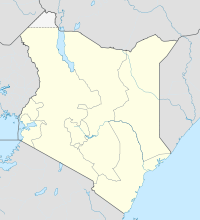
Naivasha is located in Kenya
{{{alt}}}
Naivasha
Location of Naivasha Airport in Kenya
Placement on map is approximate
Summary
Airport type Public, Civilian
Owner Kenya Airports Authority
Serves Naivasha, Kenya
Location Naivasha,  Kenya
Elevation AMSL 6,352 ft / 1,936 m
Coordinates 00°47′06″S 36°26′02″E / 0.785°S 36.43389°E / -0.785; 36.43389 (Naivasha Airport)
Runways
Direction Length Surface
ft m
3,315 1,102 Asphalt

Naivasha Airport is an airport in Kenya.

Contents

Location

Naivasha Airport (IATA: n/aICAO: HKNV) is located in Nakuru District, Rift Valley Province, in the town of Naivasha, at a location called Karagite, approximately 100 kilometres (62 mi), by road, northwest of Nairobi, the capital of the Republic of Kenya and the largest city in that country.[1]

Its location lies approximately 87 kilometres (54 mi), by air, northwest of Nairobi International Airport, the country’s largest civilian airport.[2] The geographic coordinates of this airport are:0° 47' 6.00"S, 36° 26' 2.00"E (Latitude:-0.785000; Longitude:36.433890).

Overview

Naivasha Airport is a small civilian airport, serving the town of Naivasha and surrounding communities. The airport is situated 1,936 metres (6,352 ft) above sea level.[3] Nakuru Airport has a single asphalt runway that is 1,102 metres (3,615 ft) long.[4]

Airlines and destinations

There is no regular, scheduled airline service to Naivasha Airport at this time.

External links

See also

References

Coordinates: 0°47′06″N 36°26′02″E / 0.785000°N 36.433890°E / 0.785000; 36.433890


Wikimedia Foundation. 2010.

Игры ⚽ Поможем сделать НИР

Look at other dictionaries:

  • Wilson Airport (Kenya) — Infobox Airport name = Wilson Airport nativename = nativename a = nativename r = image width = caption = IATA = WIL ICAO = HKNW type = Public owner = operator = Kenya Airports Authority city served = location = Nairobi elevation f = 5,536… …   Wikipedia

  • Liste der Flughäfen in Kenia — Die Liste der Flughäfen in Kenia führt zivile und militärische Flughäfen im ostafrikanischen Staat Kenia geordnet nach Ort auf. Inhaltsverzeichnis 1 Quellen 2 Weblinks Ort ICAO Code …   Deutsch Wikipedia

  • East African lakes — ▪ lake system, East Africa Introduction  group of lakes in East Africa (eastern Africa). The majority of the East African lakes lie within the East African Rift System, which forms a part of a series of gigantic fissures in the Earth s crust… …   Universalium

  • Nairobi —   City   Nairobi s skyline at dusk …   Wikipedia

  • Kenya — Kenyan, adj., n. /ken yeuh, keen /, n. 1. a republic in E Africa: member of the Commonwealth of Nations; formerly a British crown colony and protectorate. 28,803,085; 223,478 sq. mi. (578,808 sq. km). Cap.: Nairobi. 2. Mount, an extinct volcano… …   Universalium

  • Calendar of 2003 — ▪ 2004 January So long as there is a single Brazilian brother or sister going hungry, we have ample reason to be ashamed of ourselves. Lula, in his inaugural address as president of Brazil, January 1 January 1       The Socialist Lula (Luiz… …   Universalium

  • Mombasa — Mvita redirects here. For the electoral constituency, see Mvita Constituency. Island of War redirects here. For the television series, see Island at War. For the asteroid, see 1428 Mombasa. Mombasa   City   …   Wikipedia

  • January 9 — Events * 475 Byzantine Emperor Zeno is forced to flee his capital at Constantinople. *1349 The Jewish population of Basel, Switzerland, believed by the residents to be the cause of the ongoing bubonic plague, were rounded up and incinerated.… …   Wikipedia

  • Cooperative Bank of Kenya — We are you Type Public: NSE: COOP Industry Financial Services Founded 1965 Headquarters Nairobi, Kenya …   Wikipedia

  • North Eastern Province (Kenya) — North Eastern Province   Province   Location in Kenya. Coordin …   Wikipedia

Share the article and excerpts

Direct link
Do a right-click on the link above
and select “Copy Link”