- Mysia, Victoria
-
Mysia
Victoria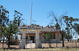
War Memorial School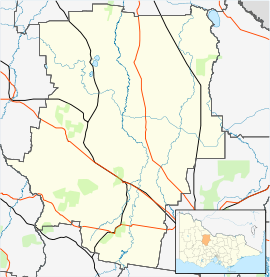
 Mysia
MysiaPopulation: 105[1] Postcode: 3518 Location: - 243 km (151 mi) N of Melbourne
- 89 km (55 mi) NW of Bendigo
- 29 km (18 mi) NE of Wedderburn
- 18 km (11 mi) s of Boort
LGA: Shire of Loddon State District: Swan Hill Federal Division: Murray Mysia is a locality in north central Victoria, Australia. It is located in the Shire of Loddon local government area, 243 kilometres (151 mi) north of the state capital, Melbourne. At the 2006 census, Mysia and the surrounding area had a population of 105.[1]
Mysia Post Office opened on 6 June 1877 and Mysia Railway Station office opened in 1883. Mysia closed in 1895, but reopened in 1911 replacing Mysia Railway Station office, finally closing in 1992. [2] The War Memorial School was opened on 9 November 1921 by the Earl of Stradbroke, Governor of Victoria.The school was funded by public subscription which raised 500 pounds.[3] The building was restored in 1999, and is currently used as a community hall.[4]
References
- ^ a b Australian Bureau of Statistics (25 October 2007). "Mysia (State Suburb)". 2006 Census QuickStats. http://www.censusdata.abs.gov.au/ABSNavigation/prenav/LocationSearch?collection=Census&period=2006&areacode=SSC26271&producttype=QuickStats&breadcrumb=PL&action=401. Retrieved 2009-30-03.
- ^ Premier Postal History. "Post Office List". https://www.premierpostal.com/cgi-bin/wsProd.sh/Viewpocdwrapper.p?SortBy=VIC&country=. Retrieved 2008-04-11.
- ^ "Governor on Tour - Visit to Mysia and Boort". Argus: p. 6. 14 November 1921. http://ndpbeta.nla.gov.au/ndp/del/article/4620659. Retrieved 16 April 2009.
- ^ Southwell-Keely, Michael. "Mysia War Memorial School". War Memorials in Australia. http://www.skp.com.au/memorials2/pages/30020.htm. Retrieved 16 April 2009.
Towns in the Shire of Loddon Arnold · Boort · Bridgewater On Loddon · Buckrabanyule · Dingee · Durham Ox · Fentons Creek · Inglewood · Kingower · Korong Vale · Laanecoorie · Llanelly · Logan · Mitiamo · Mysia · Newbridge · Pyramid Hill · Serpentine · Tarnagulla · Wedderburn
- Mysia, Victoria is at coordinates 36°13′48″S 143°45′22″E / 36.230°S 143.756°ECoordinates: 36°13′48″S 143°45′22″E / 36.230°S 143.756°E
Categories:- Towns in Victoria (Australia)
- Victoria (Australia) geography stubs


Wikimedia Foundation. 2010.