- Geography and cartography in medieval Islam
-
 This map of the Indian Ocean and the China Sea was engraved in 1728 by the Hungarian-born Ottoman cartographer and publisher Ibrahim Müteferrika; it is one of a series that illustrated Katip Çelebi’s Cihannuma (Universal Geography), the first printed book of maps and drawings to appear in the Islamic world.
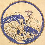
Geography and cartography in medieval Islam refers to the advancement of geography, cartography and the earth sciences in the medieval Islamic civilization.
After its beginnings in the 8th century based on Hellenistic geography,[1] Islamic geography was patronized by the Abbasid caliphs of Baghdad. Various Islamic scholars contributed to its development, and the most notable include Al-Khwārizmī, Abū Zayd al-Balkhī (founder of the 'Balkhī school') and Abu Rayhan Biruni. Muslim geography reached its apex with Muhammad al-Idrisi in the 12th century. Later developments took place under Turks, particularly under the Ottoman Empire, with notable scholars such as Mahmud al-Kashgari and Piri Reis.
Contents
Impetus
Previous learning
Islamic cartographers inherited Ptolemy's Almagest and Geographia in the 9th century which is said to have stimulated an interest in geography and map-making, however, they made almost no direct use of the latter in map-making.[2] The way in which earlier knowledge reached Muslim scholars is crucial. For example, since Muslims inherited Greek writings directly without the influence of the Latin west, T-O maps play no role in Islamic cartography though popular in the European counterpart.[2] Muslim scientists then made many of their own contributions to geography and the earth sciences.
See also
Notes and references
- Notes
- Citations
- ^ Gerald R. Tibbetts, The Beginnings of a Cartographic Tradition, in: John Brian Harley, David Woodward: Cartography in the Traditional Islamic and South Asian Societies, Chicago, 1992, pp. 90-107 (97-100), ISBN 0-226-31635-1
- ^ a b Edson & Savage-Smith 2004, pp. 61–63.
- Bibliography
- Alavi, S. M. Ziauddin (1965), Arab geography in the ninth and tenth centuries, Aligarh: Aligarh University Press
- Edson, Evelyn; Savage-Smith, Emilie (2004). Savage-Smith, Emilie. ed. Medieval Views of the Cosmos. Oxford: Bodleian Library. ISBN 9781851241842.
- King, David A. (1983), "The Astronomy of the Mamluks", Isis 74 (4): 531–555, doi:10.1086/353360
- King, David A. (2002), "A Vetustissimus Arabic Text on the Quadrans Vetus", Journal for the History of Astronomy 33: 237–255
- King, David A. (December 2003), "14th-Century England or 9th-Century Baghdad? New Insights on the Elusive Astronomical Instrument Called Navicula de Venetiis", Centaurus 45 (1-4): 204–226, doi:10.1111/j.1600-0498.2003.450117.x
- King, David A. (2005), In Synchrony with the Heavens, Studies in Astronomical Timekeeping and Instrumentation in Medieval Islamic Civilization: Instruments of Mass Calculation, Brill Publishers, ISBN 900414188X
- McGrail, Sean (2004), Boats of the World, Oxford University Press, ISBN 0199271860
- Mott, Lawrence V. (May 1991), The Development of the Rudder, A.D. 100-1337: A Technological Tale, Thesis, Texas A&M University
- Rashed, Roshdi; Morelon, Régis (1996), Encyclopedia of the History of Arabic Science, 1 & 3, Routledge, ISBN 0415124107
- Sezgin, Fuat (2000) (in German), Geschichte Des Arabischen Schrifttums X–XII: Mathematische Geographie und Kartographie im Islam und ihr Fortleben im Abendland, Historische Darstellung, Teil 1–3, Frankfurt am Main
External links
- "How Greek Science Passed to the Arabs" by De Lacy O'Leary
- Islamic Geography in the Middle Ages
Geography and cartography in medieval Islam Geographers 9th century10th centuryIbn Khordadbeh • Ahmad ibn Rustah • Ahmad ibn Fadlan • Abu Zayd al-Balkhi • Abū Muhammad al-Hasan al-Hamdānī • Al-Masudi • Istakhri • Khashkhash Ibn Saeed Ibn Aswad • Ibn Hawqal • Ibn al-Faqih • Al-Muqaddasi11th centuryAbū Rayḥān al-Bīrūnī • Abu Saʿīd Gardēzī • Al-Bakri • Mahmud al-Kashgari12th centuryAl-Zuhri • Muhammad al-Idrisi13th century14th century15th centuryAhmad ibn Mājid16th centuryWorks Schools Balkhi school • Iraqi school
Influences Geography (Ptolemy)Categories:- Islamic geography
- Islamic Golden Age
Wikimedia Foundation. 2010.

