- Mundulla
-
Mundulla
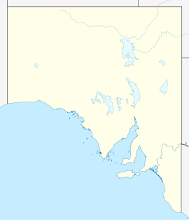
South AustraliaPopulation: 1,042[1] Postcode: 5270 Coordinates: 36°22′S 140°42′E / 36.367°S 140.7°ECoordinates: 36°22′S 140°42′E / 36.367°S 140.7°E Location: - 278 km (173 mi) SE of Adelaide
- 182 km (113 mi) N of Mount Gambier
- 10 km (6 mi) SW of Bordertown
LGA: Tatiara District Council State District: MacKillop Federal Division: Barker Mundulla is a town in eastern South Australia. The town is located in the Tatiara District Council local government area, 278 kilometres (173 mi) south east of the state capital, Adelaide. The name of the town is derived from the Aboriginal work mantala meaning "place of thunder", referring to a rumbling sound made when trampling on the earth as a result of the many caves in the area.[2]
At the 2006 census, Mundulla and the large surrounding area had a population of 1,042.[1]
The Mundulla school opened in 1878.[2] An Australian rules football club, Mundulla Football Club, compete in the Kowree Naracoorte Tatiara Football League.[3]
References
- ^ a b Australian Bureau of Statistics (25 October 2007). "Mundulla (State Suburb)". 2006 Census QuickStats. http://www.censusdata.abs.gov.au/ABSNavigation/prenav/LocationSearch?collection=Census&period=2006&areacode=SSC44336&producttype=QuickStats&breadcrumb=PL&action=401. Retrieved 7 November 2010.
- ^ a b "Morphettville - Munno Para". Place names of South Australia. State Library of South Australia. http://www.slsa.sa.gov.au/manning/pn/m/m12.htm#mundulla. Retrieved 7 November 2010.
- ^ Gerritson, Tim (29 June 2009). "Football upset: Pumped up Mundulla downs leader Keith". Australian Broadcasting Corporation. http://blogs.abc.net.au/sa/2009/06/football-upset-pumped-up-mundulla-downs-leader-keith.html?site=northandwest&program=north_and_west_sa_late_afternoons. Retrieved 7 November 2010.
Categories:- Towns in South Australia
- South Australia geography stubs
Wikimedia Foundation. 2010.

