- Mueang Ubon Ratchathani District
-
Mueang Ubon Ratchathani
เมืองอุบลราชธานี— Amphoe — Amphoe location in Ubon Ratchathani Province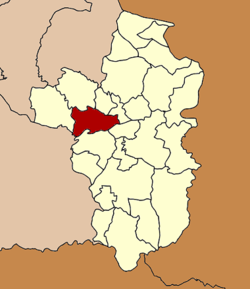
Coordinates: 15°13′44″N 104°51′15″E / 15.22889°N 104.85417°ECoordinates: 15°13′44″N 104°51′15″E / 15.22889°N 104.85417°E Country  Thailand
Province Ubon Ratchathani Seat Nai Mueang Tambon Muban Amphoe established Area – Total 406.4 km2 (156.9 sq mi) Population (2005) – Total 211,855 – Density 521.3/km2 (1,350.2/sq mi) Time zone THA (UTC+7) Postal code 34000 Geocode 3401 Mueang Ubon Ratchathani (Thai: เมืองอุบลราชธานี) is the capital district (Amphoe Mueang) of Ubon Ratchathani Province, northeastern Thailand.
Contents
History
The district was originally named Buphapala Nikhom (บุพปลนิคม). Later the name was changed to Burapha Ubon (บูรพาอุบล) in 1909 and Mueang Ubon Ratchathani in 1913.[1]
Geography
Neighboring districts are (from the west clockwise) Khueang Nai, Muang Sam Sip, Lao Suea Kok, Don Mot Daeng, Sawang Wirawong, Warin Chamrap of Ubon Ratchathani Province and Kanthararom of Sisaket Province.
The important water resource is the Mun River.
Administration
The district is subdivided into 12 subdistricts (tambon), which are further subdivided into 148 villages (muban). The city (thesaban nakhon) Ubon Ratchathani covers the whole tambon Nai Mueang. Ubon is a township (thesaban tambon) which covers parts of tambon Kham Yai and Chaeramae. There are further 11 Tambon administrative organizations (TAO).
No. Name Thai name Villages Inh. 1. Nai Mueang ในเมือง - 86,809 4. Hua Ruea หัวเรือ 14 8,968 5. Nong Khon หนองขอน 15 8,436 7. Pathum ปทุม 12 10,294 8. Kham Yai ขามใหญ่ 24 30,471 9. Chaeramae แจระแม 10 12,622 11. Nong Bo หนองบ่อ 13 7,595 12. Rai Noi ไร่น้อย 17 19,589 13. Krasop กระโสบ 12 5,565 16. Ku Talat กุดลาด 13 10,178 19. Khilek ขี้เหล็ก 10 6,024 20. Pa-ao ปะอาว 8 5,304 Missing numbers are tambon which form the district Don Mot Daeng and Lao Suea Kok.
References
- ^ "แจ้งความกระทรวงมหาดไทย เรื่อง เปลี่ยนนามอำเภอ" (in Thai). Royal Gazette 30 (0 ง): 1536–1537. October 12 1913. http://www.ratchakitcha.soc.go.th/DATA/PDF/2456/D/1536.PDF.
External links
Mueang Ubon Ratchathani · Si Mueang Mai · Khong Chiam · Khueang Nai · Khemarat · Det Udom · Na Chaluai · Nam Yuen · Buntharik · Trakan Phuet Phon · Kut Khaopun · Muang Sam Sip · Warin Chamrap · Phibun Mangsahan · Tan Sum · Pho Sai · Samrong · Don Mot Daeng · Sirindhorn · Thung Si Udom · Na Yia · Na Tan · Lao Suea Kok · Sawang Wirawong · Nam Khun
Categories:- Amphoe of Ubon Ratchathani
- Isan geography stubs

Wikimedia Foundation. 2010.