- Mueang Trat District
-
Mueang Trat
เมืองตราด— Amphoe — Amphoe location in Trat Province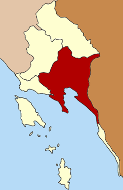
Coordinates: 12°13′54″N 102°30′48″E / 12.23167°N 102.51333°ECoordinates: 12°13′54″N 102°30′48″E / 12.23167°N 102.51333°E Country  Thailand
Province Trat Seat Nong Samet Tambon Muban Amphoe established Area – Total 938.611 km2 (362.4 sq mi) Population (2000) – Total 89,661 – Density 95.5/km2 (247.3/sq mi) Time zone THA (UTC+7) Postal code 23000 Geocode 2301 Mueang Trat (Thai: เมืองตราด) is the capital district (Amphoe Mueang) of Trat Province, eastern Thailand.
Contents
History
The area was settled in 1901 as a Khwaeng of Mueang Trat. The government upgraded the Khwaeng to be Mueang Trat district in 1908. In 1921 the district was renamed to Bang Phra after the name of the central tambon. The district name was changed to Mueang Trat in 1938 due to the new naming policy of the capital districts.[1]
Geography
Neighboring districts are (from the west clockwise) Laem Ngop, Khao Saming, Bo Rai of Trat Province, the province Pursat, Koh Kong of Cambodia, Khlong Yai of Trat province again and the Gulf of Thailand.
Administration
The district is subdivided into 14 subdistricts (tambon), which are further subdivided into 97 villages (muban). Trat itself has town (thesaban mueang) status and covers the tambon Bang Phra and part of Wang Krachae. The township (thesaban tambon) Tha Phrik Noen Sai covers the complete tambon Tha Phrik and parts of Noen Sai. There are further 12 Tambon administrative organizations (TAO).
1. Bang Phra บางพระ 2. Nong Samet หนองเสม็ด 3. Nong Sano หนองโสน 4. Nong Khan Song หนองคันทรง 5. Huang Nam Khao ห้วงน้ำขาว 6. Ao Yai อ่าวใหญ่ 7. Wang Krachae วังกระแจะ 8. Huai Raeng ห้วยแร้ง 9. Noen Sai เนินทราย 10. Tha Phrik ท่าพริก 11. Tha Kum ท่ากุ่ม 12. Takang ตะกาง 13. Chamrak ชำราก 14. Laem Klat แหลมกลัด References
- ^ "พระราชกฤษฎีกาเปลี่ยนนามจังหวัด และอำเภอบางแห่ง พุทธศักราช ๒๔๘๑" (in Thai). Royal Gazette 55 (0 ก): 658. November 14 1938. http://www.ratchakitcha.soc.go.th/DATA/PDF/2481/A/658.PDF.
External links
Categories:- Amphoe of Trat
- Eastern Thailand geography stubs

Wikimedia Foundation. 2010.