- Mpondwe
-
Mpondwe Map of Uganda showing the location of Mpondwe.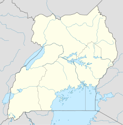
 Mpondwe
Coordinates: 00°02′28″N 29°43′30″E / 0.04111°N 29.725°E Country  Uganda
Region Western Uganda Sub-region Rwenzururu sub-region District Kasese District Government - Mayor Elevation 1,190 m (3,904 ft) Population (2011 Estimate) - Total 16,700 Time zone EAT (UTC+3) Mpondwe is a town in Western Region, Uganda.
Contents
Location
Mpondwe is located in the Rwenzori Mountains, in Kasese District, Western Uganda. The town lies at the border with the Democratic Republic of the Congo. Bwera is another settlement to the immediate east of Mpondwe border crossing. The Mpondwe Town Council incorporates Bwera and in this article Mpondwe refers to the combined Mpondwe-Bwera metropolitan area.
Mpondwe is located approximately 37 kilometres (23 mi), by road, southwest of Kasese, the district headquarters.[1] This location lies approximately 390 kilometres (240 mi), by road, west of Kampala, Uganda's capital and largest city.[2] The coordinates of the town are:00 02 28N, 29 43 30E (Latitude:0.0411; Longitude:29.7250).
Overview
Mpondwe is a busy border town in western Uganda at its border with the DRC. In 2005, the town was the busiest border crossing between Uganda and DRC, based on volume of exports and imports.[3] See table below:
Uganda Border Towns' Market Share of Crossborder Trade in 2005 Rank Border Town Share of Exports Share of Imports 1 Busia 42.7% 54.3% 2 Mpondwe 25.0% 10.6% 3 Malaba 7.8% 19.9% 4 Paidha 9.3% 2.2% 5 Others 15.2 % 13.0 % Total 100.0% 100.0% The road from Mpondwe all the way to Kampala is all-weather tarmac. On the Congolese side of the border, the road from the border town of Kasindi to Beni is murram. From Beni, the highway continues south to Bukavu and west to Kisangani.
Population
The Uganda Bureau of Statistics (UBOS) estimated the population of Mpondwe at 14,900 in 2008. [4] In 2011, UBOS estimated the mid-year population of the town at 16,700.[5]
Landmarks
The landmarks within the town limits or close to the edges of town include:
- The offices of Uganda Revenue Authority
- Bwera Hospital - A 120 bed public Hospital, administered by the Uganda Ministry of Health
- Mpondwe Central Market
- The offices of Mpondwe-Bwera Town Council
- The International Border Crossing between Uganda and the Democratic Republic of the Congo
Photos
- Photo of A Woman in the Rwenzori Mountains
- Photo of A Woman in Mpondwe-Bwera Uganda
- Photo of Mother and Child in Mpondwe-Bwera Uganda
- Photo of A Man in the Rwenzori Mountains
External links
See also
- Kasese District
- Rwenzururu sub-region
- Rwenzururu Kingdom
- Western Region, Uganda
References
 Kasese District
Capital: Kasese Towns and villages Economy Barclays Bank · Centenary Bank · Equity Bank (Uganda) · Stanbic Bank · PostBank Uganda · Pride Microfinance Limited · Bugoye Power Station · Hima Cement Limited · Hotel Margarita · Kilembe Mines Limited · Kilembe Cobalt Company Limited · Mubuku I Power Station · Mubuku III Power StationNotable landmarks Kasese Airport · Rwenzori Mountains · Rwenzori National Park · Queen Elizabeth National Park · Lake Edward · Lake George · Kazinga Channel · Kasese Hospital · Kagando Hospital · Bwera General Hospital · Kilembe Hospital · Kasese Central Market · Kasenyi Airport · Mweya Airport · Roman Catholic Diocese of KaseseNotable people Categories:- Populated places in Uganda
- Cities in the Great Rift Valley
- Democratic Republic of the Congo–Uganda border crossings
- Western Region, Uganda
- Kasese District

Wikimedia Foundation. 2010.