- Mount Scott (Clackamas County, Oregon)
-
Mount Scott 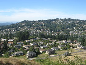
Southeast slope of Mount Scott, with the city of Happy ValleyElevation 1,091 ft (333 m) NAVD 88[1] Prominence 745 ft (227 m) [2] Location Clackamas County, Oregon, USA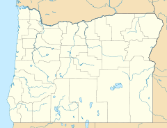
 Mount Scott
Range Cascade Range Coordinates 45°27′16″N 122°33′05″W / 45.454500414°N 122.551319919°WCoordinates: 45°27′16″N 122°33′05″W / 45.454500414°N 122.551319919°W[1] Topo map USGS Gladstone Geology Volcanic arc/belt Boring Lava Field Last eruption 500,000 years ago [3] Mount Scott is an volcanic cinder cone with its summit in Clackamas County, Oregon. The summit rises to an elevation of 1,091 feet (333 m).[1] It is part of the Boring Lava Field,[3] a zone of ancient volcanic activity in the area around Portland and was named for Harvey W. Scott, 19th and 20th century editor of The Oregonian newspaper.[3]
The mountain is developed, with most of its southern flank within the city of Happy Valley, Oregon. The Willamette National Cemetery is located on the northeastern slope of the mountain, which is partially in Multnomah County.
References
- ^ a b c "Mount Scott". NGS data sheet. U.S. National Geodetic Survey. http://www.ngs.noaa.gov/cgi-bin/ds_mark.prl?PidBox=RD2442.
- ^ "Mount Scott, Oregon". Peakbagger.com. http://www.peakbagger.com/peak.aspx?pid=18906.
- ^ a b c "The Boring Lava Field, Portland, Oregon". U.S. Geological Survey. http://vulcan.wr.usgs.gov/Volcanoes/Oregon/BoringLavaField/description_boring_lava.html.
External links
- "Mount Scott". Geographic Names Information System, U.S. Geological Survey. http://geonames.usgs.gov/pls/gnispublic/f?p=gnispq:3:::NO::P3_FID:1136734.
Categories:- Volcanoes of Oregon
- Mountains of Oregon
- Cinder cones of the United States
- Extinct volcanoes
- Landforms of Clackamas County, Oregon
- Landforms of Multnomah County, Oregon
- Clackamas County, Oregon geography stubs


Wikimedia Foundation. 2010.