- Mount Natib
-
Mount Natib 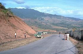
Mt. Natib from the WSWElevation 1,253 m (4,111 ft) [1] Location Bataan,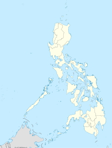
 Mount Natib
 Philippines
Coordinates 14°43′N 120°24′E / 14.72°N 120.40°ECoordinates: 14°43′N 120°24′E / 14.72°N 120.40°E[1] Geology Type Stratovolcano-Caldera Natib[pronunciation?] is a thermal stratovolcano in the Philippines.
Natib is located in the province of Bataan, in region III, on western Luzon Island, in the Philippines. It is partially in Bataan National Park.
Contents
Physical features
Natib is a thermal stratovolcano with an elevation of 1,253 metres (4,111 ft) asl, and base diameter of 26 km.
Phivolcs records Natib as thermal: hotsprings Mamot, Tigulangin, Uyong and Paipit springs within Natib caldera have temperatures ranging from 30-56°C, low flows, and discharge neutral to slightly alkaline water.
Eruptions
Studies in 1991 indicate last eruptive activity probably to be Holocene to upper Pleistocene, about 70,000 years ago. There have been no historical eruptions.[1]
Geology
Rock type is biotite hornblende andesite trending to dacite flows and dacitic tuffs.
Tectonically, Natib is on the Western Bataan Lineament.
Listings
- Smithsonian Institution lists Natib as Holocene(?) and mentions current thermal activity.
- Philippine Institute of Volcanology and Seismology (Phivolcs) lists Natib as Potentially Active.
See also
- Active volcanoes in the Philippines
- Potentially active volcanoes in the Philippines
- List of inactive volcanoes in the Philippines
- Philippine Institute of Volcanology and Seismology
- Pacific Ring of Fire
References
- ^ a b c "Natib". Global Volcanism Program, Smithsonian Institution. http://www.volcano.si.edu/world/volcano.cfm?vnum=0703-082. Retrieved 2008-12-02.
External links
Categories:- Stratovolcanoes
- Subduction volcanoes
- Volcanoes of Luzon
- Mountains of the Philippines
- Landmarks in the Philippines
- National parks of the Philippines
- Bataan
- Potentially active volcanoes of the Philippines


Wikimedia Foundation. 2010.