- Mount Keith
-
Mount Keith 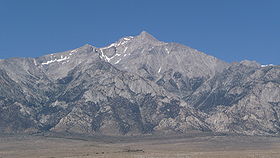
Mount Keith from ManzanarElevation 13,982 ft (4,262 m) [1][2] Prominence 1,903 ft (580 m) [2] Parent peak Mount Tyndall[2] Listing SPS Emblem peak[3] Location Location in California
 Mount Keith
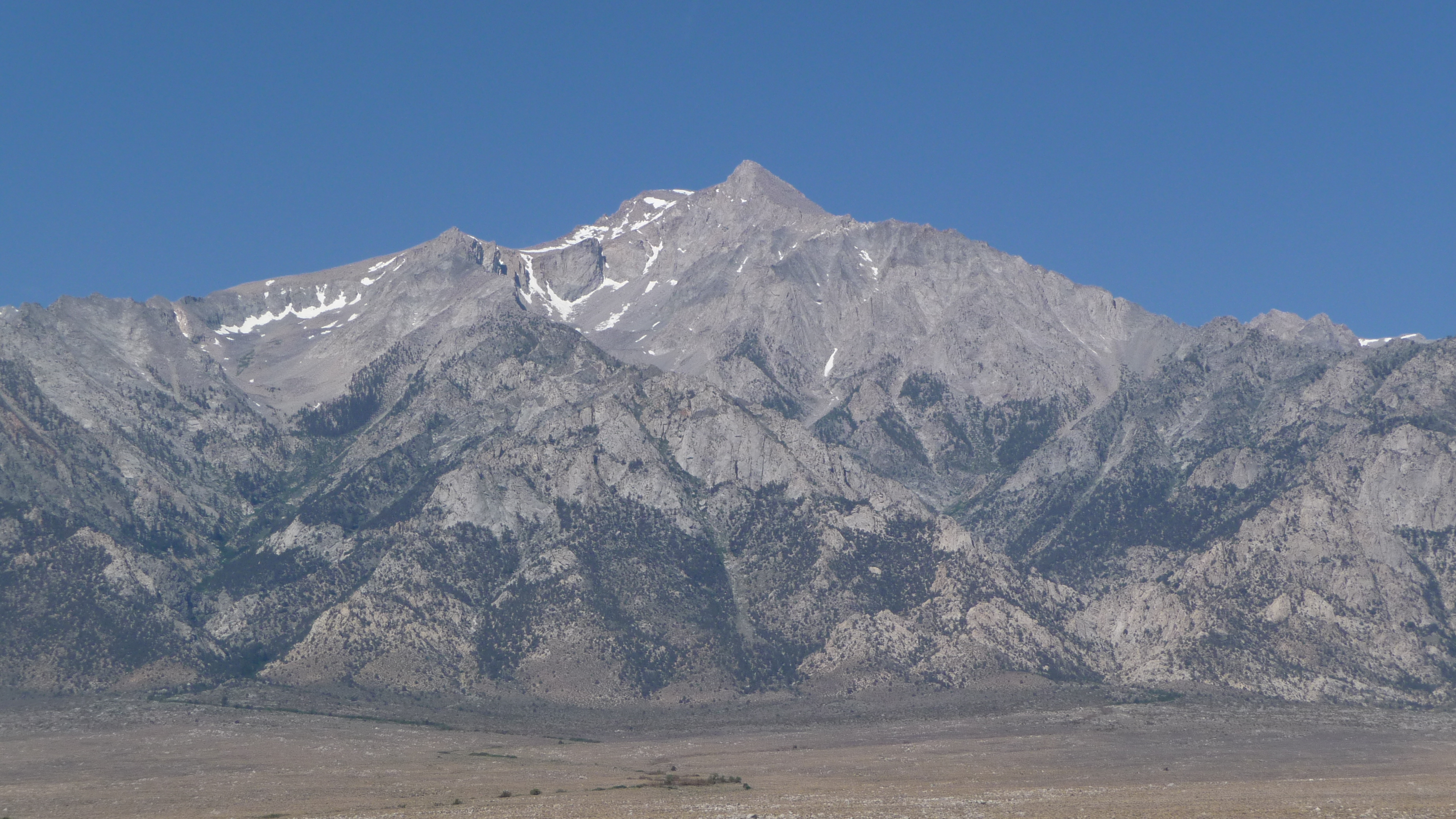
Location Inyo and Tulare counties, California, USA Range Sierra Nevada Coordinates 36°42′00″N 118°20′37″W / 36.700092008°N 118.343612578°WCoordinates: 36°42′00″N 118°20′37″W / 36.700092008°N 118.343612578°W[4] Topo map USGS Mount Williamson Climbing First ascent 1898, by Cornelius Beach Bradley, Jennie E. Price, Robert M. Price and Joseph C. Shinn[5] Easiest route Scramble, class 2 by Northwest Face, South Face or Northeast Slopes[6] Mount Keith is a thirteener on the crest of California's Sierra Nevada, between Mount Bradley to the north, and Junction Peak to the southwest. Its north and west facing slopes feed the Kings River watershed by way of Bubbs Creek, and its east and south slopes feed the Owens River via Shepherd Creek. By the same dividing line, Keith stands on the boundary of Kings Canyon National Park to the northwest, and the John Muir Wilderness to the southeast.[2]
The peak was named for artist and Sierra Club member, William Keith, by Helen Gompertz (later Helen LeConte) in July 1896.[5]
The first ascending party consisted of Cornelius Beach Bradley, Jennie and Robert Price, and Joseph Shinn. Scrambling over boulders and scree from the upper lakes of Center Basin, they made the summit by the Northwest Face route on July 6, 1898.[6]
See also
- Table of the highest major summits of North America - 63rd
- Table of the highest major summits of the United States - 48th
- Highest mountain peaks of California - 7th
- Thirteener
References
- ^ The NGVD 29 elevation of 13,976 feet was converted using VERTCON to the NAVD 88 elevation of 13,982 feet.
- ^ a b c d "Mount Keith, California". Peakbagger.com. http://www.peakbagger.com/peak.aspx?pid=2811. Retrieved 2011-06-01.
- ^ "Sierra Peaks Section List". Angeles Chapter, Sierra Club. http://angeles.sierraclub.org/sps/spslist.pdf. Retrieved 2011-06-01.
- ^ "Mt Keith". NGS data sheet. U.S. National Geodetic Survey. http://www.ngs.noaa.gov/cgi-bin/ds_mark.prl?PidBox=GT1807. Retrieved 2011-06-01.
- ^ a b Farquhar, Francis P. (1926). Place Names of the High Sierra. San Francisco: Sierra Club. http://www.yosemite.ca.us/library/place_names_of_the_high_sierra/k.html. Retrieved 2009-01-21.
- ^ a b Secor, R.J. (1999). The High Sierra: Peaks, Passes and Trails (2nd ed.). Seattle: The Mountaineers Books. p. 140. ISBN 0-89886-625-1.
External links
- "Mount Keith". SummitPost.org. http://www.summitpost.org/page/151671. Retrieved 2011-06-01.
- "Mount Keith". Geographic Names Information System, U.S. Geological Survey. http://geonames.usgs.gov/pls/gnispublic/f?p=gnispq:3:::NO::P3_FID:262096. Retrieved 2011-06-01.
Categories:- Mountains of Kings Canyon National Park
- Mountains of the John Muir Wilderness
- Mountains of Tulare County, California
- Mountains of Inyo County, California

Wikimedia Foundation. 2010.