- Mount Earnslaw
-
Mount Earnslaw Pikirakatahi 
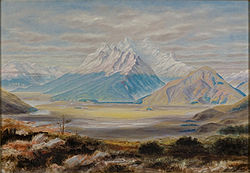
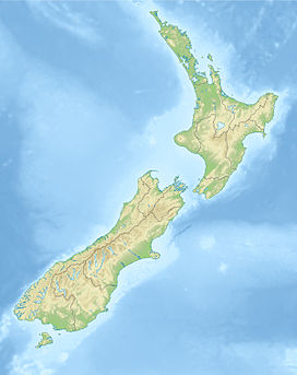
"Mount Earnslaw" by John Turnbull Thomson (1883)Elevation 2,819 m (9,249 ft) Location South Island, New Zealand Range Forbes Range, Southern Alps Coordinates 44°37′S 168°23′E / 44.617°S 168.383°ECoordinates: 44°37′S 168°23′E / 44.617°S 168.383°E[1] Mount Earnslaw, also known by its Māori name of Pikirakatahi, is a 2819 m mountain in New Zealand's South Island. It is named after Earnslaw (formerly Herneslawe) village in the parish of Eccles, Berwickshire, hometown of the surveyor John Turnbull Thomson's father.[2][3][4][5][6]
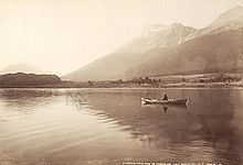
Mount Earnslaw is within Mount Aspiring National Park at the southern end of the Forbes Range of New Zealand's Southern Alps. It is located 25 kilometres north of the settlement of Glenorchy, which lies at the northern end of Lake Wakatipu.
Mount Earnslaw and various other sites in its vicinity feature in the live-action film version of The Lord of the Rings.
References
- ^ "Mount Earnslaw". Peakbagger.com. http://www.peakbagger.com/peak.aspx?pid=11758. Retrieved 2009-11-29.
- ^ http://www.genuki.org.uk/big/sct/BEW/gazetteer/E.html
- ^ http://www.independentmountainguides.co.nz/earnslaw.html
- ^ http://www.travelpod.com/travel-blog-entries/mertonkiwis/1/1228001040/tpod.html
- ^ http://www.nzetc.org/tm/scholarly/tei-Cyc04Cycl-t1-body1-d6-d2-d56.html
- ^ http://digital.otago.ac.nz/results?lcreator=Thomson,%20John%20Turnbull&PHPSESSID=068 e70c223902799...
Categories:- Mountains of New Zealand
- Otago Region
- Mount Aspiring National Park
- Otago Region geography stubs
Wikimedia Foundation. 2010.


