Mount Buchon

Mount Buchon
Mount Buchon
Mountain Range
Country United States
State California
District San Luis Obispo County
Coordinates 35°13′19.911″N 120°47′34.638″W / 35.2221975°N 120.792955°W / 35.2221975; -120.792955
Highest point
 - elevation 552 m (1,811 ft)
Timezone Pacific (UTC-8)
 - summer (DST) PDT (UTC-7)
Topo map USGS Port San Luis
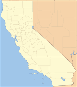
location of Mount Buchon in California [1]

Mount Buchon, also known as the San Luis Range, is a mountain range in San Luis Obispo County, California.[1]

References


Wikimedia Foundation. 2010.

Игры ⚽ Поможем написать курсовую

Look at other dictionaries:

  • Mount Diablo — West face of Mount Diablo and Hwy 24 Elevation …   Wikipedia

  • Mount Shasta Wilderness — IUCN Category Ib (Wilderness Area) Location …   Wikipedia

  • Mount Tamalpais State Park — Main article: Mount Tamalpais Mount Tamalpais State Park IUCN Category III (Natural Monument) …   Wikipedia

  • Mount San Jacinto State Park — Rock formation and trees seen from Round Valley trail in winter Mount San Jacinto State Park is in the San Jacinto Mountains, of the Peninsular Ranges system, in Riverside County, California. The park is close to both Greater Los Angeles and the… …   Wikipedia

  • Montaña de Oro State Park — Location San Luis Obispo County, California …   Wikipedia

  • Lassen Volcanic National Park — IUCN Category II (National Park) …   Wikipedia

  • Sequoia National Park — IUCN Category II (National Park) Giant sequoia trees in the Giant Forest, Sequoia National Park …   Wikipedia

  • Desolation Wilderness — IUCN Category Ib (Wilderness Area) …   Wikipedia

  • Chumash Wilderness — IUCN Category Ib (Wilderness Area) …   Wikipedia

  • Angel Island (California) — Angel Island Angel Island Geography Location San Francisco Bay Coordinates …   Wikipedia

Share the article and excerpts

Direct link
Do a right-click on the link above
and select “Copy Link”