- Morse Field (Hawaii)
-
Morse Field 
Part of Seventh Air Force Hawaii County, near Ka Lae Type Army Airfield Coordinates 18°54′58″N 155°40′41″W / 18.91611°N 155.67806°W Built 1941 In use 1941-1953 Controlled by United States Army Air Forces Garrison Seventh Air Force 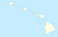
 Morse FieldLocation of Morse Field, Hawaii
Morse Field is a former military airfield located approximately 12 miles (19 km) south-southwest of Naʻālehu, Hawaii. It was also known as South Cape Airport, South Point Air Force Station, or Ka Lae Military Reservation. It is now abandoned.
Contents
History
The facility was located at Ka Lae, the southernmost point on the island of Hawaii and consisted of 11.8 acres (4.8 ha) of land owned in fee simple plus utility easements covering 21 acres (8.5 ha) of land.
Morse Field
In 1941 construction was underway on five buildings, runways, and access roads at Morse Field. Activities were centralized at this airport inasmuch as its location shortened by approximately 200 miles (320 km), from a routing through Oahu, the transpacific air ferry route to Australia and the Philippines. Construction work, originally under the Zone Constructing Quartermaster, was transferred to the District Engineer in late 1940. A total of $1,534,793 was requested from the War Department in May for completion of the project; this amount later increased to $2,020,000.
The work on runways at Morse Field was suspended shortly after 7 December 1941 and all adjacent landing areas demolished and the strip destroyed as a precautionary measure against enemy use. By 28 December 1941, gasoline storage facilities were complete, a water line installed, and mobilization buildings were more than half finished. These projects were all that were deemed appropriate for continuance at the time.
Blocking of landing areas on the island occupied large amounts of time and manpower due to the extensive areas involved and the comparatively smooth surfaces surrounding the field, which could be used as landing fields.
After World War II it was declared surplus and on January 16, 1948, a right of entry from the U.S. Army to the Territory of Hawaii was approved. It was not until August 30, 1952 that the property was finally restored to the Territory by Executive Order.
South Point Air Force Station
In December 1964, General Bernard A. Schriever of the AFSC announced that the Air Force would assume control of space tracking and communications from the Navy at South Point on 1 February 1965. Then on 30 September 1965, the Station was closed.
It was later reopened, however, in support of Project Have Lent, a sounding rocket probe program to evaluate advanced ballistic reentry system experiments. The close proximity and aspect angle of South Point to the optical site sensors located on the island of Maui were the primary reasons for launching the probes from this location.
In 1979, the Station was divided in two parcels located about 1.5 miles (2.4 km) apart, containing approximately 5.9 acres (24,000 m2) each. One of the sites was the main operations area, while the other areas was used for a boresight tower.
The Station was under the operational control of the Space and Missile Test Center (SAMTEC).
South Point AFS was one of the few Air Force installations in the State of Hawaii that did not fall under the control of the 15th Air Base Wing at Hickam AFB. It belonged to the Air Force Systems Command (AFSC), with headquarters at Andrews AFB.
See also
- Hawaii World War II Army Airfields
References
 This article incorporates public domain material from websites or documents of the Air Force Historical Research Agency.
- Shaw, Frederick J. (2004), Locating Air Force Base Sites History’s Legacy, Air Force History and Museums Program, United States Air Force, Washington DC, 2004.
- Abandoned & Little-Known Airfields: Hawaii, Hawaii island
- 15th Air Base Wing History Office via Hawaii Aviation
External links
Previously: Hawaiian Air Force (1940-1942)Airfields Hawaii Okinawa Ie Shima · YontanPacific USAAF in the Central Pacific · USAAF in the Southwest Pacific
Units Commands VII Bomber · VII FighterWings 7th FighterGroups Bombardment 5th Bombardment · 11th Bombardment · 30th Bombardment · 41st Bombardment · 307th Bombardment · 494th BombardmentFighter Troop Carrier 419th Troop CarrierSquadrons Reconnaissance 28th Reconnaissance · 41st Reconnaissance · 43d ReconnaissanceTransport Night Fighter Categories:- 1941 establishments
- Airfields of the United States Army Air Forces in Hawaii
- Buildings and structures in Hawaii County, Hawaii


Wikimedia Foundation. 2010.