- Montebello Avenue (Bethany Home Road) and 19th Avenue (Christown) (METRO Light Rail station)
-
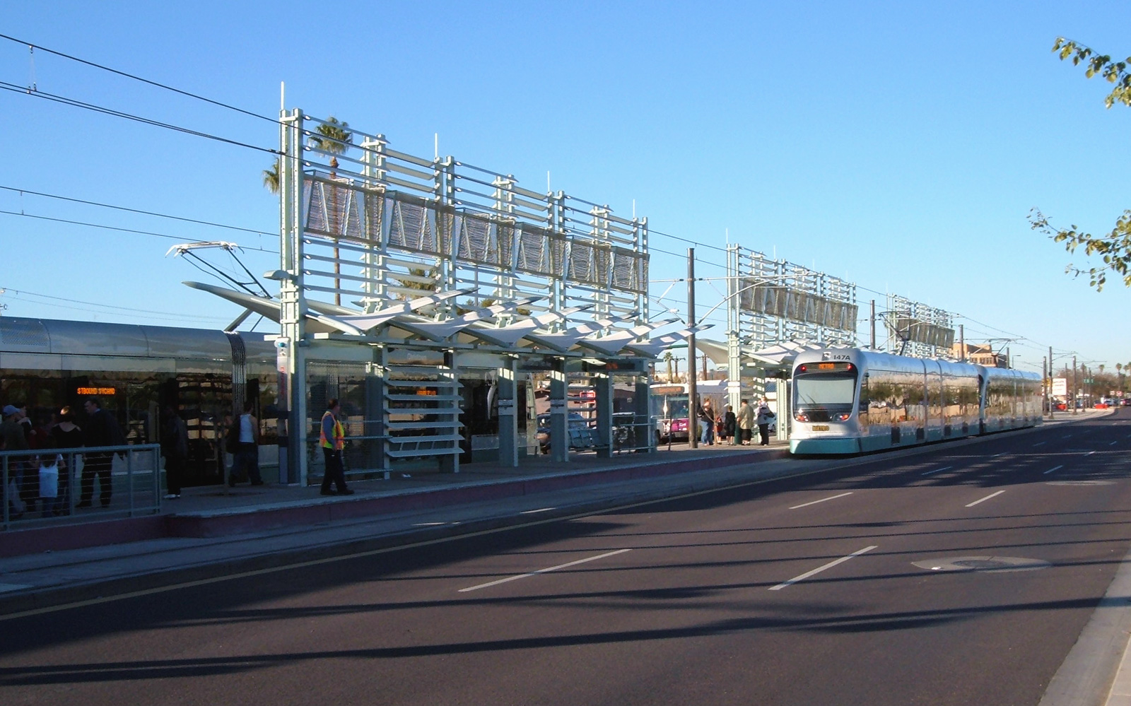
Montebello Avenue [Bethany Home Road] and 19th Avenue 
Christown station on December 29th, 2008Station statistics Address 19th Avenue and Montebello (one block south of Bethany Home Rd.) Lines METRO Light Rail Parking 795 spaces[1] Other information Opened December 27, 2008 Accessible 
Owned by Valley Metro (Phoenix) Services Preceding station Valley Metro Following station Terminus Metro Light Rail 19th Avenue and Camelback RoadThe Montebello Avenue and 19th Avenue station, immediately south of the well-known major arterial Bethany Home Road, is also known as Phoenix Christown Spectrum Mall Station and is the western terminus station on the METRO light rail line in Phoenix, Arizona, USA. A large park and ride lot is located on the east side of 19th Avenue.
Note that although this station is easily accessible from the Bethany Home Road exit of Interstate 17, there is currently no signage from the highway to direct travelers here. Curiously, METRO never mentions Bethany Home Road when discussing this station, referring to it only as "Montebello." Montebello here is a one-lane wide, one-block long cul-de-sac residential street that exists only on the west side of 19th Avenue; Montebello is not shown on most maps.
Contents
Notable places nearby
- Christown Spectrum Mall
- Solano School (K-6)
Ridership
Weekday Rail Passengers[2] Year In Out Average Daily In Average Daily Out 2009 783,372 818,930 3,084 3,224 2010 852,905 870,143 3,371 3,439 Bus connections
- 15, 19, 60, 576 [3]
References
- ^ Frequently Asked Questions
- ^ "2010 Ridership by Station". 1-4-2011. http://www.valleymetro.org/images/uploads/lightrail_publications/METRO-Weekday-Rail-Passengers-by-Station-2010.pdf. Retrieved 2011-09-28.
- ^ "Valley Metro Bus Book Online". July 28, 2008. http://www.valleymetro.org/Bus/Bus_Book_Online/. Retrieved September 1, 2008.
External links
Phoenix Light Rail stations Beginning in Uptown Phoenix Montebello Avenue (Bethany Home Road) and 19th Avenue (Christown) (terminus) - 19th Avenue and Camelback Road - 7th Avenue and Camelback Road (Melrose) - Central Avenue and Camelback Road (Uptown)Entering Midtown Phoenix Campbell Avenue and Central Avenue (Central High) - Indian School Road and Central Avenue - Osborn Road and Central Avenue (Park Central) - Thomas Road and Central Avenue (Midtown) - Encanto Boulevard and Central Avenue (Heard Museum) - McDowell Road and Central Avenue (Library; Cultural District)Entering Downtown Phoenix Roosevelt Street and Central Avenue (Cathedral; Arts District) - Van Buren Street and Central Avenue and Van Buren Street and 1st Avenue (Central Station) - Washington Street and Central Avenue and Jefferson Street and 1st Avenue (City Hall) - 3rd Street and Washington Street and 3rd Street and Jefferson Street (Convention Center)Washington Street Corridor 12th Street and Washington Street and 12th Street and Jefferson Street (Eastlake Park) - 24th Street and Washington Street and 24th Street and Jefferson Street (Hollywood Heights) - 38th Street and Washington Street (GateWay Community College) - 44th Street and Washington Street (Sky Harbor Airport) - Priest Drive and Washington Street (Papago Park) - Center Parkway and Washington StreetCrossing the Tempe Town Lake Bridge and entering Tempe Mill Avenue and 3rd Street (Downtown Tempe) - Veterans Way and College Avenue (Sun Devil Stadium) - University Drive and Rural Road (ASU) - Dorsey Lane and Apache Boulevard - McClintock Drive and Apache Boulevard - Smith Road and Martin Road and Apache Boulevard - Price Road (Route 101) and Apache BoulevardEntering Mesa Sycamore Drive (Dobson Road) and Main Street (terminus)Official route and station location map from Valley Metro
Coordinates: 33°31′13″N 112°5′59″W / 33.52028°N 112.09972°WCategories:- Valley Metro Rail stations
- Railway stations opened in 2008
- Buildings and structures in Phoenix, Arizona
- Western United States railway station stubs
- Arizona building and structure stubs
Wikimedia Foundation. 2010.