- Mount Saint Peter
-
Mount Saint Peter 
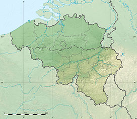
Mount Saint Peter and Casters cutting from the Albert Canal, with the Lanaye locks in the foregroundElevation 120 m (394 ft) Location  Netherlands,
  Belgium
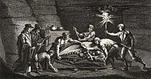
Coordinates 50°48′52″N 05°41′06″E / 50.81444°N 5.685°ECoordinates: 50°48′52″N 05°41′06″E / 50.81444°N 5.685°E  Discovered in the Maastricht caves, the Mosasaurus skull is the first fossil of an extinct reptile identified as such
Mount Saint Peter (Sint Pietersberg in Dutch, Montagne Saint-Pierre in French) is a ridge running north to south between the valleys of the Geer and the Meuse from Maastricht in the Netherlands to the area of Liège in Belgium.
Contents
Principal characteristics
Mount Saint Peter's limestone composition, its deposits of flint nodules and its geographic position make it a remarkable place. The locale has been mined for flint from Neolithic times. The network of mining tunnels extended 200 kilometres (120 mi) by the 19th century. The mountain supports the richest environment for bats in Benelux, as well as the richest environment for orchids in Benelux.[1] Some of the first recognised reptile fossils among which the famous Mosasaurus and turtles were found here in the 18th century; later dinosaur remains were discovered also, belonging to Betasuchus and Orthomerus.
In modern times the mountain has been a source of lime. The mountain's height and strategic location made it the site of Fort Eben-Emael in the twentieth century.[2]
Geology
At Mount Saint Peter the Geer (Jeker in Dutch) and the Meuse rivers have cut into the limestone plateau known in the east as the Herve plateau and in the west as Hesbaye. The succeeding geologic layers include loess, gravel, quartz sand and chalky limestone of the Maastricht Formation with inclusions of flint. The chalk deposits contain numerous fossils of sea urchins, clams and belemnites
Hydrography
The mountain is bounded on the east by the Meuse and on the west by the Geer. The Albert Canal cuts the mountain in two for 1,300 metres (4,300 ft) in length and 65 metres (213 ft) in depth at the Casters cutting. The Lanaye locks at the end of the cutting permit boats to pass to the Meuse basin from the Juliana Canal and the Rhine. To the east the course of the Meuse has been altered, creating backwaters and old channels.
Ecology
Because of its limestone soil, the Mount Saint Peter is exceptional in its botanical variety. It is the northern limit for a number of species of orchids due to its favorable microclimate.[1] Some of the orchids found there include:
- Aceras anthropophorum
- Ophrys apifera
- Ophrys insectifera
- Orchis militaris
- Orchis purpurea
- Platanthera bifolia
Industry
Humans have used the site since the lower Paleolithic period. The area around Spiennes is known for its flint mines.[3] Marl has been quarried in the area for building stone. Limestone continues to be quarried for portland cement production. Abandoned quarries are used to dispose of ashes from municipal waste incinerators.
Source
- This article incorporates text translated from the corresponding French Wikipedia article as of November 4, 2010.
References
- ^ a b "Nature sans frontieres" (in French). Montagne Saint-Pierre. Regionaal Landschap Haspengouw vzw. http://www.montagnesaintpierre.org/natuur_landschap/landschap.html. Retrieved 4 November 2010.
- ^ Dunstan, Simon (2005). Fort Eben Emael: The Key to Hitler's Victory in the West. Osprey. p. 12. ISBN 1-84176-821-9.
- ^ "Neolithic Flint Mines of Petit-Spiennes : Official web site". http://www.minesdespiennes.org/en.html. Retrieved 2007-12-16.
External links
- Montagne Saint-Pierre, site describing the region (French)
- Sint Pietersberg Maastricht, Dutch version (Dutch)
Categories:- Mountains and hills of Belgium
- Mountains and hills of the Netherlands
Wikimedia Foundation. 2010.


