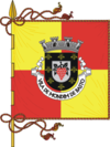
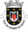
Mondim de Basto Municipality
- Mondim de Basto Municipality
-
Mondim de Basto (Portuguese pronunciation: [mõˈdĩ dɨ ˈβaʃtu]) is a municipality in Portugal with a total area of 172.1 km² and a total population of 8,470 inhabitants.
The municipality is composed of 8 parishes, and is located in the district of Vila Real.
The present Mayor is Humberto Cerqueira, elected by the Socialist Party.
The municipal holiday is July 25.
Parishes
- Atei
- Bilhó
- Campanhó
- Ermelo
- Mondim de Basto
- Paradança
- Pardelhas
- Vilar de Ferreiros
External links
| v · Vila Real District |
|
|
|
 |
|
Wikimedia Foundation.
2010.
Look at other dictionaries:
Mondim de Basto — Infobox Municipality pt official name = Mondim de Basto image coat of arms = MDB.png Region = Norte Subregion = Tâmega District = Vila Real Mayor name = Fernando Moura Mayor party = PSD area total = 172.1 population total = 8,470 population… … Wikipedia
Celorico de Basto — Infobox Municipality pt official name = Celorico de Basto image coat of arms = CBT.png Region = Norte Subregion = Tâmega District = Braga Mayor name = Albertino Mota Silva Mayor party = PSD area total = 181.1 population total = 20,128 population… … Wikipedia
Cabeceiras de Basto — Infobox Municipality pt official name = Cabeceiras de Basto image coat of arms = CBC.png Region = Norte Subregion = Tâmega District = Braga Mayor name = Joaquim Barreto Mayor party = PS area total = 241.8 population total = 17,775 population… … Wikipedia
Montalegre Municipality — Coordinates: 41°45′25″N 7°50′58″W / 41.75694°N 7.84944°W / 41.75694; 7.84944 … Wikipedia
Chaves Municipality, Portugal — Coordinates: 41°44′26″N 7°28′17″W / 41.74056°N 7.47139°W / 41.74056; 7.47139 … Wikipedia
Murça Municipality — Coordinates: 41°25′33″N 7°27′5″W / 41.42583°N 7.45139°W / 41.42583; 7.45139 … Wikipedia
List of postal codes in Portugal — Aveiro districtMealhada municipality*3050 Antes *3050 Barcouço *3050 Casal Comba *3050 Luso *3050 Mealhada *3050 Pampilhosa *3050 Vacariça *3050 Ventosa do BairroMurtosa municipality*3870 Bunheiro *3870 Monte *3870 Murtosa *3870 TorreiraOliveira… … Wikipedia
Monuments of Portugal — The Monuments of Portugal were constructed throughout the Portuguese territory, and date back to the period of pre historic settlement of occupation. Subsequently, the region that is today Portugal has been colonized by many civilizations, which… … Wikipedia
Administrative divisions of Portugal — The border between the municipalities of Lisbon and Oeiras; shared also by the civil parishes of Santa Maria de Belém (Lisbon) and Algés (Oeiras) Administratively, Portugal is a unitary and decentralized State. Nonetheless, operationally, it is… … Wikipedia
List of towns in Portugal — A vila is a town in Portugal. It does not necessarily correspond to a municipality . There are 533 towns in Portugal.Alphabetically, the towns are as follows:Source: Instituto Nacional de Estatística NOTOC A* A dos Cunhados * Abragão * Abraveses… … Wikipedia


 Portugal
 Categories:
