- Middle Harbour Creek
-
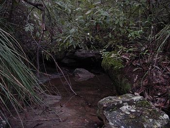 Middle Harbour Creek close to the source near Mona Vale Road St Ives.
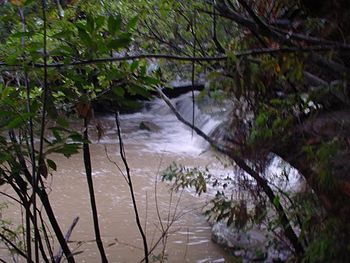 Middle Harbour Creek after heavy storms downstream from the Cascades.
Middle Harbour creek is a tributary into Middle Harbour Sydney, New South Wales. Located in the Garigal National Park the creek flows from Mona Vale Road in the north down to Bungaroo where the creek becomes middle harbour. Access along the majority of the creek is easy with tracks from (the western shore) St Ives, East Killara, East Lindfield, (Eastern shore) Belrose, Davidson, Frenchs Forest and Forestville. Day walks are popular with access to the creek along several well maintained fire trails, the better-known being the Bungaroo Track, Cascades Track and Bare Creek track. The bushland surrounding the creek is rich in Bloodwoods (Eucalyptus gummifera, Scribbly gums (Eucalyptus haemastoma), The narrow-leaved stringy bark (Eucalyptus oblonga)
Contents
History
Middle Harbour creek was first explored by Governor Arthur Phillip on an expedition that started from Manly Cove on 15 April 1788. Their original intention was to discover food. They camped on 16 April at Bungaroo where the tidal Middle Harbour finishes and the creek begins [1]
Access
- Bungaroo Track
- Cascades Track runs from the Corner of Acron Road and Douglas Street, St Ives or Stone Parade, Frenchs Forest. The track is a well maintained fire trail with an extremely steep cemented section and a creek crossing (from the St Ives side) at a ford before reaching the cascades, which is a beautiful cascading of water over sandstone. Until the 1970s the Cascades was a popular swimming water hole with local children. There are several sandstone caves in the area which offer walkers a great view of the area.
- Bare Creek Track runs from close to Austlink Corporate Park on the intersection of Mona Vale Road and Forest Way Roads, however the trail is overgrown and often difficult to find at that location. The best way to find the track is by following the trail from the end of Wyatt Avenue around the back of Sydney East Substation to find the Heath Track which meets the Bare Creek Track after a short walk.
External links
- The Northern Beaches Mountain Biking Group (NoBMoB) have details of trails around Cascades
References
- ^ "Bungaroo Track - St Ives". Ku-ring-gai Council. Archived from the original on 31 August 2011. http://www.webcitation.org/61L0onW3H.
Categories:- Creeks and canals of Sydney
- Sydney geography stubs


Wikimedia Foundation. 2010.