Mitchelton railway station
- Mitchelton railway station
-
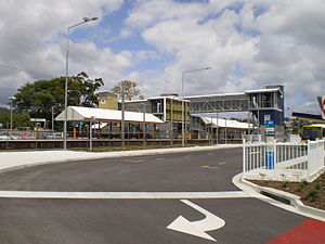
Mitchelton Station is a railway station on the Ferny Grove Line of Brisbane, Australia. It is part of the Queensland Rail City network.
It is in Zone 3 of the TransLink integrated public transport system.
Services by platform
See also
External links
Categories:
- Railway stations in Brisbane
- Queensland rail transport stubs
Wikimedia Foundation.
2010.
Look at other dictionaries:
Mitchelton railway station, Brisbane — Citytrain Station station name=Mitchelton region=Brisbane North servicearea1=Ferny Grove IB1=Gaythorne OB1=Oxford Park street=between McConaghy Street and Kedron Avenue suburb=Mitchelton zone=3 distance=10.94 platforms=2 platform arch=1 island… … Wikipedia
Mitchelton, Queensland — Mitchelton Brisbane, Queensland Population: 7033 (2006)[1] Postcode: 4053 … Wikipedia
Oxford Park railway station — Oxford Park Station statistics Address Scanlan Road, Mitchelton Coordinates … Wikipedia
Oxford Park railway station, Brisbane — Citytrain Station station name=Oxford Park region=Brisbane North servicearea1=Ferny Grove IB1=Mitchelton OB1=Grovely street=between Railway Parade and Blaker Road suburb=Oxford Park, Mitchelton zone=3 distance=11.97 platforms=2 platform arch=1… … Wikipedia
Newmarket railway station, Brisbane — Newmarket Station statistics Address Abuklea Street, Newmarket Coordinates … Wikipedia
Gaythorne railway station, Brisbane — Citytrain Station station name=Gaythorne region=Brisbane North servicearea1=Ferny Grove IB1=Enoggera OB1=Mitchelton street=between Samford Road and Station Avenue suburb=Gaythorne, Enoggera zone=2/3 distance=9.63 platforms=2 platform arch=2 side… … Wikipedia
Brookside Bus Station, Brisbane — TL Bus Station station name=Brookside region=Brisbane North street=Osborne Road suburb=Mitchelton zone=3 stands=2 routes=10 trainconnect=yes, at Mitchelton station pnr=yes phones=yes toilets=yes disabled=yesThe Brookside Bus Station, at… … Wikipedia
Ferny Grove railway line, Brisbane — SEQ Transit Lines line type = rail from = Brisbane central business district to = Ferny Grove name = Ferny Grove Line transport mode = Commuter rail line line owner = QR Limited map colour = Red line length = 16.1 stations number= 15 operator… … Wikipedia
List of South East Queensland railway stations — This is a list of the suburban and interurban railway stations of south east Queensland, Australia focused around Brisbane, the capital city of Queensland.These services are operated by QR Citytrain under TransLink.For detailed travel information … Wikipedia
Brookside Shopping Centre — infobox shopping mall shopping mall name = Brookside Shopping Centre caption = location = Mitchelton, Brisbane Australia opening date = 1971 developer = manager = Retail First owner = Yu Feng number of stores = 120 cite web… … Wikipedia