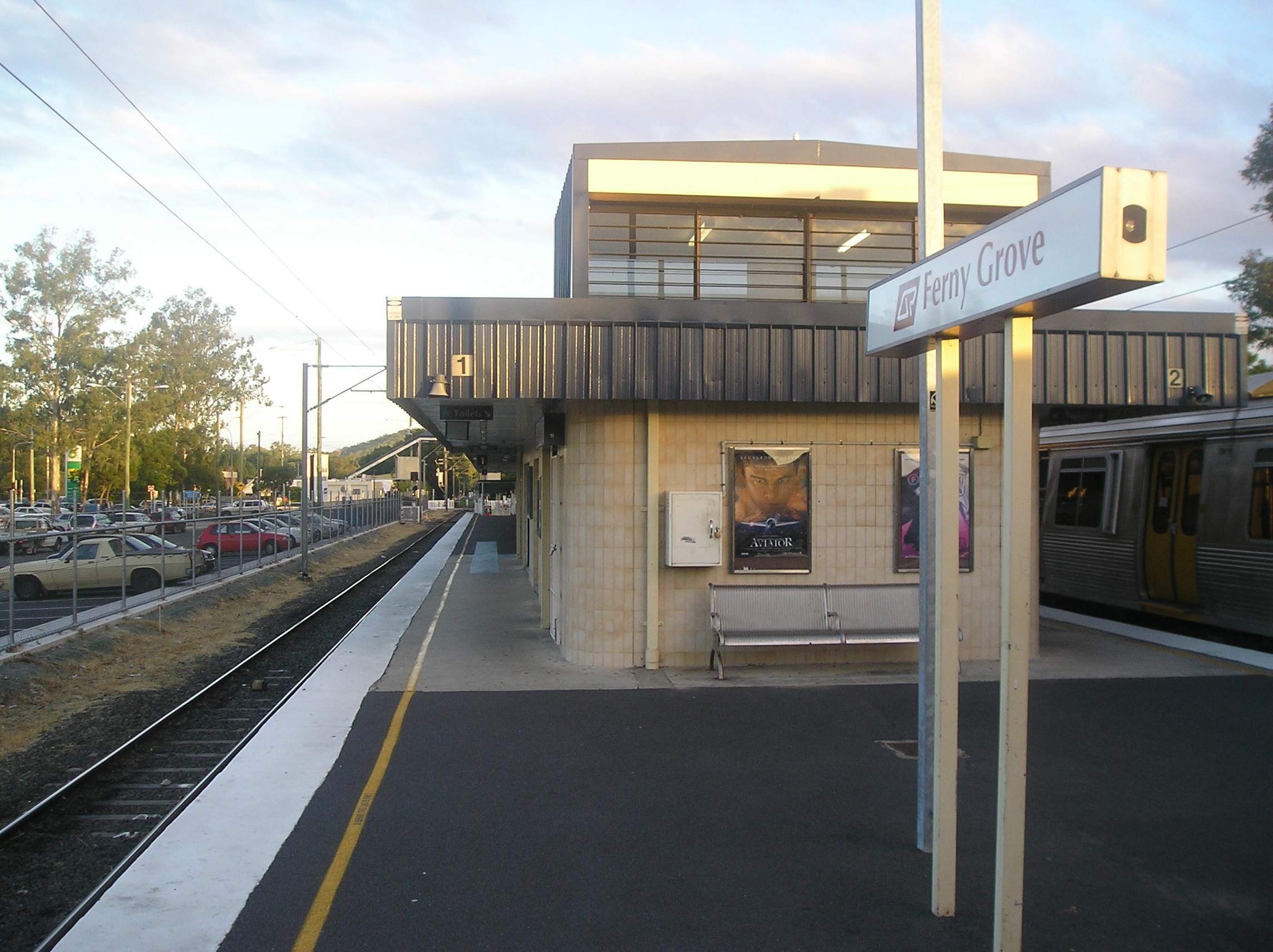
Ferny Grove railway station, Brisbane
- Ferny Grove railway station, Brisbane
Citytrain Station
station_name=Ferny Grove
region=Brisbane North
servicearea1=Ferny Grove
IB1=Keperra
street=Conavalla Street and Samford Road
suburb=Ferny Grove
zone=3
distance=16.080
platforms=2
platform_arch=1 island
access=ramp, overpass
trainconnect=no
busconnect=yes
tvm=Yes
disability=assisted
facilities= [http://www.citytrain.com.au/stations/station_details/ferny_grove.asp Link]
Ferny Grove Station is a railway station on the Ferny Grove Line of Brisbane, Australia. It is part of the QR Citytrain network. It is the terminus for the Ferny Grove Line.
It is in Zone 3 of the TransLink integrated public transport system.
The Brisbane Tramway Museum is a short walk south of the station.
The line formerly extended to Dayboro, but was cut back to Ferny Grove in 1955, as part of a larger rationalisation by the Queensland Government of its train lines. The line now terminates here with bus services running to Samford during peak times.
The Camp Mountain train disaster occurred in 1947 west of Ferny Grove on the Dayboro stretch of the line. It is Queensland's worst railway accident. 16 people were killed when a picnic excursion train failed to negotiate a bend on the line between Camp Mountain and Samford. A small memorial marks the site of the accident.
ervices by platform
Platform 1
*Ferny Grove Line - terminating services
*Beenleigh Line - all stations and peak-hr express services to the City and BeenleighPlatform 2
*Ferny Grove Line - terminating services
*Beenleigh Line - all stations and peak-hr express services to the City and Beenleigh
=TransLink bus routes servicing Ferny Grove=
*TL Route Display | 367
*TL OB Route Display | N390
*TL Route Display | 397
*TL Route Display | 398
*TL Route Display | 399
ee also
*List of South East Queensland railway stations
External links
* [http://www.transinfo.com.au TransInfo]
* [http://www.citytrain.com.au Citytrain]
* [http://qroti.com/placeinfo/qld/rail/ferny-grove/ Ferny Grove Station at QROTI]
Wikimedia Foundation.
2010.
Look at other dictionaries:
Ferny Grove railway line, Brisbane — SEQ Transit Lines line type = rail from = Brisbane central business district to = Ferny Grove name = Ferny Grove Line transport mode = Commuter rail line line owner = QR Limited map colour = Red line length = 16.1 stations number= 15 operator… … Wikipedia
Ferny Grove — could refer to:*Ferny Grove, a suburb of Brisbane, Queensland *Ferny Grove railway line, Brisbane *Ferny Grove railway station, Brisbane *Ferny Grove State High School … Wikipedia
Oxford Park railway station, Brisbane — Citytrain Station station name=Oxford Park region=Brisbane North servicearea1=Ferny Grove IB1=Mitchelton OB1=Grovely street=between Railway Parade and Blaker Road suburb=Oxford Park, Mitchelton zone=3 distance=11.97 platforms=2 platform arch=1… … Wikipedia
Newmarket railway station, Brisbane — Newmarket Station statistics Address Abuklea Street, Newmarket Coordinates … Wikipedia
Keperra railway station, Brisbane — Citytrain Station station name=Keperra region=Brisbane North servicearea1=Ferny Grove IB1=Grovely OB1=Ferny Grove street=Cnr Silvertop and Mooney Streets suburb=Keperra zone=3 distance=13.46 platforms=2 platform arch=1 island access=ramp,… … Wikipedia
Windsor railway station, Brisbane — Citytrain Station station name=Windsor region=Brisbane North servicearea1=Ferny Grove IB1=Bowen Hills OB1=Wilston street=between Prospect and Eildon Roads suburb=Windsor zone=1/2 distance=4.52 platforms=2 platform arch=1 island access=overpass… … Wikipedia
Gaythorne railway station, Brisbane — Citytrain Station station name=Gaythorne region=Brisbane North servicearea1=Ferny Grove IB1=Enoggera OB1=Mitchelton street=between Samford Road and Station Avenue suburb=Gaythorne, Enoggera zone=2/3 distance=9.63 platforms=2 platform arch=2 side… … Wikipedia
Alderley railway station, Brisbane — Citytrain Station station name=Alderley region=Brisbane North servicearea1=Ferny Grove IB1=Newmarket OB1=Enoggera street=corner South Pine Road and Railway Place suburb=Alderley zone=2 distance=7.96 platforms=2 platform arch=2 side access=South… … Wikipedia
Enoggera railway station, Brisbane — Citytrain Station station name=Enoggera region=Brisbane North servicearea1=Ferny Grove IB1=Alderley OB1=Gaythorne street=corner Wardell Street and Glenalva Terrace suburb=Enoggera zone=2 distance=8.860 platforms=2 platform arch=1 island… … Wikipedia
Grovely railway station, Brisbane — Citytrain Station station name=Grovely region=Brisbane North servicearea1=Ferny Grove IB1=Oxford Park OB1=Keperra street=corner Dawson Parade and Blaker Road suburb=Keperra zone=3 distance=12.67 platforms=2 platform arch=2 side access=Dawson… … Wikipedia