- Meroh
-
Meroh Coordinates: 1°38′00″N 111°36′00″E / 1.63333°N 111.6°E Country  Malaysia
State  Sarawak
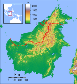
Administrative Division Saratok Elevation 262 m (860 ft) Meroh is a settlement in the Saratok division of Sarawak, Malaysia.[1][2] It lies approximately 141 kilometres (88 mi) east of the state capital Kuching.
Neighbouring settlements include:
- Penom 2.6 kilometres (1.6 mi) southwest
- Danau 5.2 kilometres (3.2 mi) southwest
- Sungai Langit 5.2 kilometres (3.2 mi) southeast
- Sungai Kepayang 6.7 kilometres (4.2 mi) southeast
- Bagumbang 6.7 kilometres (4.2 mi) southeast
- Sungai Tipus 7.9 kilometres (4.9 mi) southeast
- Langit 7.9 kilometres (4.9 mi) southeast
- Nanga Linsum 8.3 kilometres (5.2 mi) southeast
- Lampong 8.3 kilometres (5.2 mi) southwest
- Titik 9.3 kilometres (5.8 mi) southwest
References
- ^ M. Mohizah, S. Julia and W. K. Soh (2006). A Sarawak Gazetteer. Kuala Lumpur: Sarawak Forestry Department Malaysia and Forest Research Institute Malaysia. ISBN 9832181860. OCLC 85818866. http://www.chm.frim.gov.my/Sarawak_Gazetteer.pdf. Retrieved 2011-01-01.
- ^ "Meroh, Malaysia". Geonames. 1994-02-10. http://www.geonames.org/1754628. Retrieved 2010-12-27.
 Sarawak
Divisions Cities Districts Sub-Districts SebauhTowns Asajaya · Ba'kelalan · Bau · Beladin · Betong · Bintangor · Bintulu · Daro · Dalat · Debak · Engkilili · Julau · Kanowit · Kapit · Kota Samarahan · Lawas · Limbang · Lingga · Lubok Antu · Lundu · Maludam · Matu · Mukah · Marudi · Oya · Pakan · Pusa · Saratok · Sebuyau · Selangau · Serian · Serikin · Sibu · Siburan · Simunjan · Spaoh · Sungai Tujuh · Tanjung Kidurong · Tatau · TebeduCategories:- Populated places in Sarawak
Wikimedia Foundation. 2010.

