Megunticook River

Megunticook River
Megunticook River
Origin Maine
Mouth West Penobscot Bay
44°12′36″N 69°03′47″W / 44.210°N 69.063°W / 44.210; -69.063 (Megunticook River)Coordinates: 44°12′36″N 69°03′47″W / 44.210°N 69.063°W / 44.210; -69.063 (Megunticook River)
Basin countries United States
Length 3.5 miles (5.6 km)
Source elevation 142 feet (43 m)
Mouth elevation sea level

The Megunticook River is a short river in Camden, Maine.

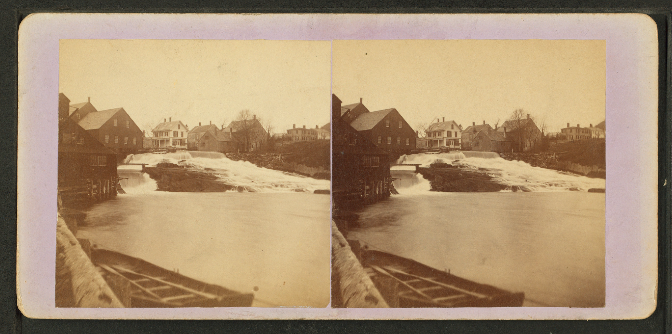
Megunticook River falls, Camden, Maine, from Robert N. Dennis collection of stereoscopic views

From the spillway of Megunticook Lake (44°14′06″N 69°05′59″W / 44.2350°N 69.0997°W / 44.2350; -69.0997 (Megunticook River source)), the river runs 3.5 miles (5.6 km)[1] southeast through the town to West Penobscot Bay.

See also

References

  1. ^ U.S. Geological Survey. National Hydrography Dataset high-resolution flowline data. The National Map, accessed June 22, 2011


Wikimedia Foundation. 2010.

Игры ⚽ Нужна курсовая?

Look at other dictionaries:

  • Camden, Maine — Infobox Settlement official name = Camden, Maine settlement type = Town nickname = motto = imagesize = image caption = Camden, viewed from the summit of Mount Battie image |pushpin pushpin label position =left pushpin map caption =Location within …   Wikipedia

  • List of rivers of Maine — List of rivers in Maine (U.S. state). The list is organized by tributary structure, from north to south along the coast. Contents 1 Saint John River 2 Down East 3 Penobscot Bay 4 …   Wikipedia

  • Camden (Maine) — 44° 13′ 05″ N 69° 04′ 55″ W / 44.2181, 69.0819 …   Wikipédia en Français

  • Center for Creative Imaging — The Center for Creative Imaging (CCI) was a short lived Camelot located in the renovated Knox Mill complex in Camden, Maine from about 1991 to 1994. The Center was an Eastman Kodak Company facility designed to teach digital imaging and related… …   Wikipedia

  • Maine — /mayn/, n. 1. a state in the NE United States, on the Atlantic coast. 1,124,660; 33,215 sq. mi. (86,027 sq. km). Cap.: Augusta. Abbr.: ME (for use with zip code), Me. 2. a historical region and former province in NW France. 3. (italics) a U.S.… …   Universalium

  • Rockport, Maine — Infobox Settlement official name = Rockport, Maine settlement type = Town nickname = motto = imagesize = image caption = View of Rockport Harbor image |pushpin pushpin label position =left pushpin map caption =Location within the state of Maine… …   Wikipedia

Share the article and excerpts

Direct link
Do a right-click on the link above
and select “Copy Link”