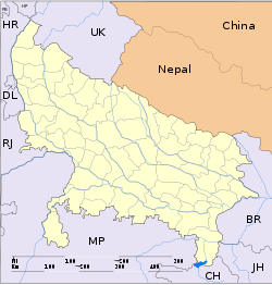
- Mawar
-
Mawar — town — Coordinates 26°18′0″N 79°55′0″E / 26.3°N 79.916667°ECoordinates: 26°18′0″N 79°55′0″E / 26.3°N 79.916667°E Country India State Uttar Pradesh District(s) Kanpur Dehat Time zone IST (UTC+05:30) Area
• Elevation
• Coastline
• 118 metres (387 ft)
• 0 kilometres (0 mi)Codes-
• Vehicle • UP-
Mawar is a town in Kanpur Dehat district in the state of Uttar Pradesh, India.
Transport
It is well connected by rail and road.
Geography
Mawar is located at 26°18′0″N 79°55′0″E / 26.3°N 79.916667°E. It has an average elevation of 118 meters (390 feet).
Categories:- Cities and towns in Kanpur Dehat district
- Kanpur division geography stubs
-
Wikimedia Foundation. 2010.


