- Marshwood Vale
-
Coordinates: 50°46′48″N 2°49′48″W / 50.780°N 2.830°W
Marshwood Vale 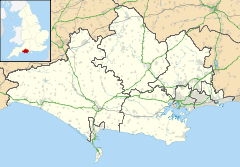
 Marshwood Vale
Marshwood Vale shown within DorsetOS grid reference SY410980 District West Dorset Shire county Dorset Region South West Country England Sovereign state United Kingdom Post town Bridport Postcode district DT6 Police Dorset Fire Dorset Ambulance South Western EU Parliament South West England UK Parliament West Dorset List of places: UK • England • Dorset The Marshwood Vale (or Vale of Marshwood) is a low-lying, bowl-shaped valley of Lower Lias clay, in the western tip of the county of Dorset in south-west England. It lies to the north of the A35 trunk road between the towns of Bridport and Lyme Regis, and to the south of the two highest hills in Dorset, Lewesdon Hill (279m) and Pilsdon Pen (277m). It is drained by the River Char, which flows south-west to its mouth on the English Channel coast at Charmouth. All of the vale lies within the Dorset Area of Outstanding Natural Beauty.
Due to the poorly-draining nature of its clay soil, until modern times the vale maintained a reputation for being difficult to traverse in wet weather. In 1905 Sir Frederick Treves called it "marshy and full of trees" and quoted the Dorset historian John Hutchins (1698 - 1773) who said it "was hardly passable by travellers but in dry summers"[1], whilst in 1965 the Dorset-born agriculturalist and broadcaster Ralph Wightman remembered that in his boyhood in the early twentieth century "after months of hopeless winter rain .... little farms across the fields were cut off in desperate poverty and loneliness".[2]
Today a number of small villages and hamlets (Fishpond Bottom, Marshwood, Birdsmoorgate, Bettiscombe, Pilsdon, Bowood, Broadoak, Ryall and Whitchurch Canonicorum) surround the vale, sited mostly on the hills and higher ground which virtually encircle it. The impervious clay soil of the floor of the vale has historically provided less amenable sites for building, and only supports a few scattered farms. Several of the farms in the vale have names ending in '-hay', which means 'enclosure', and have their origins in the first forest clearances of the Middle Ages.[3]
The village of Whitchurch Canonicorum is the largest settlement connected to the vale, and is notable for its church, which has the rare distinction (shared with few other churches) of possessing the bodily remains of the saint to which it is dedicated (St.Wite or St. Wita, in this case).[4] Pilgrims to this shrine stopped to refresh themselves at the thirteenth-century inn which still stands a couple of miles to the north in the centre of the vale, and folklore recounts that this is why thereafter the inn became known as the "Shave Cross Inn", after the shaved heads of its pious guests.[5]
The village which shares its name with the vale, Marshwood, stands on the line of hills to the north, and from the churchyard the whole vale can be viewed to the south, with the coastal hills and the English Channel beyond.
References
Categories:- Geography of Dorset
- Valleys of England

Wikimedia Foundation. 2010.