- Marsabit Airport
-
Marsabit Airport IATA: RBT – ICAO: HKMB Location of Isiolo Airport in Kenya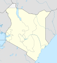
 RBT
RBT
Placement on map is approximateSummary Airport type Public, Civilian Owner Kenya Airports Authority Serves Marsabit, Kenya Location Marsabit,  Kenya
KenyaElevation AMSL 4,390 ft / 1,338 m Coordinates 02°20′42″N 38°00′00″E / 2.345°N 38°E Runways Direction Length Surface ft m 3,623 1,104 Asphalt Marsabit Airport is an airport in Kenya.
Contents
Location
Marsabit Airport (IATA: RBT, ICAO: HKMB) is located in, Marsabit District, Eastern Province, in the town of Marsabit, in the northern Kenyan desert, near the International border with Ethiopia.
Its location is approximately 420 kilometres (260 mi), by air, north of Nairobi International Airport, the country’s largest civilian airport.[1] The geographic coordinates of this airport are:2° 20' 42.00"N, 38° 0' 0.00"E (Latitude:2.345000; Longitude:38.000000).
Overview
Marsabit Airport is a small civilian airport, serving Marsabit and surrounding communities. Situated at 1,338 metres (4,390 ft) above sea level, the airport has a single asphalt runway that measures 3,623 feet (1,104 m) long.[2]
Airlines and destinations
See also
- Marsabit
- Mount Marsabit
- Eastern Province (Kenya)
- Kenya Airports Authority
- Kenya Civil Aviation Authority
References
External links
- Location of Marsabit Airport at Google Maps
- Website of Kenya Airports Authority
- Airport information for HKMB at Great Circle Mapper.
Coordinates: 2°20′42″N 38°00′00″E / 2.345000°N 38.000000°E
Categories:- Airports in Kenya
- Marsabit District
- Eastern Province (Kenya)

Wikimedia Foundation. 2010.