- Marlboro Mountains
-
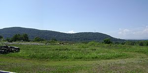
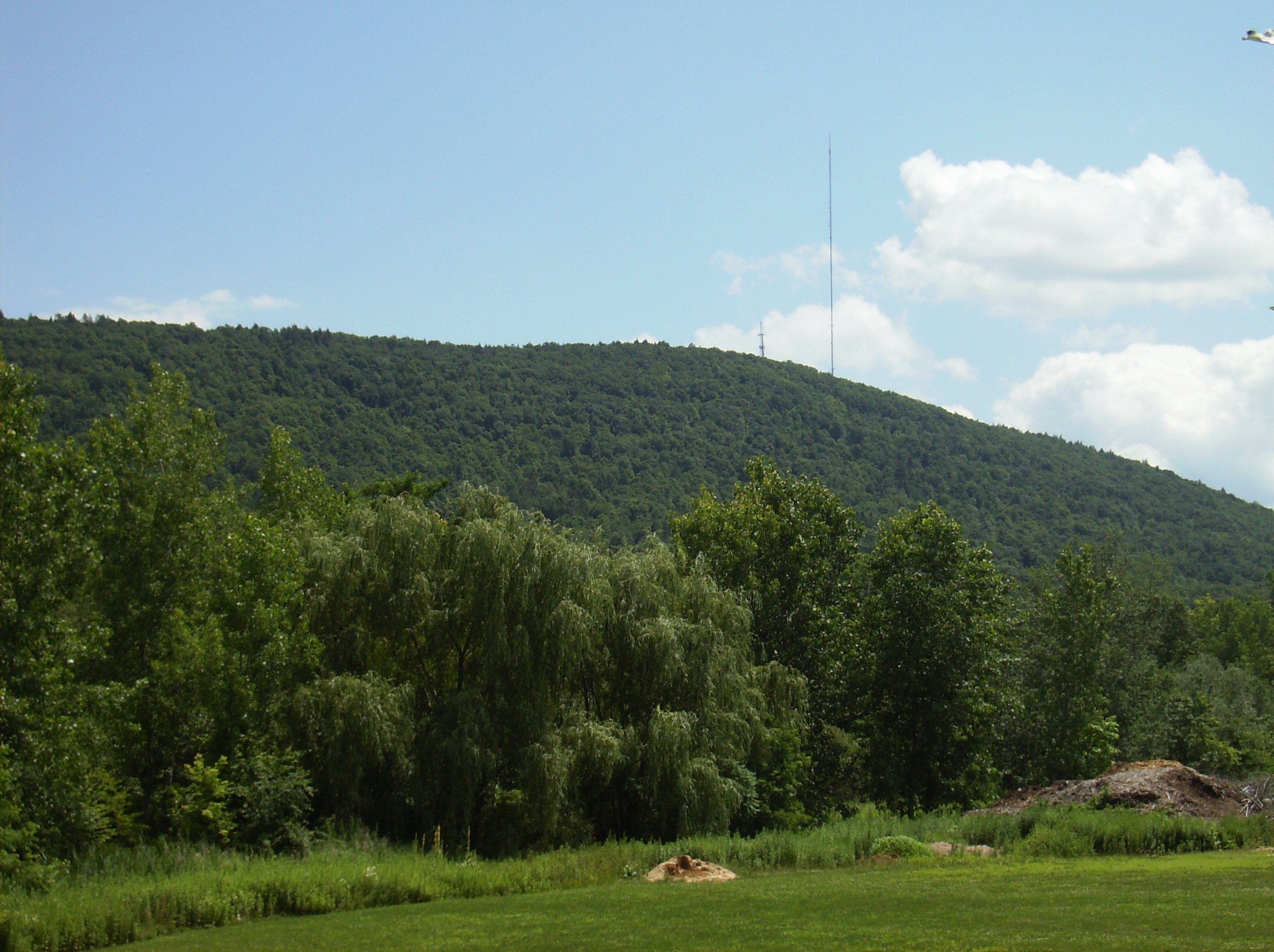
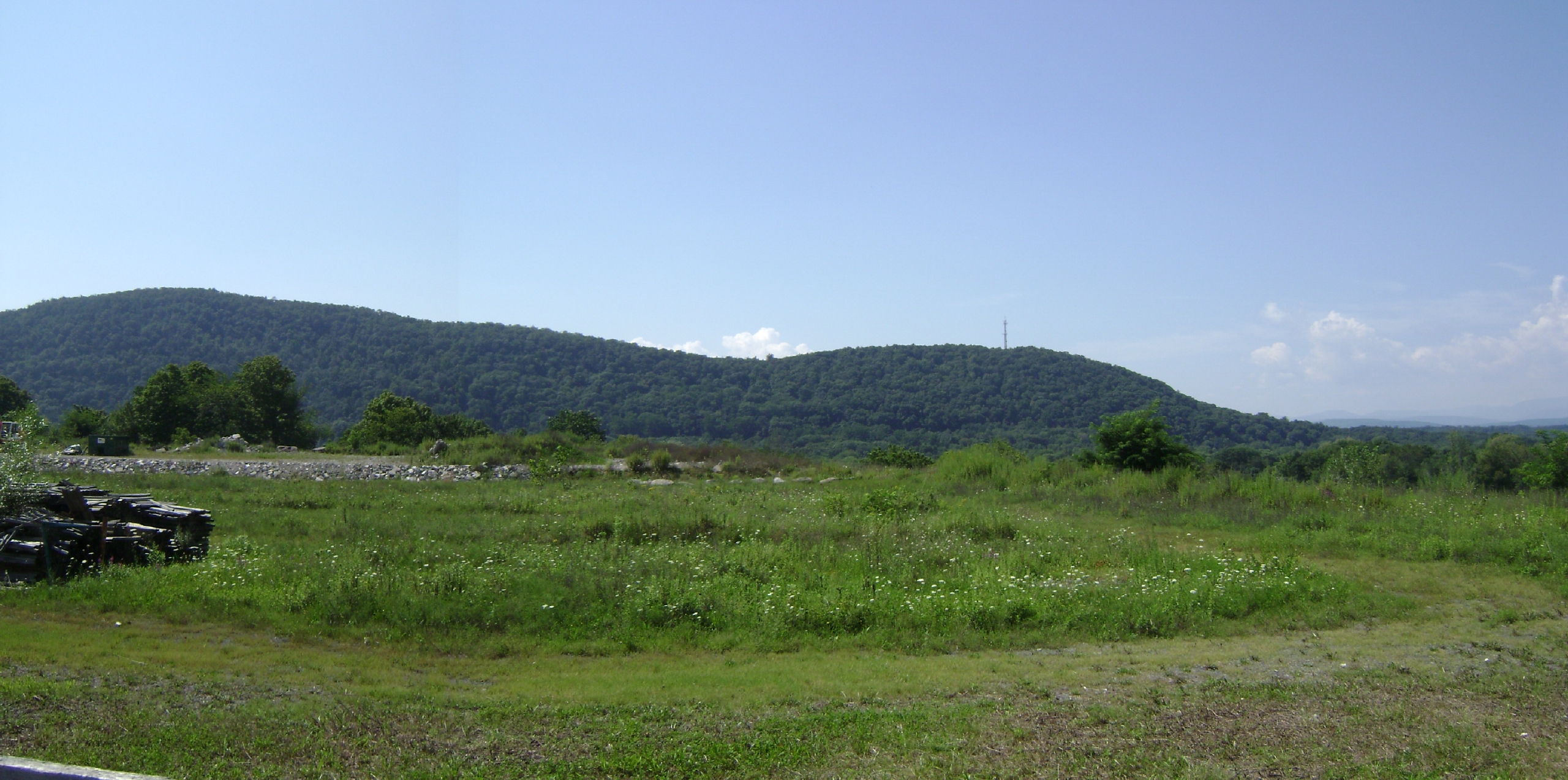
Marlboro Mountains Range 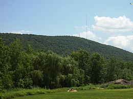 Illinois Mountain, the second highest ridge of the Marlboro Mountains, seen from Tony Williams Park in Lloyd, New York.
Country United States of America State New York Highest point Marlboro Mountain - elevation 1,127 ft (344 m) - coordinates 41°40′43.31″N 74°00′43.6″W / 41.6786972°N 74.012111°W Length 25 mi (40 km), north–south Geology sedimentary Period Ordovician The Marlboro Mountains, sometimes Marlborough Mountains, are a group of hogbacked mountains arranged in a 25 mile long ridge extending from Newburgh, New York to just south of Kingston, New York. Considered to be part of the Ridge and Valley Appalachians, the mountains, which reach elevations over 1,100 feet, form an imposing geologic barrier just west of the Hudson River. They subdivide the relatively flat Hudson River Valley (a section of the Great Appalachian Valley) to create the Wallkill Valley further west.[1] Rising abruptly on their eastern flanks, the Marlboro Mountains are known for their sweeping views of the region.
Contents
Geography
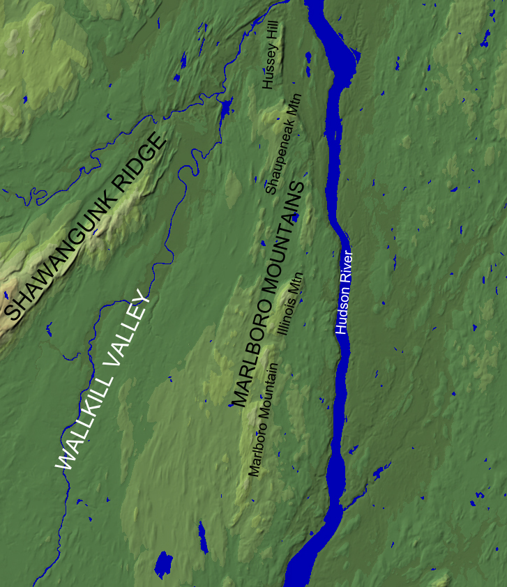
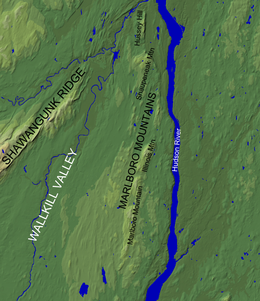 Shaded relief map of the Marlboro Mountains region
The Marlboro Mountains form a broken ridgeline running from the Ulster–Orange County border in the south to the mouth of Rondout Creek in the north. The southernmost 9 miles (14 km) of the ridge form Marlboro Mountain, the namesake mountain of the range. Just north of the Marlboro Mountain ridge is Bailey's Gap, which separates Marlboro Mountain from the 31⁄2-mile (5.6 km) long Illinois Mountain. North of Illinois Mountain there is half mile wide break in the ridgeline before it slowly rises to a series of unnamed hilltops west of West Park, New York. North of this section is Shaupeneak Mountain, which bends to the north-northwest before reaching an area known as The Hell, a gap in the ridge through which a creek flows. North of this gap is Hussey Hill, which stretches to an area west of Port Ewen, New York, marking the northernmost limit of the Marlboro Mountains.[2][3]
Etymology
The name “Marlboro” is a variant of the English “Marlborough”. In the case of the mountains, the name comes from the Duke of Marlborough, for whom the town of Marlborough, New York is named.
The names of the individual ridges of the Marlboro Mountains have both European and Native American roots:
Hussey Hill is named for Frederick Hussey, a Dutch colonial settler who in 1685 had an interest in a 2,900 acre tract of land which included the hill.[4]
Shaupeneak Mountain features a Native American name of Munsee Lenape origin. The name is derived from a waterfall, Shaupeneak Falls, located on the mountain’s slope. The three syllables which comprise “shau-pe-neak” are thought to be defined as follows: shau (probably short for Asho-, as in Ashokan), meaning forceful or hard current/rapids; pe, meaning water; and neak (likely ny-ak), meaning a prominent point of land.[5] Taken together, the syllables in the name “Shaupeneak” probably mean something like ‘waterfall on the prominence’.
Illinois Mountain is named for the state of Illinois. During the early 1800s, there was a westward migration of New Englanders to the area of the former Northwest Territory, which included Illinois and Ohio. Some settlers, however, never reached their intended destination, being cut off by the swamps just west of the Marlboro Mountains. Setting up homesteads in the area, the settlers named local places and geographic features after the lands they never reached. Ohioville, New York is an example of another area with the same etymological lineage.[6]
Geology
The Marlboro Mountains are primarily formed of shallow marine/delta sediments deposited during the late Ordovician, approximately 450 million years ago.[7][3] After millions of years, these sediments have been titled and uplifted. Weathering has removed more easily eroded material surrounding the mountains, producing their modern topographic relief.
Structurally, the Marlboro Mountains constitute a geologic formation known as a dip slope.[1] The sedimentary layers comprising the bulk of the mountains dip towards the west, with a hard cap rock layer at the surface. The ridgeline of the mountains forms the edge of the cap rock layer, which is being eroded relatively slowly, protecting underlying geologic layers from being weathered. This setup leads to the hogback appearance of the mountains: gently sloping westward flanks and steeply graded eastern flanks.
The hard cap rock layer responsible for the mountains' topography is composed of rock of the Quassaic Group (named after Quassaic Creek), a geologic group consisting of hard sandstone and quartzite.[7][3] Quartzite, which consists of sandstone that has been recrystallized, is naturally resistant to erosion. This type of rocks is common to other ridges in the Appalachian Mountains.
Recreation
The Marlboro Mountains provide numerous outdoor activities to the Mid Hudson Valley, including hiking, cross country skiing, and fishing.[8][9]
Recreation areas, nature sanctuaries, and trails from north to south:
- Shaupeneak Ridge Cooperative Recreation Area
- John Burroughs Nature Sanctuary at Slabsides
- Hudson Valley Rail Trail
- Hemlock Ridge Multiple Use Area
Recently, new land has been preserved on Illinois Mountain by the Scenic Hudson organization.[10] Trail building on Illinois Mountain is currently ongoing, having started in June, 2011. It is proposed that hikers and cyclists will be able to reach the summit of Illinois Mountain from the Hudson Valley Rail Trail.[11]
References
- ^ a b Waines, Russell H. (Editor). New York State Geological Association, 39th Annual Meeting – Guide Book to Field Trips. S.U.N.Y College at New Paltz, May, 1967. Available Online
- ^ Topoquest (Map Center: N41.72506, W73.98877; overview of Marlboro Mountains). Topoquest.com, 2008-2010. Retrieved 2011-07-17.
- ^ a b c Esopus/Lloyd Scenic Area of Statewide Significance. New York State Department of State (NYS DOS) Division of Coastal Resources, 2004. Retrieved 2011-07-17.
- ^ Clearwater, Alphonso T. The History of Ulster County, New York, Volume 1. Originally published by W.J. Van Deusen, Kingston, NY, 1907. Reprint by Heritage Books Inc, Westminister, MD, 2001. ISBN 978-0788419430.
- ^ Pritchard, Evan. Algonquin Place Names in John Burrough’s World. Wake Robin: Newsletter of the John Burroughs Association at the American Museum of Natural History, Volume 42, No. 3, Spring 2010, pgs. 4-9. Available Online
- ^ Maguire, Jack. Of Turtles, Pioneers, Falcons, and Moss. Signals: News and Notes from the Hudson Valley Rail Trail Association, Volume 8, No. 2, Spring 2011, pgs. 6-7. Available Online
- ^ a b Waines, Russell H. The Quassaic Group, a Medial to Late Ordovician arenite sequence in the Marlboro Mountains Outlier, mid-Hudson Valley, New York, U.S.A. Geological Journal, Volume 21, Issue 3, pages 337–351, July/September 1986.
- ^ Hemlock Ridge Multiple Use Area NY-NJ-CT Botany Online, 2004. Retrieved 2011-07-15.
- ^ Scenic Hudson – Parks: Shaupeneak Ridge. Scenic Hudson, 2011. Retrieved 2011-07-15.
- ^ Scenic Hudson – Illinois Mountain. Scenic Hudson, 2011. Retrieved 2011-07-16.
- ^ Building Trails for National Trails Day. Scenic Hudson Events and Outings, 2011. Retrieved 2011-07-14.
Categories:- Mountains of Ulster County, New York
- Marlboro Mountains
Wikimedia Foundation. 2010.