- Matecaña International Airport
-
Matecaña International Airport
Aeropuerto Internacional MatecañaIATA: PEI – ICAO: SKPE Location of airport in Colombia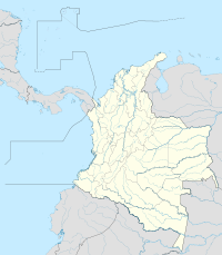
 PEI
PEISummary Airport type Public Owner Aerocivil Location Pereira, Colombia Elevation AMSL 4.416 ft / 1.346 m Coordinates 04°48′45″N 75°44′22″W / 4.8125°N 75.73944°W Runways Direction Length Surface m ft 08/26 2.020 6.627 Asphalt Statistics (2009) Aircraft operations 19.048 Passengers 646.152 Cargo tonnage 1.957 Matecaña International Airport (Spanish: Aeropuerto Internacional de Matecaña) (IATA: PEI, ICAO: SKPE) is an airport located in the city of Pereira, Colombia. It connects the Risaralda department of Colombia. It also serves the cities of Armenia, Cartago, and Manizales in emergency situations.
The airport was built in 1945, and the runway was expanded to its current length between 1966 and 1968. It has one cargo ramp built in 1978. The terminal consists of a departures and an arrivals level, with two jetways attached to it. The city of Pereira owns and manages the terminal building, while the operations are in charge of Aerocivil. On average, there are 25 daily commercial operations.
Airlines and destinations
Airlines Destinations ADA Medellín - Olaya Herrera Aexpa Cali, Condoto, Quibdó Aires Bogotá, Medellín-Olaya Herrera Avianca Bogotá Copa Airlines Colombia Panama City Satena Bogota, Medellín-Olaya Herrera External links
- Airport information for SKPE at World Aero Data. Data current as of October 2006.
Categories:- South American airport stubs
- Colombian building and structure stubs
- Pereira
- Airports in Colombia

Wikimedia Foundation. 2010.