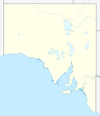
- Manoora, South Australia
-
Manoora is a settlement in South Australia.[1] At the 2006 census, Manoora had a population of 277.[2]
References
- ^ "2905.0 - Statistical Geography: Volume 2 -- Census Geographic Areas, Australia, 2006". Australian Bureau of Statistics. http://www.abs.gov.au/AUSSTATS/abs@.nsf/Latestproducts/2905.0Appendix82006?opendocument&tabname=Notes&prodno=2905.0&issue=2006&num=&view=. Retrieved 08 December 2009.
- ^ Australian Bureau of Statistics (25 October 2007). "Manoora (State Suburb)". 2006 Census QuickStats. http://www.censusdata.abs.gov.au/ABSNavigation/prenav/LocationSearch?collection=Census&period=2006&areacode=SSC44091&producttype=QuickStats&breadcrumb=PL&action=401. Retrieved 26 September 2011.
Coordinates: 34°00′00″S 138°49′01″E / 34.000°S 138.817°E
Towns and localities of the District Council of Clare and Gilbert Valleys Anama · Armagh · Auburn · Barinia · Benbournie · Black Springs · Boconnoc Park · Bungaree · Clare · Clare North · Donnybrook · Giles Corner · Gillentown · Hill River · Hilltown · Kooramo · Leasingham · Lower Skilly · Manoora · Marrabel · Merildin · Mintaro · Morella · Mulkirri · Navan · Penwortham · Peters Hill · Polish Hill River · Rhynie · Rices Creek · Riverton · Saddleworth · Sevenhill · Skilly · Spring Farm · Spring Gully · Stanley Flat · Steelton · Stockport · Tarlee · Tarnma · Tatkana (Siding) · Tothill Belt · Tothill Creek · Undalya · Waterloo · Watervale · White Hut · Woolshed FlatCategories:- Towns in South Australia
- Mid North (South Australia)
- South Australia geography stubs
Wikimedia Foundation. 2010.

