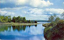
Manitou River (Manitoulin Island)
- Manitou River (Manitoulin Island)
-

Manitou River,
Manitoulin Island,
Ontario
The Manitou River is a river in Ontario, Canada. It is approximately 15 km in length.
It starts at the south end of Lake Manitou at a dam in Sandfield, ON in the Township of Central Manitoulin and ends at Michael's Bay on Lake Huron at the south end of Manitoulin Island.
The Blue Jay Creek and Manitou River Enhancement Strategy[1] was completed in June 2001 and approved in December 2003 by the Manitoulin Streams Improvement Association. The organization has rehabilitated 17 major sites along the river which has improved water quality and the fisheries in the region.
References
External links
Wikimedia Foundation.
2010.
Look at other dictionaries:
Manitou River — may refer to: Manitou River (Manitoulin Island), drains Lake Manitou on Manitoulin Island in Ontario, Canada Manitou River (Seine River), a tributary of the Seine River in Kenora District, Ontario, Ontario, Canada Manitou River (Minnesota) drains … Wikipedia
Manitoulin Island — Manitoulin Satellite image of Manitoulin Island. Geography Location … Wikipedia
Manitoulin Streams Improvement Association — is a not for profit group that rehabilitates streams, rivers and creeks on the largest freshwater island in the world Manitoulin Island, Ontario, Canada. They partner with the entire community, including farmers, fisherman, and local lake and… … Wikipedia
Manitoulin — Vorlage:Infobox Insel/Wartung/Höhe fehlt Manitoulin Manitoulin (Satellitenfoto) Gewässer Huronsee … Deutsch Wikipedia
Lake Manitou — For other places with the same name, see Manitou Lake (disambiguation). Lake Manitou Location Manitoulin Island, Lake Huron Coordinates … Wikipedia
Islands of the Great Lakes — The Great Lakes islands consist of 35,000 Great Lakes islands created by uneven glacial activity in the Great Lakes Basin.At 1,068 square miles (2,766 km²), the largest lake island in the world is Manitoulin Island in Lake Huron in Canada s… … Wikipedia
Great Lakes — This article is about the Great Lakes of North America. For the region, see Great Lakes region (North America). For other uses of this term, see Great Lakes (disambiguation). A rare cloudless satellite view of the entire Great Lakes region, April … Wikipedia
Georgian Bay — Infobox lake lake name = Georgian Bay image lake = 2007.05.17 45 Road Dyers Head Cabot Head Ontario.jpg caption lake = Georgian Bay at Cabot Head coords = coord|45.5|N|81.0|W|type:waterbody scale:3000000 region:CA|display=inline,title basin… … Wikipedia
List of place names in Canada of Aboriginal origin — This list of place names in Canada of Aboriginal origin contains Canadian places whose names originate from the words of the First Nations, Métis, or Inuit, collectively referred to as Aboriginal peoples in Canada. When possible the original word … Wikipedia
Lake Michigan — Landsat … Wikipedia

