Mangualde (parish)

Mangualde (parish)
Mangualde
—  Freguesia  —

Coat of arms
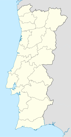
Mangualde is located in Portugal
Mangualde
Coordinates: 40°36′21″N 7°45′57″W / 40.60583°N 7.76583°W / 40.60583; -7.76583Coordinates: 40°36′21″N 7°45′57″W / 40.60583°N 7.76583°W / 40.60583; -7.76583
Country Portugal
District Viseu
Municipality Mangualde
Area
 – Total 34.79 km2 (13.4 sq mi)
Population (2001)
 – Total 8,904
 – Density 255.9/km2 (662.9/sq mi)

Mangualde is a civil parish in the municipality of Mangualde, Portugal.[1]

References


Wikimedia Foundation. 2010.

Игры ⚽ Поможем написать реферат

Look at other dictionaries:

  • Dolmen of Cunha Baixa — Coordinates: 40°34′2.23″N 7°44′59.56″W / 40.5672861°N 7.7498778°W / 40.5672861; 7.7498778 …   Wikipedia

  • Administrative divisions of Portugal — The border between the municipalities of Lisbon and Oeiras; shared also by the civil parishes of Santa Maria de Belém (Lisbon) and Algés (Oeiras) Administratively, Portugal is a unitary and decentralized State. Nonetheless, operationally, it is… …   Wikipedia

  • Monuments of Portugal — The Monuments of Portugal were constructed throughout the Portuguese territory, and date back to the period of pre historic settlement of occupation. Subsequently, the region that is today Portugal has been colonized by many civilizations, which… …   Wikipedia

  • Santiago — is the name of:In Argentina: *Santiago del Estero Province **Santiago del Estero, capital of the provinceIn Brazil: *Santiago, Rio Grande do SulIn Cape Verde: *Santiago, Cape VerdeIn Chile: *Santiago, Chile, the capital *Santiago Province, Chile… …   Wikipedia

  • Travanca — There are parishes that have the name Travanca in Portugal:*Travanca, a parish in the municipality of Amarante *Travanca, a parish in the municipality of Cinfães *Travanca, a parish in the municipality of Mogadouro *Travanca, a parish in the… …   Wikipedia

  • Fornos — may refer to several parishes in Portugal:*Fornos, a parish in the municipality of Castelo de Paiva *Fornos, a parish in the municipality of Freixo de Espada à Cinta *Fornos, a parish in the municipality of Marco de Canaveses *Fornos, a parish in …   Wikipedia

  • Moimenta — may refer to: Places Portugal Moimenta (Cinfães), a civil parish in the municipality of Cinfães Moimenta (Terras de Bouro), a civil parish in the municipality of Terras de Bouro Moimenta (Vinhais), a civil parish in the municipality of Vinhais… …   Wikipedia

  • Moimenta da Beira Municipality — Coordinates: 40°57′22.82″N 7°38′38.98″W / 40.9563389°N 7.6441611°W / 40.9563389; 7.6441611 …   Wikipedia

  • Rio Dão — or river Dão is a Portuguese river that originates in the plateau regions of Trancoso Aguiar da Beira in the Eirado parish, Aguiar da Beira council, District of Guarda, and varies between 714 meters and 757 meters in elevation.It flows in a… …   Wikipedia

  • Dão River — at Santa Comba Dão. Rio Dão (or river Dão) is a Portuguese river that originates in the plateau regions of Trancoso Aguiar da Beira in the Eirado parish, Aguiar da Beira Municipality, Guarda District, and varies between 714 meters and 757 meters… …   Wikipedia

Share the article and excerpts

Direct link
Do a right-click on the link above
and select “Copy Link”