- Malo, Washington
-
Malo, Washington — Unincorporated community — 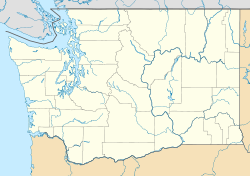
 Malo, Washington
Coordinates: 48°48′06″N 118°36′25″W / 48.80167°N 118.60694°WCoordinates: 48°48′06″N 118°36′25″W / 48.80167°N 118.60694°W Country United States State Washington County Ferry Elevation 2,182 ft (665 m) Time zone Pacific (PST) (UTC-8) - Summer (DST) PDT (UTC-7) ZIP code 99150 Area code(s) 509 GNIS feature ID 1522664[1] Malo is an unincorporated community in Ferry County, Washington, United States. Malo is located on Washington State Route 21 12.5 miles (20.1 km) north-northeast of Republic. Malo has a post office with ZIP code 99150 and had a 2010 census population of 28.[2]
References
Municipalities and communities of Ferry County, Washington City 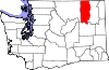
CDP Communities Indian reservation Footnotes ‡This populated place also has portions in an adjacent county or counties
Categories:- Populated places in Ferry County, Washington
- Unincorporated communities in Washington (state)
- Washington (state) geography stubs


Wikimedia Foundation. 2010.