- Majura Parish
-
Majura Parish
New South Wales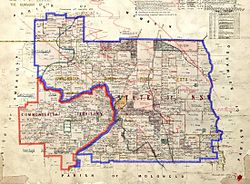
1924 cadastral map with highlights:Boundary of Majura parish since 1909The eastern tip of the ACT, which was formerly part of the parish; transferred to the Commonwealth in 1909County: Murray Land District: Queanbeyan Division: Eastern LGA: Palerang Council Lands administrative divisions around Majura Parish Wamboin Wamboin Butmaroo Amungula Majura Parish Butmaroo Amungula Molonglo Butmaroo  Portion 210 of Majura Parish is an exclave, cut off from the rest by the railway line-border of the ACT
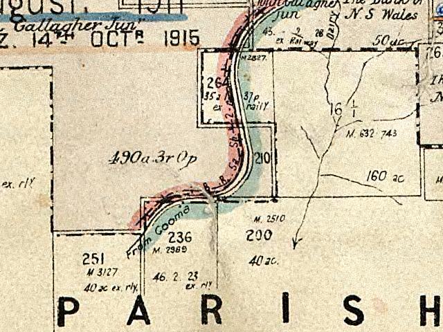
Majura Parish, Murray County is a parish of Murray County, New South Wales, a cadastral unit for use on land titles. It is located to the east of the extreme eastern tip of the ACT. The Queanbeyan-Bungendore railway line and the Kings Highway pass through the parish. About a quarter of the original nineteenth century parish was transferred to the ACT in 1909. The land transferred was the area between the railway line in the south and the watershed of the Molonglo River in the north. This cut off part of portion 210 of Majura Parish from the rest, giving the parish a small exclave.
At the time of the transfer of land, it was located in Yarrowlumla Shire, but is now in Palerang Council.
References
- Map showing proposed Federal Capital Territory and tenures of land within same, Charles Robt. Scrivener, 22nd May, 1909
- Geographic names board of New South Wales
- NSW Dept. of Lands Parish map preservation project
Coordinates: 35°18′30″S 149°25′44″E / 35.30833°S 149.42889°ECategories:- Parishes of Murray County
- New South Wales geography stubs

Wikimedia Foundation. 2010.