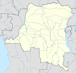
- Dungu Territory
-
Dungu Coordinates: 3°37′02″N 28°34′17″E / 3.617246°N 28.571491°ECoordinates: 3°37′02″N 28°34′17″E / 3.617246°N 28.571491°E Country Democratic Republic of Congo Province Orientale District Haut-Uele Dungu is a territory in the Haut-Uele District of the Democratic Republic of the Congo. The administrative center is the town of Dungu, which lies on both sides of the Uele River. The territory is divided into the Ndolomo, Malingindu and Wando chiefdoms.[1]
Starting in September 2008, the Lord's Resistance Army (LRA) conducted a series of attacks on civilians in Dungu territory. By December that year there are more than 83,000 Internally Displaced Persons in the territory. An attack on Dungu city on 1 November 2008 caused 57,000 of its inhabitants to flee. The next month some had returned to the south of the city, but the northern section was deserted.[2]
As of December 2008, the center of Dungu was isolated. Several access roads were not usable either due to their poor condition or for security reasons. The northern Dungu–Bitima axis (132 km) was unsafe. The southern axis towards Isiro was only accessible by bicycles, motorbikes or small vehicles. 180 kilometres (110 mi) of the road connecting Dungu to Bunia was in a poor condition.[2]
References
- ^ X. Blaes (October 2008). "Découpage administratif de la République Démocratique du Congo". PNUD-SIG. http://archive.wikiwix.com/cache/?url=http://www.rgc.cd/doctech/UNDP-GIS-25_RDC_administratif.pdf&title=D%C3%A9coupage%20administratif%20de%20la%20R%C3%A9publique%20d%C3%A9mocratique%20du%20Congo. Retrieved 2011-11-02.
- ^ a b "DR Congo – Humanitarian Situation Dungu Territory, Orientale Province - n°2". Reliefweb. OCHA. 4 December 2008. http://reliefweb.int/sites/reliefweb.int/files/resources/EC9DB4470D6CEDE149257516000CF3ED-Full_Report.pdf. Retrieved 2011-10-23.
Categories:- Democratic Republic of the Congo geography stubs
- Haut-Uele Province
- Territories in the Democratic Republic of the Congo
Wikimedia Foundation. 2010.

