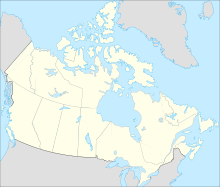
- Doris Lake Aerodrome
-
Doris Lake Aerodrome IATA: none – ICAO: none – TC LID: CDL7 Summary Airport type Private Operator Hope Bay Mining Location Doris Lake Elevation AMSL 50 ft / 15 m Coordinates 68°07′31″N 106°35′07″W / 68.12528°N 106.58528°WCoordinates: 68°07′31″N 106°35′07″W / 68.12528°N 106.58528°W Map Runways Direction Length Surface ft m 18/36 7,894 2,406 Ice Source: Canada Flight Supplement[1] Doris Lake Aerodrome (TC LID: CDL7) is a privately owned ice runway located on Doris Lake, Nunavut, Canada. The aerodrome, which is open from January to April, services the related explorations for the gold deposits that were found in the Hope Bay greenstone belt.
Airlines and destinations
Airlines Destinations Canadian North Seasonal: Cambridge Bay, Yellowknife References
- ^ Canada Flight Supplement. Effective 0901Z 20 October 2011 to 0901Z 15 December 2011
Airports in Canada By name A–B · C–D · E–G · H–K · L–M · N–Q · R–S · T–ZBy location indicator CA · CB · CC · CD · CE · CF · CG · CH · CI · CJ · CK · CL · CM · CN · CO · CP · CR · CS · CT · CV · CW · CY · CZBy province/territory National Airports System Calgary · Charlottetown · Edmonton · Fredericton · Gander · Halifax · Iqaluit · Kelowna · London · Moncton · Montréal-Mirabel · Montréal-Trudeau · Ottawa · Prince George · Québec · Regina · Saint John · St. John's · Saskatoon · Thunder Bay · Toronto · Vancouver · Victoria · Whitehorse · Winnipeg · YellowknifeRelated List of airports by ICAO code: C · List of defunct airports in Canada · List of heliports in Canada · List of international airports in Canada · National Airports System · Operation Yellow RibbonCategories:- Airports in Kitikmeot Region
- Canadian airport stubs
Wikimedia Foundation. 2010.

