- Dillon Reservoir
-
Dillon Reservoir 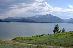
Dillon Reservoir in Summer Location Summit County, Colorado, USA Coordinates 39°36′27″N 106°03′18″W / 39.6074°N 106.0551°WCoordinates: 39°36′27″N 106°03′18″W / 39.6074°N 106.0551°W Lake type Reservoir Primary inflows Blue River Basin countries United States Surface area 3,233 acres (1,308 ha) Water volume 250,000 acre feet (310,000,000 m3) Shore length1 26.8 miles (43.1 km) Surface elevation 9,017 feet (2,748 m) 1 Shore length is not a well-defined measure. 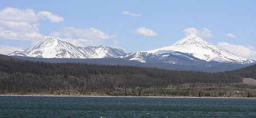 Mount Guyot (left) and Bald Mountain above Dillon Reservoir, May 2009.
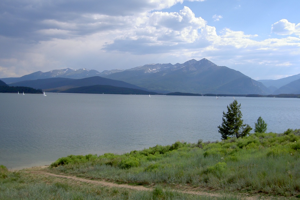
Dillon Reservoir, sometimes referred to as Lake Dillon, is a fresh water reservoir located in Summit County, south of I-70 and bordered by the towns of Frisco, Silverthorne, and Dillon. It is a reservoir for the city of Denver, and its waters are under the control of Denver Water. Popular ski towns are close to the reservoir, including Copper Mountain, Keystone, Arapahoe Basin, and Breckenridge.
Contents
History
Dillon Reservoir was originally a naturally formed lake that remained unnoticed until the mid-19th century, when gold was discovered in the area. Upon this discovery, the trade post town of Dillon was formed. The town of Dillon was on the bank of the Blue River and was the most populous area in Summit County.[citation needed] In the mid-20th century, ski resorts were becoming popular, outweighing the mines in the economy of the area; the town lost many residents to them. The lake became a target for expansion by the city of Denver, who deemed it necessary to have a water reserve in the high country.
The dam was constructed in 1961, enlarging the small finger lake into the massive reservoir it is today. The original town of Dillon was left to be flooded over and residents were forced to move. Underneath the west side of the lake, the original town is still visible. The original road leading to the old town, seen easily from both the dam road and Swan Mountain Road, is still used as a boat ramp.
Both Dillon and Frisco have marinas on the reservoir.
Tourism
During ski season, thousands of people flock to the Dillon Reservoir area. Dillon Reservoir is close to four ski-resorts. Arapahoe Basin is medium sized resort that is approximately ten miles from the lake. Keystone Ski Resort is a large tourist destination that is located approximately five miles away. Breckenridge, which is one of the largest ski resorts in Colorado, is located approximately seven miles from Dillon Reservoir. Copper Mountain is located approximately eight miles from Dillon Reservoir. These resorts stay open all year round.
The reservoir is also a center of attraction for the area. During the winter months, ice fishing and snowmobiling are common activities. For the warmer months, the Dillon Lake marina is open and hundreds of sailboats can be seen docked or sailing. Dillon Reservoir marina hosts many weekend racing regattas and also provides sailboats for rent. The Dillon Yacht Club is based out of the Marina and also hosts many sailing events. Dillon Reservoir is stocked every year with 50,000 rainbow trout by the Colorado Division of Wildlife.
Due to Dillon Reservoir’s proximity to the towns of Dillon and Frisco, the lake has many lodging, camping, and RV sites.
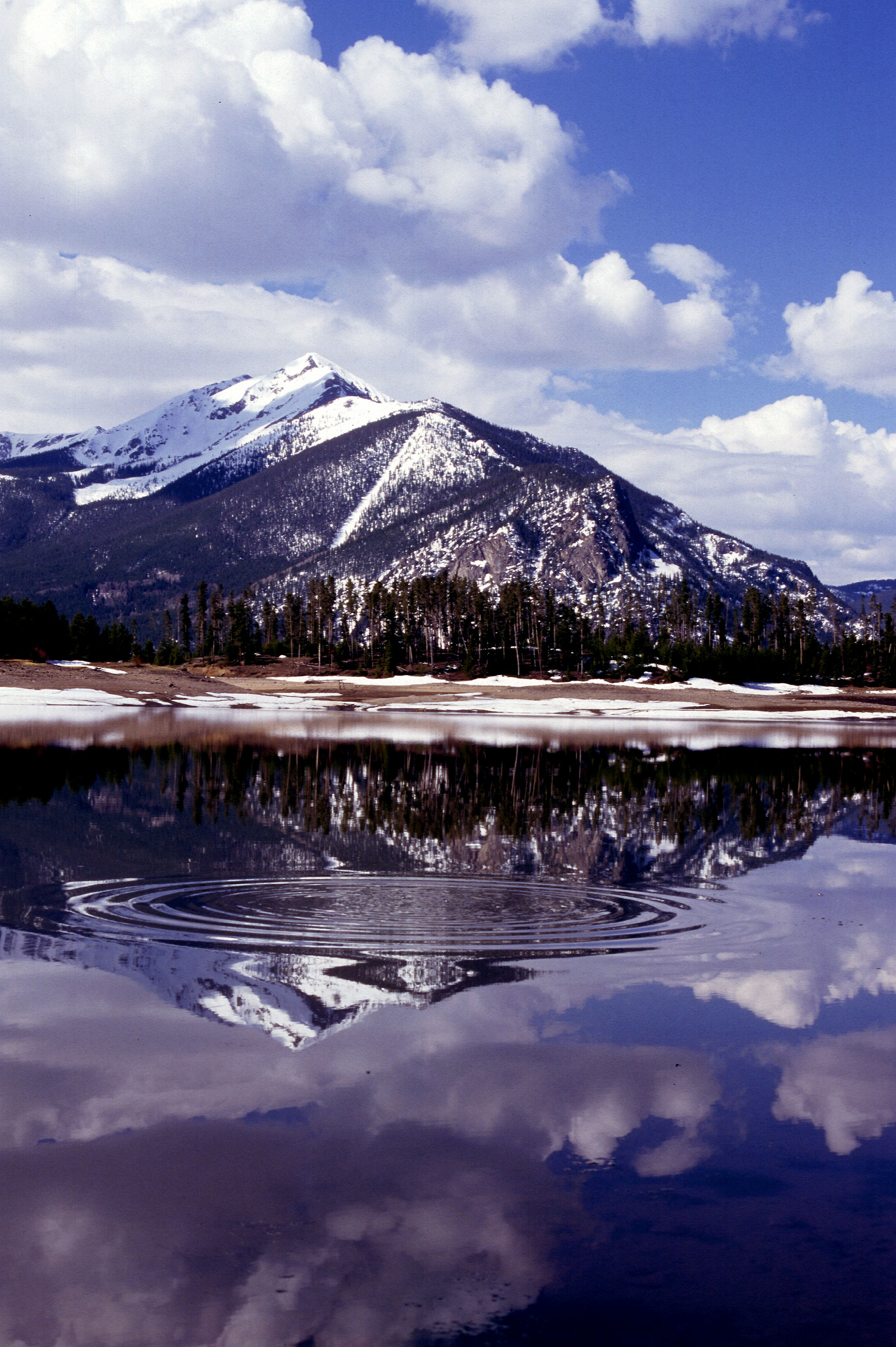
 Spring snowmelt
fills Dillon ReservoirWeather
Dillon averages around 250–300 inches of snow a year.[citation needed] It generally snows from late September to mid-May. There are nearly 300 days of sun during the year, and this keeps the area snow totals lower than the average amount of precipitation the area receives. Almost every day of the year, some sort of precipitation will fall from the sky, with July generally being the wettest month of the year. July is usually the warmest month of the year also with the average high around 73 °F (23 °C). January is the coldest month of the year with the average high being around 31 °F (−1 °C). The average low in July is 40 °F (4 °C), and the average low in January is 2 °F (−17 °C).
Geography
Dillon Reservoir has a maximum elevation of 9,017 feet (2,748 m) above sea level and a capacity of 257,304 acre feet (317,380,000 m3). Its shore length is approximately 26.8 miles (43.1 km). Dillon Dam is 5,888 feet (1,795 m) long and 231 feet (70 m) wide. The average depth of the reservoir is 79 feet (24 m). It has a regulated water level and it has a catchment area of 330 square miles (850 km2).
Security Issues
In 2008, residents of surrounding areas found Dillon Dam Road closed on numerous occasions for security reasons.
In January 2008, the Summit County Sheriff Dept. found two men videotaping a music video on the dam road, already closed at the time for weather purposes. As is protocol for possible threats involving dams, the FBI were asked to investigate the situation as well. The men were cleared of any suspicious activity though the dam remained closed for a short time afterward.[1]
On July 8 of the same year, Denver Water closed the dam road indefinitely to all vehicular traffic excluding emergency vehicles, pedestrians, and bicyclists, inciting a lawsuit against the utility company by Summit County representatives.[2] Despite having spent $10 million on increasing security measures for the dam since September 11,[3] the utility felt the dam was still at risk of possible threats, especially to the town of Silverthorne, which lies north, and directly beneath, the dam.
The dam road was re-opened on July 25, but with strict stipulations imposed by Denver Water, including weight restrictions on vehicles, officers in security vehicles being placed on either end of the dam at any time during the day,[2] and closing the road from 10 p.m. to 6 a.m. Emergency vehicles requiring the use of the road during the closed hours must lower the steel barricades on both ends to get through.[4]
Water Use
Dillon Reservoir is the largest water storage facility owned and operated by Denver Water. The reservoir is currently at approximately forty percent of capacity, holding 257,304 acre feet (317,380,000 m3) of water. Of that, 249,000 acre feet (307,000,000 m3) is “usable” water. “Usable” is defined as being free to use due to legal, operational, or physical constraints. Customers of Denver Water number upwards of 1.3 million people who consume an annual 265,000 acre feet (327,000,000 m3) of water.[5]
To reach that level, Denver water uses several sources of which Dillon Reservoir provides forty percent of the total amount, or 106,000 acre feet (131,000,000 m3). The reservoir has an annual median usable water level of ninety-two percent.[5]
As a measure of volume, an acre-foot of water is equal to 325,851 gallons. One acre-foot of water will, on average, service 2.5 single-family households per year.
As Dillon reservoir is on the west side of the continental divide, in 1962 the Harold D. Roberts Tunnel was completed to bring water to Denver across the Divide. Because of the large concentration of population of the eastern side of the state, and the concentration of water sources on the western slope, the State of Colorado, and Denver Water have determined it necessary to transfer water from west to east in order to support the population.[5]
Service Area
The Denver Water service area extends from the borders of Highlands Ranch north to Denver International Airport and just north of Interstate 70. The service area also extends from the edge of west edge of Aurora to the east edge of Morrison. The exception in this region is that Denver Water does not cover the City of Edgewater.[6] Legally, Denver water is not obligated to, nor does it provide customers the information of which watershed their tap water originated.[5]
See also
References
- ^ "Dillon Dam Road closed after 'suspicious activity'". Rocky Mountain News. 2008-01-10. http://www.rockymountainnews.com/news/2008/jan/10/dillon-dam-road-closed-after-suspicious-activity/. Retrieved 2009-10-11.
- ^ a b "Compromise Reached, Dillon Dam Road Reopens". CBS Channel 4 News. 2008-07-26. http://cbs4denver.com/local/dillon.dam.road.2.779985.html. Retrieved 2009-10-11.
- ^ Bunch, Joey; Fender, Jessica (2008-07-09). "Dillon Dam Road closed to cars". The Denver Post. http://www.denverpost.com/ci_9821382. Retrieved 2009-10-11.
- ^ McPhee, Mike (2008-07-25). "After uproar, Dillon Dam road reopens". The Denver Post. http://www.denverpost.com/ci_9997255. Retrieved 2009-10-11.
- ^ a b c d “Welcome to Denver Water,” http://www.denverwater.org/.
- ^ City and County of Denver Board of Water Commissoners, “Denver Water Service Area” (Denver Water, 2009), http://www.denverwater.org/docs/assets/3F32FA08-CF24-1D76-BEABACA2D2AC9627/csa_metro_area_20091.pdf.
External links
- Dillon Marina.com - official site
- Water.Denver.CO.gov - Dillon Reservoir 1963
- FishExplorer.com - Current lake conditions and information
- Google video - A sunset cruise on Lake Dillon
- Lake Dillon Lake Dillon Fire Protection District
- Dillon Tourist Info - Dillon Tourist info
- Dillon Home Page
- Dillon Yacht Club
- Snow totals for area
Categories:- Reservoirs in Colorado
- Geography of Summit County, Colorado
- Mountain lakes
- Visitor attractions in Summit County, Colorado

Wikimedia Foundation. 2010.