- Dien Khanh District
-
Diên Khánh District — District — Front gate of the old citadel of Dien Khanh
Country  Vietnam
Region South Central Coast Province Khanh Hoa Province Capital Dien Khanh Area – Total 198.1 sq mi (513 km2) Population (2003) – Total 134,118 Time zone UTC + 7 (UTC+7) Dien Khanh (Vietnamese: Diên Khánh) is a district (huyện) of Khanh Hoa Province in the South Central Coastal region of Vietnam.
Dien Khanh Citadel
The Dien Khanh Citadel is situated on Dien Khanh Townlet, Dien Khanh District, Khanh Hoa Province. The Citadel was built by the French officer Olivier de Puymanel for Nguyễn Ánh in 1793 with an area of 36,000 square meters according to the Vauban military architecture which was popular in Western Europe in 17th - 18th centuries.
The citadel's wall was in an inequilateral hexagon of 3.5m height. The outer face was vertically constructed while the inner was a little bit sloping by two terraces forming a favorable pavement. Inside the corners, there were large fields which were convenient for military resident. On the top of corners there stood fortresses of 2m high with canons above. On the roof of the citadel, there planted closet bamboo and other barricade trees. Surrounding the citadel were moats of 4 to 5 meters deep, 10 meters wide, flooded by water.
At first the citadel had 6 gates but nowadays it remains only 4 ones which are East Gate, West Gate, Front Gate (to the South), Back Gate (to the North). There had been here royal palace, private residents of feudal mandarins, warehouses and jails...
Dien Khanh is one of the oldest citadels in the south of Vietnam and it is one of the precious vestiges for studying ancient citadels.
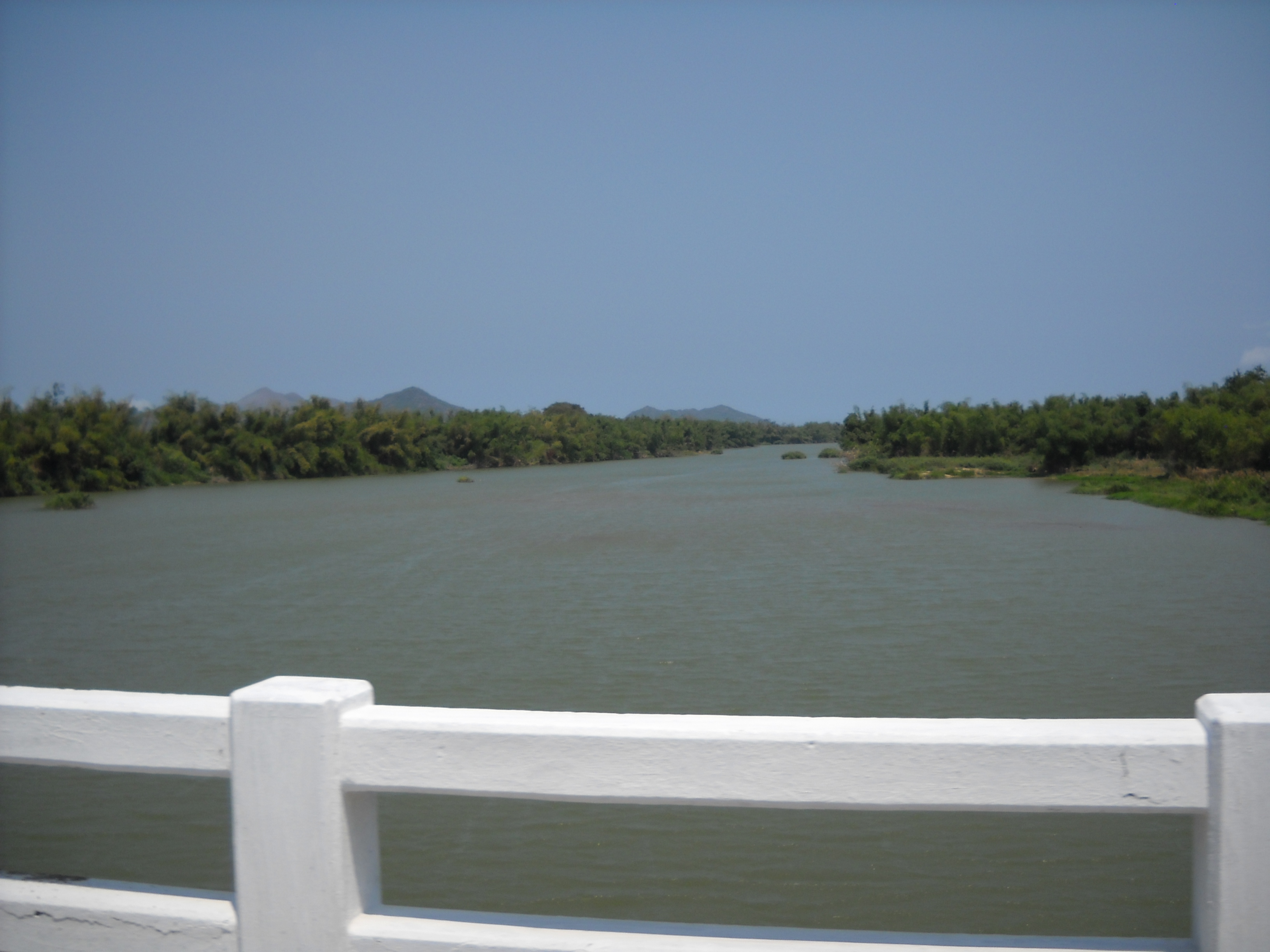
 Wall leading to the Western gate.
As of 2003 the district had a population of 134,118.[1] The district covers an area of 513 km². The district capital lies at Dien Khanh.[1]
References
- ^ a b "Districts of Vietnam". Statoids. http://www.statoids.com/yvn.html. Retrieved March 20, 2009.
Coordinates: 12°15′00″N 109°00′00″E / 12.250°N 109.000°E
 Districts of South Central Coast (Nam Trung Bo), Vietnam
Da Nang Da Nang · Cam Le · Hai Chau · Hoa Vang · Paracel Islands (disputed) · Lien Chieu · Ngu Hanh Son · Son Tra · Thanh Khe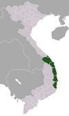
Quang Nam province Tam Ky · Hoi An · Bac Tra My · Duy Xuyen · Dai Loc · Dien Ban · Dong Giang · Hiep Duc · Nam Giang · Nam Tra My · Nong Son · Nui Thanh · Phu Ninh · Phuoc Son · Que Son · Tay Giang · Thang Binh · Tien PhuocQuang Ngai province Quang Ngai · Ba To · Binh Son · Duc Pho · Minh Long · Mo Duc · Nghia Hanh · Son Ha · Son Tay · Son Tinh · Tay Tra · Tra Bong · Tu Nghia · Ly SonBinh Dinh province Qui Nhon · An Lao · An Nhon · Hoai An · Hoai Nhon · Phu Cat · Phu My · Tuy Phuoc · Tay Son · Van Canh · Vinh ThanhPhu Yen province Khanh Hoa province Nha Trang · Cam Ranh · Khanh Son · Khanh Vinh · Cam Lam · Dien Khanh · Ninh Hoa · Spratly Islands (disputed) · Van NinhCategories:- Districts of Khanh Hoa Province

Wikimedia Foundation. 2010.