- Dhofar Governorate
-
This article is about the Dhofar region. For the football club, see Dhofar S.C.S.C..
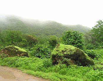 During the Khareef (Monsoon) the mountains around Salalah are rainsoaked and shrouded in fog
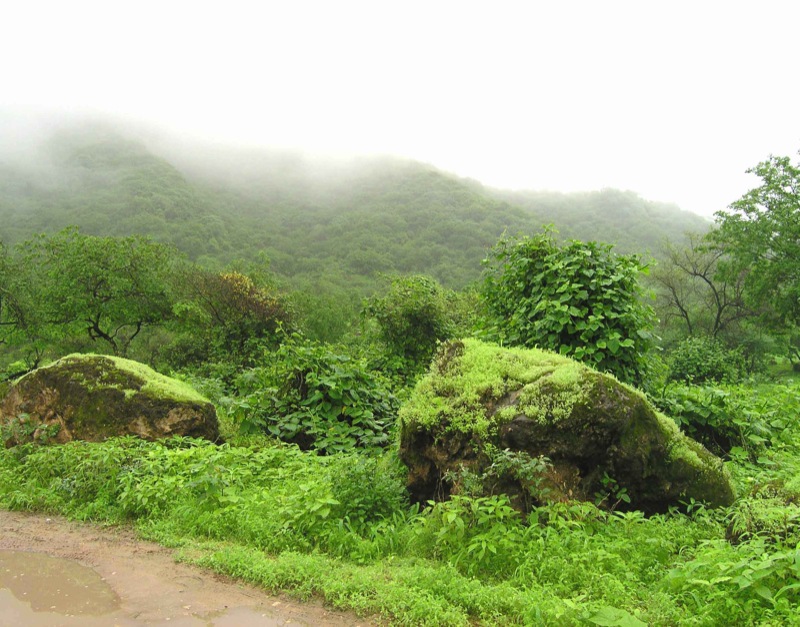
The Dhofar (Arabic ظفار Ẓufār)

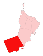
region lies in Southern Oman, on the eastern border with Yemen. Its mountainous area covers 99,300 km2 (38,300 sq mi) and has the population of 215,960 as of census 2003. The largest town in the region is Salalah. Historically, it was the chief source of frankincense in the world. However, its frankincense is now mostly used locally. (Somalia is now the leading exporter.)
While Arabic speakers from the dominant Omani culture have come to live in the province, especially the larger cities and towns, Dhofar has been the traditional homeland of many tribespeople speaking a variety of South Arabian Semitic languages. One of the largest—spoken by the Qara (Ehkelô), Shahra, Barahama, ِAl Mashaikh and Bathira mountain tribes—is called Jeballi, (or Shehri)—popularly referred to as Jeballi people or mountain talk. The Yemeni language of Mehri is somewhat linked to Jeballi. Other indigenous groups speaking smaller languages such as Bathari live in the coastal towns of Shuwaymiya and Sharbithat. The Harasis, speaking Harsusi, number 1,000–2,000 and live in Jiddat al-Harasis.
Dhofar and a small portion of the northern tip of Yemen are directly exposed to the South East monsoon from mid-June to mid-September[1]; this is known as the Khareef. As a result, it has a lush green climate during the monsoon season and for sometime after until the vegetation loses its moisture. Dhofar's temporarily wet climate contrasts sharply with the neighboring barren Empty Quarter Desert. The Salalah plain was once a well cultivated area with a sophisticated irrigation system. During World War I it was fertile enough to produce food and grain to supply a large proportion of the requirement of the British Army fighting in Mesopotamia. It was ruled by Kathiri Sultanate, Dhofar Sultanate and Ottoman Empire (1539–1829) before Omani rule.
A counter-insurgency campaign—the Dhofar Rebellion—was fought here by the Sultan of Oman's Armed Forces in 1965–1975 against guerrilla fighters of the Marxist Popular Front for the Liberation of Oman and the Persian Gulf (PFLOAG), supported by Communist South Yemen after that territory's independence and several other socialist states including East Germany. It aimed to depose the Sultan. The Sultan's forces, assisted by the United Kingdom, Iran, and support from loaned officers and doctors from Pakistan and India[2], prevailed, and once the campaign was declared over in December 1975, the active remainder of PFLOAG forces surrendered.
In Mormon culture, Dhofar is the most popular traditional location of the Book of Mormon land of Bountiful. This association is not an official LDS Church doctrine, however.
Dhofar is a tribal community, home to many ancient tribes. The Arab tribes include Al-Hakli (Qara), Al Kathiri, Al-Hashmeis, Al-Yafei, Al-Mashaikhi, Al-Shahri, Al-Mahri, Al-Batahri, and Al-Barami.
The Dhofar region is rich in meteorites.
The Burj-al-Nadha Clock-tower is a popular landmark and is featured in the Dhofar Municipality coat of arms(right)
Districts
The Dhofar governorate consists of ten districts (wilayat):
- Dhalkut
- Mazyonah or al-Mazuna (new since October 2006)
- Mirbat
- Muqshin
- Rakhyut
- Sadah
- Salalah
- Shalim and the Hallaniyat Islands
- Taqah
- Thumrait
Salalah is the capital of Dhofar Governorate
References
External links
- Coins issued for Dhofar region AH1359 - AH1378 (1940-1959)
- Port of Salalah
- Zufar at WN
- Dhofar’s Summer Monsoon

 Eastern Province, Saudi Arabia
 Hadhramaut Governorate
Al Wusta  Dhofar Governorate

Arabian Sea Subdivisions of Oman Regions 
Governorates Categories:- Governorates of Oman

Wikimedia Foundation. 2010.